Showing posts with label ptarmigan. Show all posts

Wednesday, February 7, 2018

Smoke and Snow: Opabin Plateau

The morning of September 14th was bright and cheerful -- and the landscape frosty/snowy.
The photogs loved it.
Joan and I decided to hike up to and around the Opabin Plateau today,
and leave a more alpine hike for tomorrow, when those high trails might be less snowy. This photo shows snow up at Wiwaxy Gap and the Huber Ledges,
and the snow is more widespread in the shady areas. Clouds began to form as moisture rose from the sunlit slopes.
The West Opabin trail started out through the woods.
Then it began to climb the west flank of the plateau, and Mary Lake came into view.
After traversing rocky steps and switchbacks, Joan and I neared the crest of the trail. But wait -- was that a mountain goat ahead? (Click on the image to enlarge and check the center.)
Bring up the binoculars! It sure was.
This male mountain goat was so happy to lie on the grass and chew cud in the sunshine that as long as we remained on the trail, he was unconcerned about us, even when I raised my camera. This was a great privilege he granted.
Those are horns, not antlers, meaning they are part of the animal's skull, even if covered in a sheath that darkens the color.

We left him to his meal, and took the short loop out to Opabin Prospect.
It's a great view out there.
Look down from the edge and get a great view of the lakes.
Joan and I continued around the Prospect, reaching the point where the trail dips down to the Cascade Lakes.
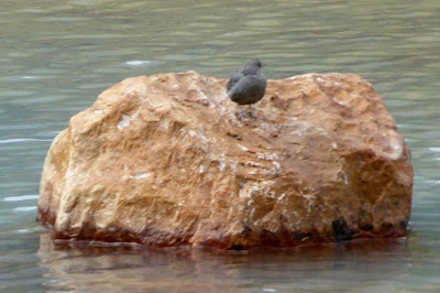
At the edge of the water we caught sight of an American Dipper, a bird that catches all its food by striding about underwater.
After crossing the footbridge I looked back the way we had just come.
A left turn took us to the Opabin Highline trail, which meanders deeper into the plateau along a ridge. We stopped for lunch at a viewpoint that looked back at the lakes and bluff.
This stretch of trail was deserted, but across the way we spotted hikers on the Yukness Ledges trail.
Before reaching the end of the Highline we encountered two gents who told us that there were ptarmigans on the last section of the East Opabin trail, where it climbs to its namesake lake.

Joan and I reached the south shore of Hungabee Lake. (That's pronounced Hun-GAH-bee, not HUNG-a-bee.) Opabin Lake is beyond the moraine that rises from the far shore, and can be reached from either side.
We encountered a pair of guys navigating, barely, by a map on their phone that had no topographic lines or lake names. They asked if this was Hungabee, and we assured them it was.

Ascending the East Opabin trail, we indeed encountered ptarmigans. Seven of them, in the dry creekbed just left of the footpath. They were fluffed up against the cold,
 and changing into their winter plumage.
Some would venture out of the creekbed from time to time,
and one, seemingly cast out from the group, gave us quite a stare. Was it curious, or on alert?
We, and others, approached Opabin Lake.
The water levels were low here too, similar to our visit to Lake McArthur.
To make a loop Joan and I crossed to the west side of the moraine, where another trail ascends/descends, and looked down on Hungabee Lake. The West Opabin trail is visible on the left.
We noticed a group that was traveling "cross-country" towards the All Souls trail, rather than taking the West Opabin down to the far end of the plateau, where the two intersect. Technically this may be the shorter distance but I don't think they could have saved much time.

Joan and I returned to our cabin, and I caught this sunset photo on our return from dinner.
What a day, with ptarmigans and a mountain goat closeup! Tomorrow, our last day at Lake O'Hara.


Friday, February 10, 2017

CR2016: A Huber Ledges Round Trip

The next day, July 28th, Joan and I began a double Huber Ledges day by heading around the southern end of Lake O'Hara. This photo looks across the south arm of the lake to the peninsula with our cabin.
An overview of today's trails, and our start.
We continued on to Lake Oesa. On the way we saw lots of beardtongue.
A peek at All Souls Prospect. We aren't going there today.
Joan and I took the direct route to Lake Oesa.
Arriving at the lake,
we spotted researchers taking measurements of the waters.
We swung around onto the Huber Ledges trail, aiming for Wiwaxy Gap.
Early on I took this panoramic view back.
This was the way ahead, with Wiwaxy being in the saddle of the ridgeline.
Taken from the same spot, this picture shows much of the Victoria Lake Cutoff on the side of Yukness Mountain, starting with a beige thread through the greenery at the bottom. Click on the image to enlarge.
Zooming in on the junction between the cutoff and the Yukness Ledges trail reveals two hikers in the lower left corner.
The trail blazes on the Huber Ledges helped us avoid taking less desirable routes.
The wet weather of the past weeks had created miniature waterfalls along the trail, and lush green carpets of moss.
Near Wiwaxy Gap we heard and then saw a golden-mantled ground squirrel vigorously scolding and chasing off a competitor. Afterwards he sprawled under a rock and dug out a little dirt.
He approached us, probably looking for a handout.
Here's proof that we reached the gap.
This was the spot for a well-deserved lunch.

Rather than take the steep Wiwaxy trail down to Lake O'Hara, Joan and I retraced our steps to Oesa on the ledges. The view is always different coming from the other direction. There's one location in particular where it's important to stay with the trail blaze, as Joan demonstrated, rather than take the alluring path just below.
This panoramic view from the Huber Ledges covers almost everything: Lake Oesa and its satellite lakes, the Yukness Ledges, the cataract pouring down from the Opabin Plateau just left of the Opabin Prospect, All Souls Prospect, McArthur Pass, and Odaray. Not to mention Lake O'Hara.
Some summer we'll come back to O'Hara and these blocks will be gone, perhaps having bounded down to the Lake Oesa trailside.
At this point the hike became a wildlife bonanza. This is perhaps a young winter wren.
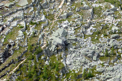
A young pika.
Just after reaching the Oesa junction we saw a Japanese couple taking pictures of rocks, but then we saw that there was a ptarmigan.
At least four youngsters, some still with fuzzy down, popped in and out among the rocks as they grazed (buds, leaves, berries) or hunted (insects).
Mom kept up her various calls, including "I am here" and possibly also "Come to me." This chick wasn't paying close attention.
This panoramic view shows the Japanese couple, preparing to take a selfie with a Canadian flag, and in lower left one of the ptarmigans!
The clouds became denser as Joan and I descended towards Lake O'Hara, but we suffered only a few drops before we reached our cabin at 4:10. Later there was a five-minute hard rain.

That evening was our final O'Hara dinner of this visit. So soon!