Wednesday, February 24, 2021

Jefferson County Loop Trail (Part 3)

Since 2010 I have documented my visits to Fairfield, Iowa, for extended TM (Transcendental Meditation) practice at Maharishi International University, plus occasional Ayurvedic treatments at The Raj. The most popular of these blog posts is here.

I've never written explicitly about the Jefferson County Loop Trail, which circles Fairfield, although references to it are scattered through the last eleven years of this blog. Now I'm remedying that. The first post in this series is here, and the second here.

My photos are from any time in the last ten years, usually in March/April or October/November, and, depending on the direction of the sun, facing the way I'm headed or the way I just came. I will sort them into physical, not chronological, order and hope they make sense.

Here is a map that contains the parking areas around the loop.

The previous post ended at Chautauqua Park, where the loop trail passes by, and a walker can head either north or south.

I continued south, towards Lamson Woods State Nature Preserve. First, the trail more or less followed the east bank of Troy Creek, and then passed underneath Business Route 34.

Image from Google Street View
From here the path criss-crossed the creek four times. In November the water was capped with a skim of ice.

As seen with a touch of spice via Deep Dream Generator.
The trail then crossed Glasgow Road, and I passed through the Nef Wetland.
Mile Marker 13 is here.
Then the final stretch, not so long,
A younger version of myself.
to the Lamson Woods parking area, at the southern extent of the reserve.
The loop trail now shares the road, Mint Boulevard, for a distance.
There is little traffic on this section, for on the left (heading south) is Lamson Woods, and on the right an occasional house on the hill.
There is a working farm at the end of Mint, where the path turns right to parallel the Route 34 bypass.
The trail wiggles and dips gently as it heads west. This photo was taken looking back towards the farm.
Further on, another boldly colored bridge, also looking back.
The fifteen mile marker leaves only 0.9 miles left to complete the loop.
Highway 1, where this account began, is in sight!
A footsore or tired hiker must trudge north for two long blocks to reach the trail crossing of Highway 1. Unlike the bridge north of town, it's a surface crossing.
Then after two blocks south on the far side of the highway there it is -- the end and origin of the Jefferson County Loop Trail.
The trail is a gem among trails, and a feather or two in the hat of Jefferson County. Thanks to them for supporting this endeavor.

I'll try to bike it sometime, and experience the whole loop in one go. As you can see from these blog entries, some sections (woods, lakes, and such) are excellent for slow, appreciative walks, and others are more for the exercise, or to get from here to there.

Wednesday, February 17, 2021

Jefferson County Loop Trail, Part 2

Since 2010 I have documented my visits to Fairfield, Iowa, for extended TM (Transcendental Meditation) practice at Maharishi International University, plus occasional Ayurvedic treatments at The Raj. The most popular of these blog posts is here.

I've never written explicitly about the Jefferson County Loop Trail, which circles Fairfield, although references to it are scattered through the last eleven years of this blog. Now I'm remedying that. The first post in this series is here, covering the trail from the start (mile 0) to mile 5.

My photos are from any time in the last ten years, usually in March/April or October/November, and, depending on the direction of the sun, facing the way I'm headed or the way I just came. I will sort them into physical, not chronological, order and hope they make sense.

The next parking spot I used was at the corner of 23rd Street and W Stone Avenue. Here is a map that contains the parking areas around the loop.

My first order of business was to hike back to mile marker 5, linking up with the previous walk, and then return. From "5" eastbound the trail was on a wide sidewalk, became a footpath, crossed a bridge,

and then Brookville Road. It wound through a patch of woods and generally worked its way north and east to Grimes Avenue, where it became a wide sidewalk again. Businesses and open areas dot Grimes, which make it much more congenial than along the congested and busy Route 34. An interesting display along the way:

The trail then turned north on 23rd Street, crossed railroad tracks, and arrived back at my parking spot. Now to push on further.

Looking south
From the parking area the path connected to Stone Avenue and headed east as a wide sidewalk and then north on 18th, and finally departed from the roads with another east turn.

I had been on this section before, but in November 2017 there was some construction beyond the Sky Factory. This was as far as I went that day. Here's a look at the factory from the other side, in 2011, when this trail segment was brand new.
The new walk continued north and east towards Gear Avenue.
Gear terminates at 8th Street, and the loop trail heads off diagonally as a gravel path on an old rail bed, raised above the surrounding terrain. It's close to the university here.
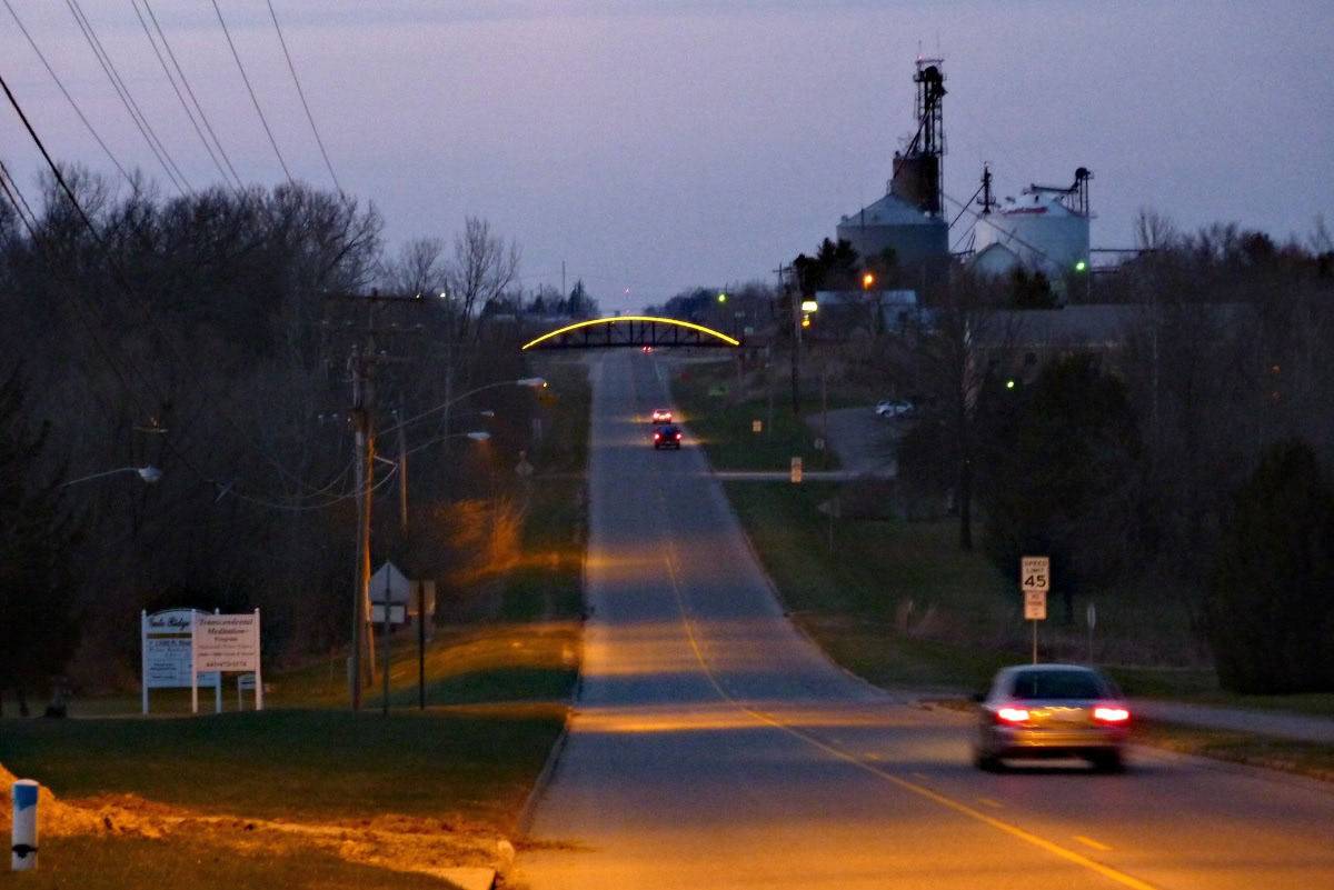
An observation deck was recently added, in 2019.
From it one can see MIU's new 1.1 megawatt solar array, west of the path.
As I walked along the trail various buildings on the MIU campus popped into view to the east. The loop trail and Highway 1 gradually converged as both headed north; as they drew closer, this structure came into view.
It's in memory of Charles William Matkin.
I was approaching the Bill Matkin Bow-String Truss Bridge over Highway 1. It replaced an old railroad trestle that had been torn down in 1979.
The bridge carries the loop trail over Highway 1. I drew closer.
Crossing the bridge.
Let's take a look at that through the Deep Dream Generator.
The bridge, seen from the highway at night.
The trail then continued northeast, still on the old railroad bed, with MIU buildings on the south side and the North Campus Village on the other.
Trails entering from either side allow residents access to and from this frequently visited stretch. Unexpected visitors also show up.
When the path hits B street it has reached its northernmost point. It then heads due south alongside B street.
Looking north along B street
The next parking area is off B street directly across from Zimmerman Boulevard and the university. Because I often stay at or near the university, I've rarely needed to park there; I just stroll over.

Heading east the trail immediately dips down to the level of Bonnifield Lake, where a gazebo picturesquely sits.

From here the path winds up the next hillside, which, as a prominent sight from B street, is often chosen as a site for art installations, such as these Star Bales from 2009.
The trail then enters an enchanting grove of conifers, with needles softening and scenting the ground. Very soon the walker arrives at the shores of Pleasant Lake, a reservoir.
The path continues close to the shoreline and crosses the small dam that creates the lake. Immediately after is the next parking area.
In this picture the hiker would be entering from the far left; click on the image to enlarge.
Captured from Google Maps Street View
The trail continues across Pleasant Plain Road, through offset gates that bar vehicles larger than bicycles from entry.
Also from Street View
After paralleling a fence line the path turns south and reaches one of the extremities of Walton Lake. This photo looks back the way we've come.
Soon thereafter the walker reaches Walton Road; this photo also looks back.On the other side, another parking area!
Continuing south, the trail winds through some woods and alongside a field, finally arriving at the bridge over the Burlington Northern Santa Fe railroad tracks. If Fairfield were a planet, Highway 1 would pass through the north and south poles, and the BNSF tracks would be the equator. Note the art panels on either side, embedded in the concrete.
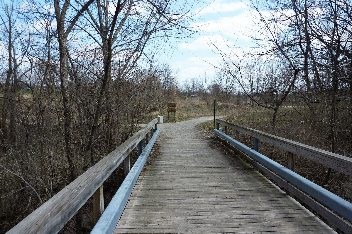
Now heading downhill, the path reaches the Chautauqua Park Orchard, where a spur trail heads west (right in this photo).
Chautauqua is an expansive, multi-use park. The loop trail passes by its eastern extent, while vehicle parking is at its western edge, but it's still an excellent parking spot for bagging loop segments. Here's a look passing through:
Keep heading east in the park, and after crossing a bridge walkers reach the loop trail.
Turn left for the BNSF bridge and Walton Lake, or right for Lamson Woods.
We'll resume our trek, heading for Lamson Woods, in the next post.