Sept. 12th began with cloudy skies. Today's goal was Lake McArthur, and having already done the Big Larches trail and its stone steps, we took the more utilitarian Schaeffer Lake trail via the Parker Hut.
The trail was enhanced by autumnal wildflowers.
A closeup of a paintbrush.When we reached the meadow next to Schaeffer Lake we could see mountain goats over on Odaray mountain. This was an auspicious start! (Click on the image to enlarge.)
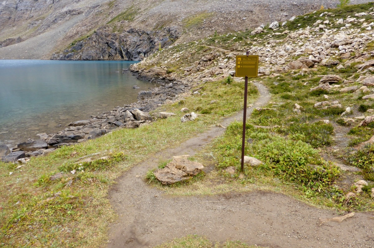
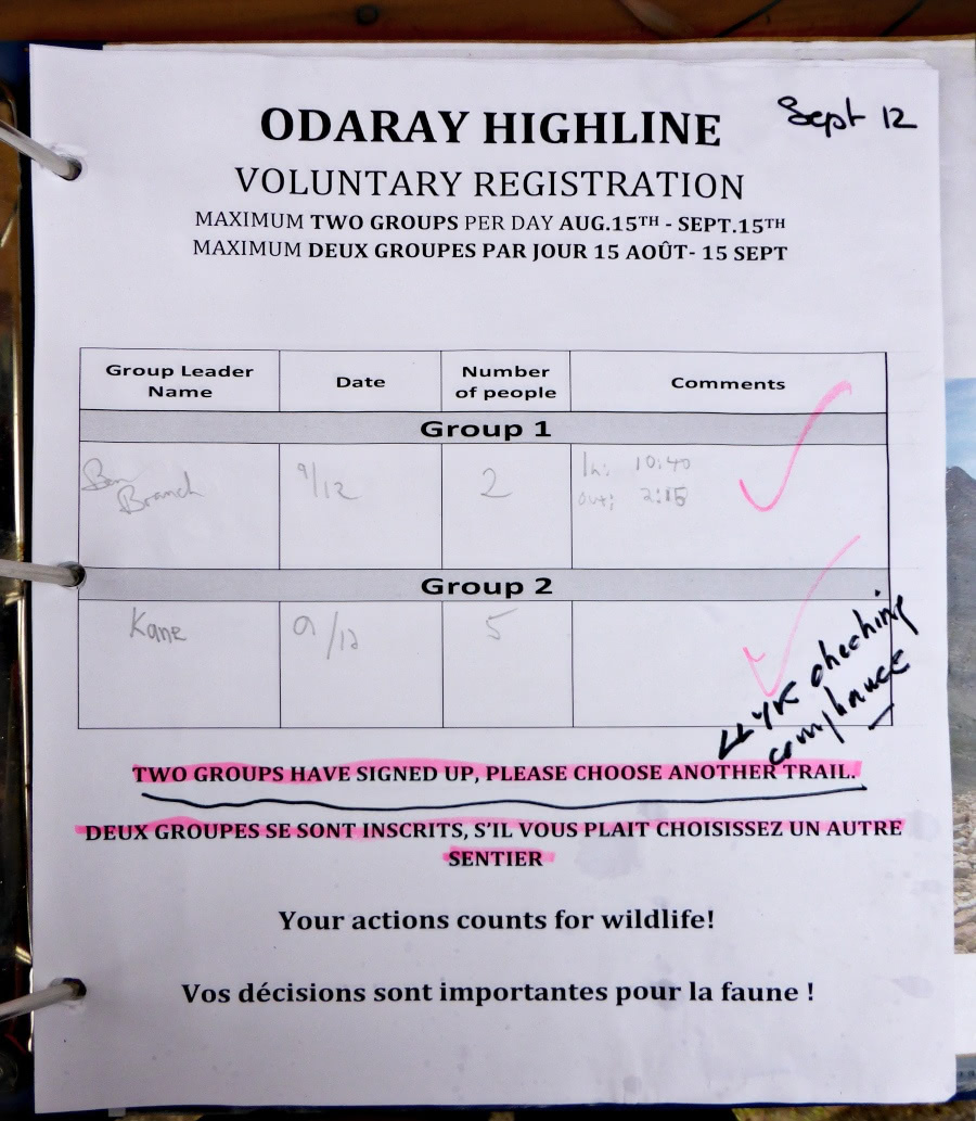
Out of curiosity we stopped at the sign-in kiosk for the Odaray Highline. From this point a trail to the left heads towards McArthur, and to the right a trail crosses the gap to the Highline. That section is restricted due to the pass's being a wildlife corridor, especially for bears. From August 15th to September 15th only two groups per day should cross to the Highline. Amazingly, although Joan and I aren't the swiftest hikers nobody had signed in yet, even though it was after 10:30. This was an opportunity not to miss. We waited to see if anyone else would show up, to form a single group for the crossing. No one did. We advanced as clouds and fog rolled into the pass.
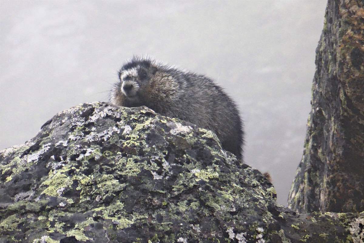
There was a creature ahead, sitting atop a boulder.
 |
That little bump on the right midway up.
|
We inched closer and I used my zoom to get a better look.
In fact, we spotted four marmots of the year. Not having seen any marmots this visit, and knowing that the odds of seeing one in September were lower, Joan and I were thrilled.Not to be outdone, a pika showed up.
The Odaray Highline trail emerged from the rock piles and became a pleasant, gently rising stroll. The Lake O'Hara basin was often visible below; the mists had departed but it was overcast and breezy. Dress warmly.
The Highline ends at a bend in the mountain's profile. Long ago, in the 1970s, it continued on to the Odaray Prospect, but after a bear incident (they are fond of hunting goats there) the area became off-limits to hikers.
Here we adjusted our layers for a body-warming clamber up to the Grandview. The trail turned sharply left and began a steep climb, and soon we met three women coming down who hadn't signed into the kiosk. We later discovered that they'd signed in for the wrong day!
The path narrowed and clung to the face of the mountain, and during the final third a few places begged for my hands to grab something to ensure my equilibrium. But it was worth it.
When we broke out onto the height there was a choice, to proceed left and continue a gentle scree-littered ascent, or straight ahead a short distance for another view. We went straight.
 |
Linda Lake below center, O'Hara valley and access road far right.
|
After gawking here we continued up the slope to one of the favored spots for a stunning panorama in the other direction. Small cairns and a rock windscreen erected by previous hikers were scattered about.
 |
Left to right: Lakes O'Hara, Schaeffer, and, up high, McArthur. Alpine routes visible in binos.
|
We drank it in and took photos, including the stratified glacier even higher up.
The wind was brutally cold up here on the flanks of the mountain, forcing us to reluctantly descend before having lunch. Just before reaching the Highline Joan and I happily sat on some rocks and munched.
We retraced the Highline and caught up with a group of five admiring a fearless young marmot; they had gone as far as the closed zone sign and then turned around.
When Joan and I reached the pass we decided to continue past the sign-in kiosk and join the Lake McArthur route briefly for our return to Schaeffer Lake. The choice was a gift as we were treated to multiple pikas,
and a full-grown marmot.
 |
I'm ready for my close-up.
|
Today's wildlife was a highlight of this O'Hara visit.
Schaeffer Lake came into view.
Just beyond the shores of the lake the switchback descent to O'Hara would begin.
Soon we were back at our cabin. After dinner we began the task of organizing all that had exploded out of our duffels over the last five days, for tomorrow afternoon we must say goodbye and take the bus 11 kilometers down to our car.