Showing posts with label Lake O'Hara. Show all posts

Tuesday, July 1, 2025

Canada 2024: Paget Lookout and Whyte Museum

Our goal on July 16th was to climb to Paget Lookout, which Joan and I had only visited once before -- in 2012! The first part of the trail serves two destinations: Paget Lookout and Sherbrooke Lake. (Click on any image to enlarge.)
Across from the parking area and Wapta Lake runs the Canadian Pacific railroad.
The trail climbed steadily, with flowers along the way.
On reaching the intersection, 
we took the right-hand path,
and the flowers continued -- for a while.
The trail grew steadily steeper and narrower, and the foliage began to change; after all, the lookout is 2,000' above the parking lot. Here are some flourishing pine cones.
The view began to unfold as we huffed, puffed, sweated, and pushed on our hiking poles. We could see Kicking Horse Pass and, beyond it, the flatter lands around the town of Field and its Canadian Pacific train yard.
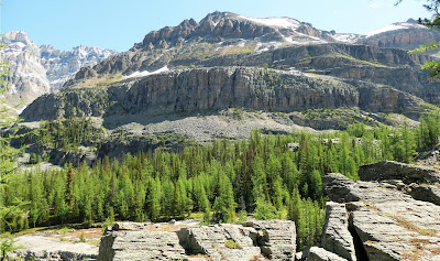
On the far-side slopes above Sherbrooke Lake, the geological stresses of the past are evident.
The trees thinned and the sun grew hotter. This was real work! Then the old lookout hove into view.
Below the hut lay a bench composed of three aging slalom boards. Here's a panoramic photo looking outward; the two segments composing it were taken from slightly different positions, so you may notice a few discontinuities. 😎
Other hikers came up. We had some good chats, particularly with two young women who have been working in Golden, about twenty miles southwest of Field, for five years. One was Dutch, and the other Quebecois.
 
Some continued on to scale Paget's peak. There is no trail, just route finding amongst loose rocks, and that did not appeal to us. The view to the east revealed a hazy sky; this image also includes the tan stones that form the upper reaches of Paget.
After consuming water and snacks, we descended to the Sherbrooke Lake intersection and headed for the water. Along the way we saw this spruce grouse. She was continually cheeping to lead her four chicks off the trail.
We had visited the lake several times in the last dozen years, most recently in 2022. I didn't take any photos this time, even though the route was lush in flowers, including orchids and insect-eaters. As usual, the prime lakeside spots were already taken, so Joan and I beat up the trail to find a decent spot to sit, and encountered our Dutch & Quebecois ladies again! We eventually found a suitable spot, ate another snack, and then began our return. The weather threatened and sprinkled a bit, but it didn't really count as rain.

The next day, the 17th, was entirely different. We began with the visitor center in Field, adjacent to the Kicking Horse River.
The river was high today, with various braided channels in the stream bed merging into a vigorous stream.
Joan and I arrived a few minutes before the visitor center opened, and we were treated to the passage of a train.
 
Inside the visitor center, I took a photo of the double spiral tunnels that the railroad takes to halve the steepness of Kicking Horse Pass. These double tunnels, modeled after those in Switzerland, were finished in 1909 after twenty-five years of runaway trains, the need for extra pushers to overcome uphill gradients, and other problems.
Then we drove up the pass and on to Banff, solely to take in the MacDonald exhibit at the Whyte Museum, commemorating the 100th anniversary of the artist's first visit to Lake O'Hara.
The geologists Patricia Cucman and the late Stanley Munn worked for 18 years to identify the spots from which MacDonald made his paintings. They also found evidence, such as paint scrapings and teacup shards, in those locations. Being Lake O'Hara devotees, Joan and I tried to identify as many of the painted views as we could. We had a great time at the museum.
 
Otherwise, there is little to recommend Banff anymore. Visitor cars must be parked at an extensive lot on the edge of town. In town, the swarms of tourists are subjected to a beehive of gift shops, art galleries, restaurants, and other methods of diverting you from the mountains and draining your purse, with quality ranging from high to, say, modest. The day was hot, and we bought some ice cream. One park had a vendor fair that we perused, but it was so hot that we saw one soft drink can, left in the sun, explode. I will confess that we did enjoy some of the veteran art galleries in town. But be aware that walking around the Banff core in high season is like trying to part the waters.

Then it was time to drive on to our next base of operations, the Lodge at Bow Lake. First opened in 1922, it has been refurbished and reopened, with ongoing work of expansion and infrastructure updates. (We got the 4th floor suite and loved it!)
Bow Lake itself is a magnet, situated just off the Icefields Parkway, that attracts walkers, hikers heading up to Bow Falls or Bow Hut, watercraft renters, wedding parties, and gawkers. There is a reserved parking area for lodge guests a short distance from the lodge, which provides transit services for guests via golf cart. Here's a photo of one portion of Bow Lake in the late evening calm.
Our goal for tomorrow is Helen Lake, an extensive hike we had done only once before, long ago.

Sunday, June 8, 2025

Canada 2024: Sights and Sounds on the Opabin Plateau

July 14, 2024, was our last day at Lake O'Hara. Joan and I would be taking the 4:00 bus down to parking and, as we often do, chose to explore the Opabin Plateau. This would leave us plenty of time to catch the bus. To mix things up, we went clockwise around O'Hara from our cabin. (Click on any image to enlarge.)
Near the lakeshore, plenty of flowers were in bloom. Here's a delicate rusty saxifrage.
And then, a 
Davidson's penstemon.
We began to climb the switchbacks of the East trail. It is usually a boring trail, but today we were treated early to the singing of a winter wren. Soon, on our right, the Opabin outflow thundered down.
The red object is somebody's lost water bottle.
A photo towards the west as we trod deeper into the plateau.
Joan and I found a congenial spot for a half-lunch on the High Line route, with good views for our binoculars. Looking down, 
we spotted hikers descending the rockpile.
Then we turned our gaze to the west and the All Souls alpine route, 
perhaps our least favorite due to the dodgy scree slope between the prospect and the Opabin plateau. This year, there were also remaining snow patches. One couple was attempting it,
but not without the occasional misstep and slide.
Then we continued on to Lake Opabin, now free of ice, for the other half of our lunch.
A ground squirrel was keeping an eye on us, hoping for a discarded morsel.
Patches of snow hosted snow algae.
Joan and I looked at the unofficial and virtually vertical beaten path up to Sleeping Poets Pool. For us, not this year -- we'd been up there in 2012 and 2019.
From the lip of the western descent from Opabin, Hungabee Lake and much of the plateau were spread out before us.
Soon after reaching the bottom, we were treated to a marmot appearance.
Looks pretty young.
All too soon, we reached the descent on the West Opabin trail.
We encountered an Eastern European couple climbing up the trail. The guy was scrambling off-trail, and the gal was distressed at the difficulty of the climb. She asked, "How much further?" Joan and I tried to help, but they had no map and seemed utterly unprepared.
 
Then -- what a treat -- we encountered a pika, harvesting greenery for next winter's food. It seemed to mind us not at all.
Joan and I reached the lodge in plenty of time to take a break and then board the departing bus. Reunited with our car, Moz, we drove down Kicking Horse Pass to the Cathedral Mountain Lodge. The next hike aims for Takakkaw/Twin Falls; our previous visit to these sights preceded this blog by several years, and it was time to visit again. 

Tuesday, May 13, 2025

Canada 2024: Yukness Ledges Snow Stomping

On July 12, 2024, Joan and I set out to hike the Yukness Ledges alpine route. We headed for the East Opabin trail, the shortest way to reach the west end of the Yukness Ledges route. But our way was blocked by red tape -- snow melt was flooding a creek outlet. (Click on any image to enlarge.)
We turned around and ascended on the West Opabin path instead, encountering both a marmot
and a pika!
So that detour worked very well indeed. We swung past the prospect for a view,
and as we continued on, the theme for the day developed -- meeting people and engaging in conversation. Soon, we encountered a group, some of whom were from Taiwan, and they asked for our help. They had no map; how far was the prospect? An older man (father? grandfather?) is waiting further back for news on which way to go. Joan gave him the best advice.

We crossed to the Highline and were rewarded with an expansive view of the Yukness Ledges.
Joan and I crossed over to the East Opabin trail and thence to the west end of the Yukness Ledges route. The beginning is adventurous, following blazes uphill through a boulder field until a trail is reached. In this panoramic shot, the boulder field is at the left, next to Lake Hungabee, and the trail is on the right.
After a short distance, the Opabin Prospect came into view on our left.
A least weasel carted across behind us; we were in awe of its speed as it dashed over, under, and through these boulder fields.
 
After finding a congenial spot, we sat down for lunch. A group of young women passed by and stopped to chat. They asked, How long have we been married? One of them took this next photo. Then a newlywed couple came up and asked us how long we'd been married. The theme was continued ...
We had not coordinated our outfits ...
The north-facing slope, rarely seeing direct sunlight, was where the snow traps were lurking. At first, they were merely close to the trail. The blue-and-yellow trail blaze is in the middle of the green circle in this photo. (Click on any image to enlarge.)
Another snowy view.
At the midpoint, hikers traveling in the other direction warned us of a dicey stretch, which we soon encountered. Snow was across the trail over a dip where it wiggled through talus and broken boulders. The terrain, we knew, had voids within the tumbled rock where a misstep could cause serious injury, but we could not see them. Joan and I continued cautiously, gripping our poles tightly, and did not come to any harm; however, I did not indulge in photography there.

We continued on and the snow intrusions withdrew. The path turned a corner and we began to draw closer to Lake Oesa.
Before the final hop up to the lake level, more snow was hidden on the approach. It's all about shadows and sunlight.
The near lake shore was snow-free, and the ice on the water had begun to retreat.
Returning to O'Hara on the Oesa trail, we encountered this snowbound sign and trail at the Victoria Lake cutoff. The snow wasn't through with us yet, but this was its last hurrah.
The series of ponds and lakes we'd passed gave way here to a torrent of melting snow.
Looking back the way we'd come.
From a lower altitude, here's a last look at the Yukness Ledges that we'd just navigated.
Joan and I reached our cabin just before 5:00pm. We were seated with Bob and Brenda again at dinner, replete with tales of their time in Malaysia. A fitting wrap-up of today's conversational theme!