On July 12, 2024, Joan and I set out to hike the Yukness Ledges alpine route. We headed for the East Opabin trail, the shortest way to reach the west end of the Yukness Ledges route. But our way was blocked by red tape -- snow melt was flooding a creek outlet. (Click on any image to enlarge.)We turned around and ascended on the West Opabin path instead, encountering both a marmotand a pika!So that detour worked very well indeed. We swung past the prospect for a view,and as we continued on, the theme for the day developed -- meeting people and engaging in conversation. Soon, we encountered a group, some of whom were from Taiwan, and they asked for our help. They had no map; how far was the prospect? An older man (father? grandfather?) is waiting further back for news on which way to go. Joan gave him the best advice.
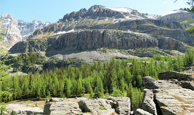
We crossed to the Highline and were rewarded with an expansive view of the Yukness Ledges.Joan and I crossed over to the East Opabin trail and thence to the west end of the Yukness Ledges route. The beginning is adventurous, following blazes uphill through a boulder field until a trail is reached. In this panoramic shot, the boulder field is at the left, next to Lake Hungabee, and the trail is on the right.After a short distance, the Opabin Prospect came into view on our left.A least weasel carted across behind us; we were in awe of its speed as it dashed over, under, and through these boulder fields.
After finding a congenial spot, we sat down for lunch. A group of young women passed by and stopped to chat. They asked, How long have we been married? One of them took this next photo. Then a newlywed couple came up and asked us how long we'd been married. The theme was continued ...
The north-facing slope, rarely seeing direct sunlight, was where the snow traps were lurking. At first, they were merely close to the trail. The blue-and-yellow trail blaze is in the middle of the green circle in this photo. (Click on any image to enlarge.)Another snowy view.At the midpoint, hikers traveling in the other direction warned us of a dicey stretch, which we soon encountered. Snow was across the trail over a dip where it wiggled through talus and broken boulders. The terrain, we knew, had voids within the tumbled rock where a misstep could cause serious injury, but we could not see them. Joan and I continued cautiously, gripping our poles tightly, and did not come to any harm; however, I did not indulge in photography there.
 |
| We had not coordinated our outfits ... |
We continued on and the snow intrusions withdrew. The path turned a corner and we began to draw closer to Lake Oesa.Before the final hop up to the lake level, more snow was hidden on the approach. It's all about shadows and sunlight.The near lake shore was snow-free, and the ice on the water had begun to retreat.Returning to O'Hara on the Oesa trail, we encountered this snowbound sign and trail at the Victoria Lake cutoff. The snow wasn't through with us yet, but this was its last hurrah.The series of ponds and lakes we'd passed gave way here to a torrent of melting snow.
 |
| Looking back the way we'd come. |


No comments:
Post a Comment
Comments may not appear immediately as they are moderated by the author to eliminate spam. Please, no commercial links!