Joan and I hadn't ventured out on an overnight trip -- sleeping somewhere other than in our own bed -- for some time. You know why. But with vaccinations in our arms and things looking up, in June we embarked on a six-day trip filled with hikes.
On the first day, we drove down to Adams County, Ohio, and visited Cedar Falls and the Davis Memorial State Nature Preserve.
Cedar Falls.
There are several "Cedar Falls" in Ohio; this one is part of the 20,000 acre Edge of Appalachia Preserve, managed by the Nature Conservancy. (Click on the images to enlarge.)
A flower called "blue-eyed grass" near the start of the trail.
Early on, a wide path and a bridge.The boulders here support more vegetation than you'd expect.On through the "boulder garden."We were surprised to see this American Colombo; it's a species that blooms once after several growing seasons and then dies. Joan and I have seen it only rarely, but today we came across this bloomer and quite a few still in the vegetative state.
 |
Colombo on the right.
|
A closeup of the bloom.
Sometimes weaving, sometimes climbing, the trail ended at an observation platform.
The view of the falls. The water volume varies widely, dependent on recent precipitation. In summer the forest soaks up much of the flow.
A bit closer.
The bright slab in lower right of the photo crashed into the creek from the surrounding cliffs in 1997.The cool ravine harbors northern white cedar, a remnant of the period just after the last Ice Age. It's rare in Ohio.Today was hot, at or near 90° F in southern Ohio, and the deck was in direct sunlight, so Joan and I did not linger, but walked back until we found a congenial, shaded spot to sit and eat our snacks.The trail employs several styles of bridge to cross muddy spots or streams.
 |
Relatively new.
|
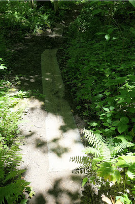 |
Rubber mats.
|
A gorgeous spider. Walk too fast, and you will miss a lot.If you don't care for spiders, how about toads?Next to the parking area sit the remnants of an old grist mill,
built in 1842 and originally powered by water, then by steam.Even preceding that, in 1811 the second iron furnace in Ohio was established here.Davis Memorial
Joan and I had time to drive on to the Davis Memorial preserve for a shorter walk. We had been here before, but often in a group gathered at the north entrance. Today we chose south.
The trail soon began to wind downhill. Then, firepinks!Down to the creek level, where we encountered sandstone bluffs.A thimbleweed, anemone virginiana.
More firepinks.There's a minor geological fault here.Joan and I couldn't easily pick out the fault itself, but the far side of the creek was full of interesting shapes. Then we climbed back up to the car and drove to our home for the next three nights, a cabin at the Murphin Ridge Inn. They even have electric car chargers (one Tesla, one J1772), which I took advantage of each evening to recharge my Pacifica plug-in hybrid.
We looked forward to more exploration the next day.


