After breakfast on July 15th, Joan and I drove up Kicking Horse Pass to the parking area for Lake O'Hara, the tent-pole that anchored our Canadian schedule. We took the lodge bus up the 11km fire road, picked up our bagged lunches at the lodge, and set out. Our traditional first hike of an O'Hara visit is to Lake Oesa, hidden among these mountains. The spring thaw was late this year, and we had been advised to avoid the higher alpine trails because of snow. Oesa would be safe, but we might find a bit of snow or ice up there.
The first leg was to go around the north shore of O'Hara, passing by the Wiwaxy Gap trail for the Oesa trail.Blooms were everywhere along the lakeshore. |
Alpine/Bog Laurel
|
As we began our climb to Oesa, I was struck by this view towards Mount Schaffer.The taller pine towards the right displayed scarlet/violet cones.More blooms among the rocks, if you look. |
Eight-petal mountain avens.
|
Gazing back to O'Hara ... still far to go to reach Oesa. The lodge and cabins sit at or near the shoreline; click on the image to enlarge.
 |
Avalanche debris forms pale green rings in the lake.
|
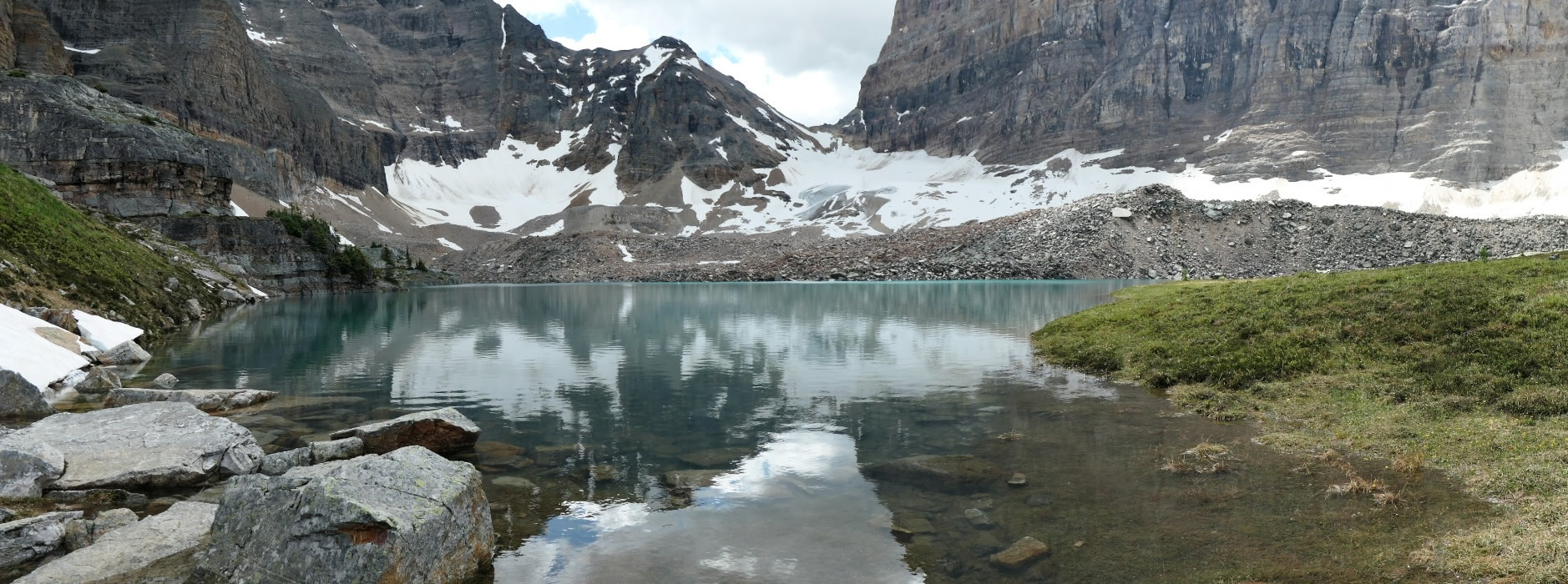
A pond at the foot of Mount Yukness appeared after the route passed through more boulders, slabs, and rubble.The cascade of water headed towards O'Hara falls down a steep face, which we must climb.The trail owes a debt of gratitude to Lawrence Grassi, who laid the trail and built steps where needed.Looking back after some climbing. The pond is now well below us.In the other direction, more steps to the top of the cascade.On past Lake Victoria and a few more staircases lay Lake Oesa. Yes, spring hadn't fully arrived here.Joan and I found a congenial, sun-drenched rock and ate our lunches, admiring the view. Then we wandered over to the western side, where the trail towards Mount Yukness, an alpine route, dropped down from the lake.Heading back as we came, I took a photo down to Lake Victoria, the final lakelet as hikers approach Oesa. |
A connector to the Yukness alpine route is there.
|
Snowmelt rushed down from the peaks surrounding O'Hara, which vary in altitude from about 8,800' to 11,000'.Joan and I continued our descent, and lower down a hermit thrush boldly sang. When I took out my camera it stared at me before flying off.We approached the level of Lake O'Hara and I snapped this view of the Seven Veils waterfall(s).Joan and I decided, on reaching the lake, to continue in a clockwise direction and thus circumambulate it. Along our way a rock supported a mini-garden: hiking in the mountains includes observing the small as well as the large.
We reached our cabin. The first order of business was to install our travel companions, the pigs Pudgy and Floppy Harry, in the window so they could check out the view and all the hikers passing by.It was a smooth and uplifting re-entry to Lake O'Hara after three years away, even if we hadn't seen any pikas or marmots yet. We had five more days to explore this mountain retreat, blessed with no internet or cellphone service to interrupt us.

 After briefly spotting an elusive pika, Joan and I admired a stoic pika looking the other way. It's still shedding its winter coat! (Click on the image to enlarge.)
 On reaching the edge of the plateau we had a choice of paths, and decided to visit the prospect first.
 Joan and I walked around to the heights above and to the west of the lower stretch of ponds and river.
 From a high spot, before descending to the waters, I took this photo that shows two trails, the Yukness Ledges alpine route (indicated by a red arrow, bottom right), and the very unofficial Sleeping Poets Pool track (green arrow). Yukness Ledges is level but not flat, that is, you don't gain altitude but you go up and down a lot. The Poets Pool, on a wide ledge above the Yukness route, is reached by a very steep and sketchy path, a bit of work going up and demanding careful foot placement going down. (Please click on the image to enlarge.)
 As we climbed the final hill to Opabin Lake on the west-side trail, I took this photo looking back. The large lake is Hungabee Lake, and the Moor Lakes lie beyond.
 Joan and I settled down for lunch near the east end of Opabin Lake.
 There we met a woman who worked for the Alberta Provincial Parks, and had discussions about ever-changing park budgets and regulations. At one point we spotted a golden eagle and studied it as well as we could as it flew on.


 We returned on the highline trail, between the east and west trails. There were good views down to the other trails.
 From our perch we saw glimpses of marmots, but none held still long enough for me to grab a photo.

 There was plenty of admire along the lakeshore, including creeping beardtongue,
 and an orchid, a northern twayblade.
 All in all, a satisfying and rain-free day!


