July 20th, 2022, was our last day at Lake O'Hara. Joan and I had signed up for the afternoon (4pm) bus, making room for one more hike. We chose to stay closer to O'Hara and aimed for the Opabin Plateau, in the lower center of this map. (Click on the image to enlarge.)
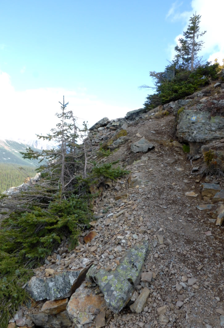
As you can see, several trails crisscross the plateau's varied terrain. We started by skirting Mary Lake on the West Opabin trail, and it soon began a rocky climb, where a marmot spotted us.He was busy foraging and ignored us.Joan and I pulled up our binoculars and zoomed in.Partway up, I took this look back toward O'Hara.Joan and I decided to go a short way along the All Souls alpine route, to visit the stretch of rocky tableland that precedes the slopes of Mount Schaffer. This photo is of the trail intersection. Hikers headed towards the All Souls prospect proceed up among the rocks following alpine route blazes, blue paint patches with two yellow bars embedded.We clambered up the stones and reached the "top,"
 |
Looking back the way we came
|
and meandered until we found a congenial spot to look down on O'Hara. The wooded plateau on the right is the Opabin prospect.
A host of landmarks were visible from this spot, including Wiwaxy gap, in the saddle above and beyond Opabin. The air was so clear that, with binoculars, we could see hikers there. (Click on the image to enlarge.)
Joan and I returned to the trail intersection and walked to the tip of the Opabin prospect. Here's the view:Many trails explore Opabin, as the map at the start of this post shows. We continued from the prospect and emerged to a viewpoint overlooking the streams, ponds, and lakes flowing down the plateau.Those boulders and bluffs on the far side are a portion of the Highline trail, one of our favorites. We descended to the streams and crossed at the next bridge. Looking back, Joan and I could see our descent route.After the initial climb, the Highline trail turns into a tabletop meander with its own views.Joan and I saw marmots on the Highline, both up at our altitude and down below. We found a good roost for our light lunch, with a browsing marmot on the valley floor providing a show. Then we decided it was time to begin our return to O'Hara, with time for a tea-hour stop at the lodge before boarding the bus for an 11km ride down to the parking area.
We descended and hiked to the stream crossing, where we noticed a cluster of people on the far side. Joan and I continued over and discovered an accident scene. A woman had fallen and hit her head on one of the flat stones forming the trail, and she was unconscious and bleeding. It was a multi-generational family group, including mom, who had fallen, and her adult daughter. The daughter's husband had already begun a run for help. An additional hiker was there with an emergency radio beacon, and a helicopter had been summoned by pressing its red button. There was nothing Joan and I could contribute in those circumstances, so we continued on and descended by the west trail.
A helicopter flew in and landed briefly, out of our view, perhaps delivering an emergency responder. A bit later, a larger helicopter flew in and landed for several minutes, doubtless loading the injured woman and maybe a family member. Due to the altitude, this helicopter circled the plateau twice, climbing all the while, and then disappeared over Abbot Pass (9600') headed east. Joan and I drew closer to O'Hara, and a helicopter arrived at the warden's cabin, perhaps to pick up the husband and/or the family's gear.
After a brief respite at the lodge, we boarded the bus to the O'Hara parking lot. There we hauled our luggage to the rental car, drove to the Trans-Canada Highway, and headed for our next accommodation, Storm Mountain Lodge and Cabins, 38 km/24 mi away.
"TING!" the car announced. Unequal tire pressure, according to the light on the dash. Crap. The car wasn't pulling to either side, so we continued to Storm Mountain. At dinner, I borrowed a tire gauge from another guest, and the front right tire barely pushed it to 14 lb. of pressure, while the other three were over-inflated to 40 lb. We asked the waitstaff if anyone at Storm Mountain could check and inflate the tire? Yes -- the chef, Gary, once he had a break! He adjusted all four tires.But should we trust the tire? Our vehicle's trunk held a temporary spare, but it was rated for only 50 miles at 50mph. That was not an option. To make a very long story shorter, I'll just report that after several phone calls to Enterprise, including the closest location (Banff) remarking that "national doesn't know what it's talking about," we arranged, through the goodwill of the staff there, to exchange vehicles the next day. Banff is not a major location for Enterprise and usually has no cars to spare.
As an aside, I'm weighing whether to be superstitious about July 20th. That's when I had a major bicycle accident in 1996, the day my father passed away in 2009, and now the events of today!
Tomorrow would begin with the drive to Banff, about half an hour away.

 Continuing from the prospect, Joan and I reached the "hidden" stairs from the heights down to the Cascade Lakes. They're "hidden" from this direction because the hiker must step down through apparently meaningless gaps in the rock formation. This year, stones lined the true path.
 Looking back from here revealed the Cascade Lakes.
 This panoramic sweep reveals, starting at the left, the Cascade Lakes, the Opabin Highline, and, in the far distance, the Opabin glacier.
 We took the low circuit and soon stared at this rocky ridge, a glacial deposit that hides Lake Opabin.
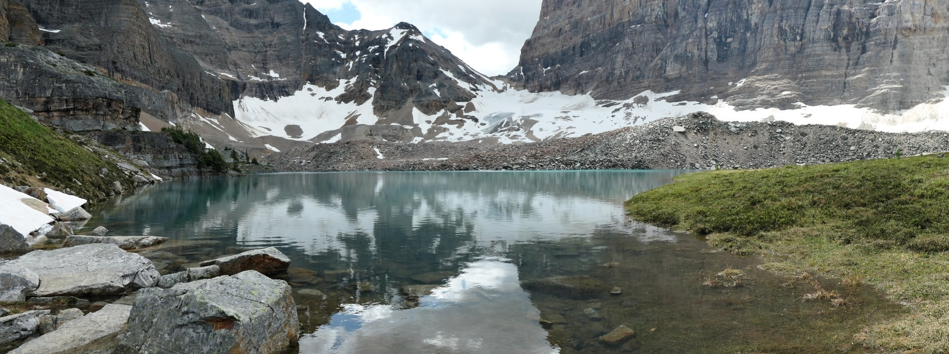
 Climbing up the west path, we reached the lake.
 Joan and I settled down for first lunch. Dark clouds gathering in the south had us wondering about rain, but fortunately they passed us by. A few mosquitoes visited us, an event we rarely encounter at O'Hara. Our view during lunch:
 Here's a closeup of the glacial patch that remains.


