Tuesday, August 24, 2021

Big Trip Day 5: Natural Bridge State Resort Park

Joan and I arose on June 9th with a plan to explore many of the trails at Natural Bridge State Resort Park.
Click on any image to enlarge.
After breakfast we donned our hiking gear and headed out, using the original trail up to the natural bridge itself.
It's an uphill walk, with some rules and signage.
In the lower part of the climb, informational stops tempted us to pause.
The logging here was selective and ended over 100 years ago.
We passed a blocked wiggle-hole entrance to "the cave." Occasionally the park offers a tour of the Natural Bridge Cave, using a much better entry, but unauthorized access is forbidden.
The trail does some switchbacking.
Our route is in blue.
The bridge began to loom ahead of us.
A few more back and forths.
After passing under the bridge,
Joan and I reached the stairs on the far side, cut into the stone.
At the top, we walked gingerly through a slot, holding our poles in front of us. Our shoulders brushed either side.
After a few more stairs, we emerged at the top. The view is worth the climb, but the camera doesn't capture it properly.
Our next destination, Lookout Point, was the bluff on the far left of the above photo.
Zooming in, somebodies were already there.
Along the way we crossed the skylift, for those who want to ride to the ridgetop. We saw it unattended, because the staff hadn't ridden up yet.
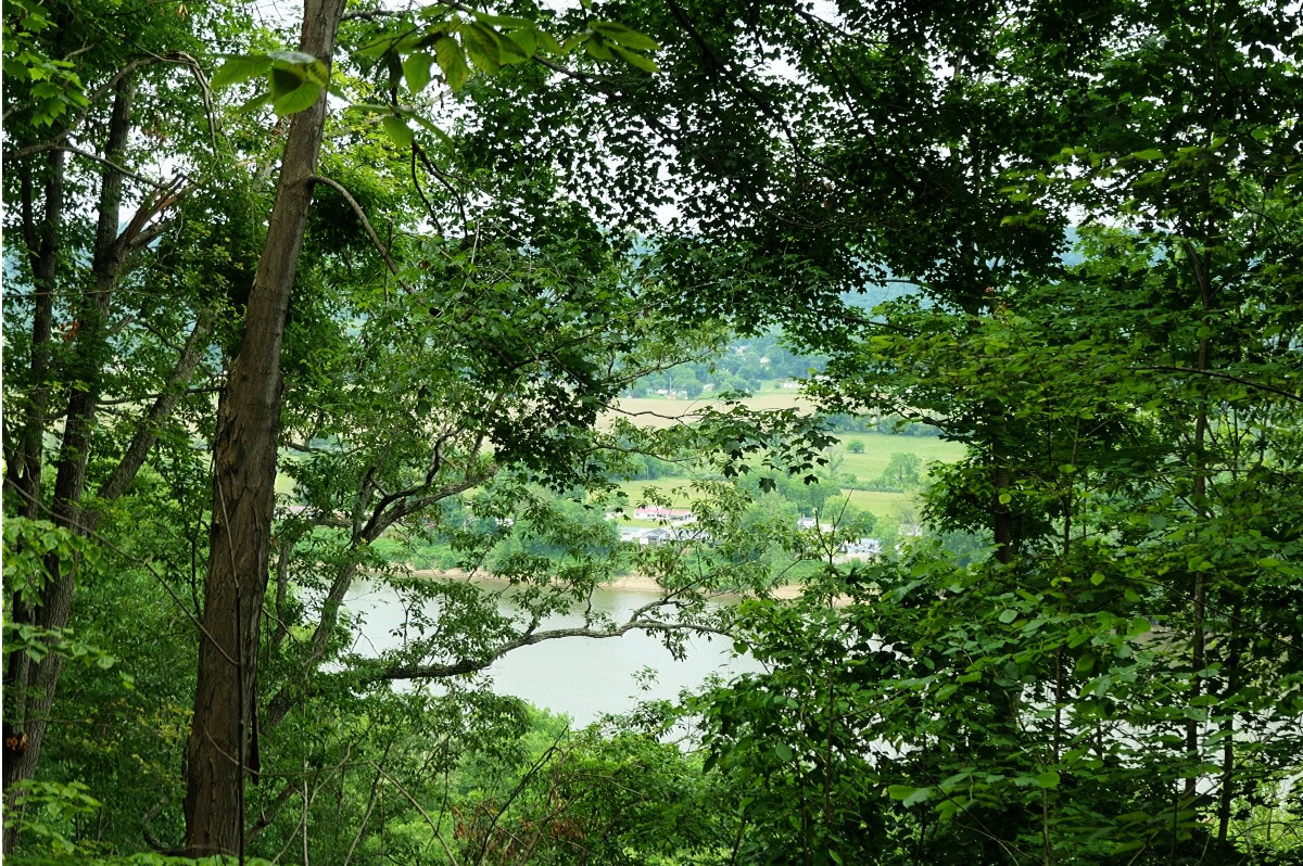
Looking down to the parking area.
On reaching Lookout Point, we stared at the view. The Natural Bridge is at the ridgeline, far right.
A closer photo ...
Our next phase was to head out to Lover's Leap, and the end of the ridge.
Along the way, mountain laurel was wrapping up its blooming season.
Another grand view at the Leap. Mists continued to rise.
A closer look at the knob.
We began to retrace our steps, and just ten minutes later a scarlet tanager flew in. I've always had a hard time photographing tanagers, as they favor staying high in the trees and flitting about. This one, however, gave me my best-ever scarlet tanager photo.
At the skylift two staffers were now in place. Joan and I walked back to the Natural Bridge, and admired the view some more.
Another hiker, studying his phone, warned us that "some showers are supposed to arrive in an hour or so." This did not worry us, as we were prepared, having brought along rain jackets and covers for our day packs. Joan and I descended from the bridge to begin taking the lower loop around the ridge, starting with Battleship Rock.
Many large blocks have fallen off the ridge. It would be fun to see how this landscape looks when the leaves are down.
Joan is in the background, right side.
Walking through the Rock Garden.
Some crazy erosion patterns.
Joan and I crossed paths with a group of young women several times as they searched for specific locations, such as Devil's Gulch (a more difficult trail); they would pass us or we would pass them. Then the trail swung in a loop towards the ridge, and they decided to head the other way.
Altitude must be regained.
At this point an occasional drop of rain or rumble of thunder reached us. We put on our rain jackets and stretched our pack covers over our day packs, and continued on. The rain grew heavier. It was no longer just a shower. Because it wasn't expected to last a long time, Joan and I took a break underneath one of the many rock shelters that the ridge offered. T
he left half of this view was being pummeled, but we were dry as long as we stayed under the overhang.
We ate some snacks. We watched puddles grow, a few feet from where we stood, sat, or leaned against the rocks. The rain did not let up. We studied how the puddles would emit small rivulets that trickled down in front of us, changing their path with each tiny variation in the micro-terrain. We noticed the small volcano-like mound of a ground-nesting bee, and spotted one who poked his head out. There were numerous antlion funnels. We watched a slug creep up a vertical rock wall.
Other hikers came and went. Some strode by, and others paused, chatted, and then continued, as we waited. After an hour and forty-five minutes of downpour, we decided it was time to continue, rain or no rain. At least the weather was still warm.

The Natural Bridge was closer than I expected, a welcome surprise. Joan and I could return to the lodge the way we'd come, or climb to the top of the bridge again, to take in the Balanced Rock route.
We were already wet, so why not go on? The stairway and slot pictured earlier in this post were gushing torrents a couple of inches deep. We laughed and climbed up. Once freed of the worry of staying dry, it was fun to watch the waters.

Of course, I wasn't pulling out my camera. Suffice it to say that we saw Balanced Rock, which would have been worth lingering beside at any other time, and returned to our room in the lodge. On the last quarter-mile the rain finally stopped.

Dealing with our dirt-splashed, sodden everything was a herculean task. The lodge rooms were of an earlier generation and on the small side. Hooks? No. Our wet gear was draped over the shower rod, on all the coat hangers, on the backs of chairs, and over the flat screen TV. We were desperate for space. Because we allowed our pants to get wet, the tops of the hiking socks picked up water, and we were in such a monsoon that every square millimeter of the socks and boot interiors were soaked when we got back. The water that ran down the backs of our rain jackets penetrated the day packs, and some items not in plastic baggies were a total loss.

And everything wanted to stay wet. We had no control over the heat or air conditioning beyond setting a temperature, and the fan automatically shut off once that temp was reached. The circulation was pitiful. The lamps had been upgraded to LED bulbs, so our trick of draping socks over hot rising air was thwarted. Joan and I took turns using the hair dryer on suitable items, including the socks.

But we persevered, and, as the night before, had a glass of wine at the bar before dinner. It had been a good day, but we hoped tomorrow, our last day of hiking, would be dryer.

Monday, August 16, 2021

Big Trip, Day 4: A drive, Sheltowee Bridge, and Hidden Arch

On June 8th Joan and I departed the Murphin Ridge Inn after another luxurious breakfast. Heading south, we crossed the Ohio River and entered Kentucky, taking a mix of busy highways and back roads. Joan rescued one box turtle attempting to cross the asphalt, but we were too late to save another.
 
We approached the Red River Gorge Geological Area and Natural Bridge State Resort Park from the north, and then turned east on the narrow, winding road towards the Gladie visitors/learning center and beyond. Our intention was to pick up several small hikes at the far extent of route 715. (Click on the image to enlarge.)
We were dismayed to discover that the visitor's center was "closed for the season" -- in June! We pushed on towards the hikes, apprehensive due to "road closed ahead" signs. Sure enough, we were forced to turn around
before reaching any of our chosen spots. Joan and I regrouped at the parking area for the Sheltowee Trace, and took a path to the footbridge crossing the Red River.
There's a deep spot in the river just up the trail, with many people who think about diving off a bluff, and a few, egged on by their friends, who do.
Joan and I reached and crossed the footbridge.
The far side was a muddy track back down the other side, so we recrossed and returned to the parking area. We began a long drive to the trailhead for Hidden Arch. You can see our route in the above map, in green. This included driving through the  Nada Tunnel, a 900-foot single-track originally blasted out between 1910-1911 for the Dana Lumber company. Once all the trees had been cut, the railroad tracks were dismantled and the road was eventually paved. Needless to say, navigating it mandates the protocol of checking whether someone is coming the other way before entering the tunnel. (This photo is by Patrick Mueller from apex, usa - nada tunnel, CC BY 2.0, via Wikimedia.)
Fortunately this was a light traffic day -- nobody else at the Sheltowee footbridge, nor here at the tunnel. Joan and I finally reached the "backpacker parking lot" at the Koomer Ridge Campground; the Koomer Ridge trail kicks off nearby, and the Hidden Arch trail is a loop off of that.
Our path followed the ridgeline for a while, and we spotted several umbrella magnolias, so named because their large leaves emerge from a tip, resembling an umbrella.
Some altitude is lost reaching the small sandstone arch, but nothing to worry about.
What we did worry about as Joan and I began our return was the weather, which had clouded over and held distant rumbles of thunder. We marched on, passing this tree growing, it would seem, directly out of the rock.
We picked up our pace and arrived, dry, back at our car. Soon after leaving we drove through a shower, and made our way to the lodge at Natural Bridge State Resort Park, where we'd spend the next three nights and have our breakfasts and dinners. After the first dinner we explored the grounds before retiring. The next day's goal was to cover as much of the trail network in the park as possible, starting with the Natural Bridge itself.

Sunday, August 8, 2021

Big Trip, Day 3: Rock Run Preserve

On Day 3, June 7th, Joan and I drove down to the Rock Run Preserve, part of the Arc of Appalachia, to hike the new trail there. We drove from the Murphin Ridge Inn down to US Highway 52 and proceeded east, parallel to the Ohio River, until reaching a gravel drive and parking lot on the north side, just beyond Sandy Springs.
The sign
A small roofed structure resides near the start of the trail.
A little further on the trail is adjacent to the McCall cemetery.
The cemetery dates back at least to the mid-1800s, and there are many stories told by the dates on the stones.
Civil War veterans, young women and their infants, all aspects of a hard existence we don't appreciate in the 21st Century.

Back on the trail, this tree caught my eye.
A thousand tentacles
We steadily climbed and encountered a boundary stone, a survey demarcation. This hillside had been an important chunk of property for someone. (Click on any image to enlarge.)
A very curvy tree trunk.
Eventually we reached the loop junction,
where a jumbled sandstone pile, perhaps from old quarrying, greeted us.
This was an excellent place to pause, with a view -- peeking between the leaves -- down to the Ohio River.
Other interesting lithic samples lay by the side of the trail.
Joan and I continued counter-clockwise on the loop, paralleling the river, passing by square-cut sandstone bluffs formed by quarrying, and the pools at their feet. Sandstone from southern Ohio was used extensively through the state for construction, including capitols and courthouses.
 
Next we encountered another boundary marker.
With a few switchbacks we gained the lip of the ridge, and an old settlement site, including a modest well dug into the ground. There were wet spots in various depressions, perhaps borrow pits from a century or more ago.
From here the route descended into a small valley, with one fallen tree to clamber over or bypass. We spotted a species of tree that puzzled us.
We were astonished to later discover that it was an Eastern Redbud! We've all admired the showy spring flowers, but here it was just leaves and the pea-like seed pods. The redbud is unusual in that although it is a member of the pea family, it does not "fix" nitrogen; it fails to take N² from the air and add it to the soil.
 
Eventually the loop turned around and took Joan and me downhill again. Here's a photo that displays the tendency of sandstone to fracture into layers.
At the loop juncture we paused again, and watched a tugboat push a couple of barges upstream.
On the final leg down to the parking area Joan and I spotted this example of new life emerging out of old.
Then it was time to drive back to the inn, clean up, have dinner, and (ugh) pack up as much as possible for tomorrow's drive down into Kentucky and the Red River Gorge.