Today, our next-to-last day in the Canadian Rockies for 2012, we hiked to Rae Lake. When driving south from the Delta Lodge, the parking area for this hike, on Highway 40, is just a couple of miles short of Highwood Pass. Here is another photo of a Gem Trek map showing the total extent of our journey today.
Elbow Lake is soon encountered after a steep hike up to the lip of the valley. Many people don't bother to go any further. With an extensive campground, Elbow Lake is also a popular family destination. As you reach the lake, the trail splits.
All the campground stuff is to the right; as through hikers, we'll stay left.
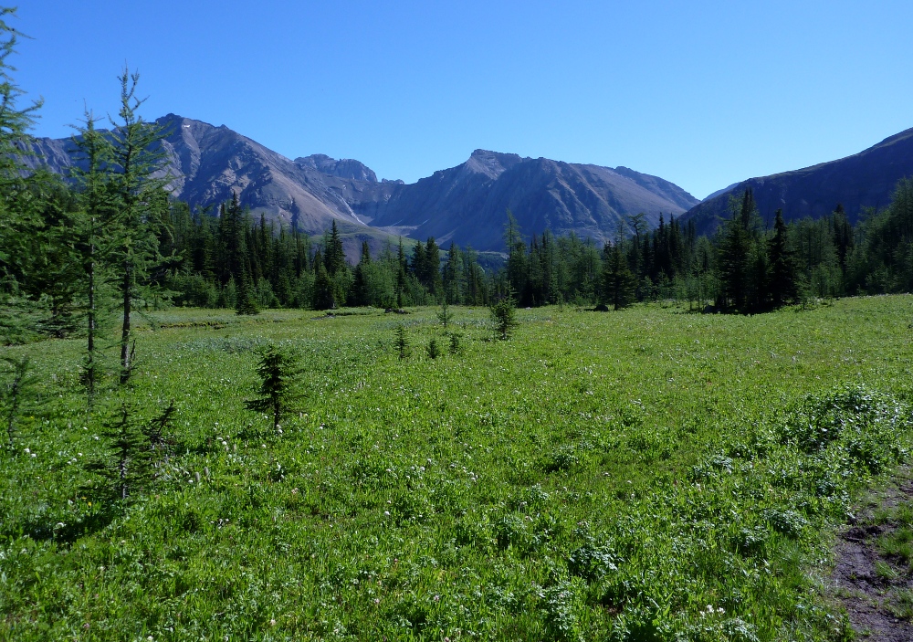
Elbow Lake is in a fabulous setting, wooded with mountains high on either side.
At this point the trail is wide, as it is wherever the route is marked in red on the map at top.
After it has passed Elbow Lake, the Big Elbow trail becomes a road.
You also change jurisdictions, from the Peter Lougheed Provincial Park to Alberta Wildland Park.
To someone from thousands of miles away such as me, the meaning of this isn't clear until you look at the signs as you come the other way, re-entering the Provincial Park.
So, in the Wildland Park, motorized vehicles and loaded and uncased firearms are OK. There is a much lower level of wilderness protection in this new jurisdiction.
For a while the road stays in the woods, shaded in the morning by Mount Rae.
Then it breaks into the open, giving us a spectacular view of Tombstone Mountain and, to the left of it, the beginnings of the Piper Creek valley.
We turn another corner, and receive a partial eclipse of the sun by Mount Rae; or, if you prefer, the emergence of the sun from Mount Rae.
Further on I must stop and compose this panorama with Elpoca Mountain on the left, the Piper Creek valley center, and Tombstone Mountain on the right.
Eventually the Big Elbow trail (dashed red line in the map at top) crosses an unnamed, black-dash trail. At this point we leave the road, taking the black-dash trail to the right. This is a trail, not a road.
The trail winds its way up,
until you come to the fork. The guidebook had us studying the terrain to make certain we didn't miss the fork, but it was easy to see. This split is visible in the map at top. We take the right fork to climb to Rae Lake, but we'll traverse the left fork on our return.
A few minutes later we passed this skeleton of dead brush, which looked almost like it had been a topiary of a sea turtle.
The trail wound uphill through open stretches and wooded stretches. A couple of gullies needed to be crossed by gingerly climbing down and clambering back up (not far). Interestingly, I spotted horseshoe tracks, even on this very narrow trail with tree limbs brushing both my sides; I doubt the horse enjoyed it. Finally we reached the high rocky platform beyond which the trail is, according to the guidebook, easier to follow. (We're almost to Rae Lake, but it is still hidden.)
We defied the expectations of the guidebook by losing the trail at this point. We knew we were headed in the right direction, but it wasn't until we reached further around the promontory that we could see the trail below us. The lesson is to go against instinct and drift downhill after the platform. In the next photo we're drawing near to Rae Lake itself.
Rae Lake is nestled between two arms of the high ridgeline; you don't see it until you are close, and much of the wind is cut off. Today the lack of a breeze was a problem, because this was the first year in ten years of our visiting the Canadian Rockies that insects were plentiful enough to be an issue. We admired Rae Lake from the shoreline, but could not find a space to eat lunch without also being lunch.
Near the shoreline is a trampled ground where visitors have tethered horses and built fire rings, one side effect I suspect of being in a Wildland Park.
A creek exits from Rae Lake at the left-hand shore of the above photo. The trail continues on the left bank of the creek, starting a few feet above it and then higher and higher as the creek, descending more rapidly, cuts a deeper and deeper gorge.
It was along this trail that the past horse traffic was most obvious and most distressing. The trail is being torn up in various ways, including deep gouges between tree roots, and in steep sections the trail is gradually falling into the creek. This trail wasn't built for horse traffic, but in the anything-goes Alberta Wildland Parks, that doesn't matter.
After about a mile the trail rejoins the valley road.
Joan took a photo of your blogger here.
Fortunately there is another black-dash trail that leaves the road after ¾ of a mile. This cuts off a loop of rock road tramping.
In fact, this trail is the left fork not taken on our ascent to the lake.
Upon rejoining the road we found the wind unopposed and blustery, almost howling, but it didn't rain. We stopped at one point to split a chocolate bar, very welcome. As we drew closer to Elbow Lake the wind returned to normal.
Here is a vista of Elbow Lake taken during the return. Overlapping multiple photos cleanly is nigh impossible when there are waves on the water and cloud shadows drifting across the land, but you get the idea.
Towards the end of the lake, just before we started down to the parking area, I took this picture to show the campground area in full sunlight on the far side of the lake (click to enlarge). No wonder it is so popular!
We greatly enjoyed our hike to Rae Lake; it was a tonic after the discouraging slog yesterday. Joan and I feel it would be fun to revisit Rae Lake in some future year without the bugs, and spend more time there. We'll have our fingers crossed hoping that horses haven't destroyed the trail.
The next day was supposed to be an easier day, but it did not feel like it. Perhaps it was the heat. Perhaps it was the trail that was a road. Perhaps it was an emotional crash, a letdown after our spectacular day at Pocaterra Cirque and Ridge. At any rate, it ended up feeling like work!
We drove just a few minutes from the Delta Lodge to the Stoney Day Use parking, part of the Kananaskis Village area, at the bottom of this map.
We first set out to Troll Falls, at map center. The morning sun cast long shadows across the road.
As the map above shows, there is a plethora of trails in the area. Most of these are roads, including the one above, that are cross-country ski routes in winter. The early portions of our trails were well marked.
The spur to the falls was narrower than the main road, but still broad.
We quickly arrived at Troll Falls.
There was an overhang and limited ability to climb higher to the left of where the falls bisected the rocky bluffs.
Then it was time to climb, climb, climb on the broad road marked Skogan Pass Trail on the map at the top of this post. The sun also rose, rose, and rose. The moon was setting.
The scenery along the road wasn't much, but we did have some avian encounters.
At the site of the old Hummingbird Plume Fire Lookout, there is a decaying shack and a picnic table on a large patch of open ground.
The panorama itself is close by. It looks over Highway 40 and the mountains of the Elbow-Sheep Wildland Provincial Park.
With binoculars we picked out features along the road.
The recreational area across the road is the Mt. Lorette Ponds Day Use.
We took in the view, and returned to the picnic ground for lunch. The sun was too strong to eat at the picnic table, so we sat in shade at the edge of the opening instead. The view from Hummingbird Plume was good, but it suffered by comparison from yesterday's view from the south peak of Pocaterra Ridge.
As we left the plume we encountered a pair of amorous dragonflies. They would not sit still for long, and spent much of their time in the air, but I did manage one photograph. Their blue color and acrobatics were spell-binding (click to enlarge).
The trail was not very interesting, beyond the birds and flowers. Here's a typical section, about 25 minutes after leaving the plume.
We did have a good listen to a crossbill song on the upper reaches of this trail, but there's no picture to accompany it. Instead, here's a marvelous picture of the wild rose, Alberta's provincial flower, taken along the road as we gave our feet a rest.
We crossed this set of power lines twice on the way down.
Harebells are among our favorites, carrying many good memories of our earlier trips to the Canadian Rockies.
The heat, hard road, tired legs, and sore feet left us wishing for the hike to be over long before it was over. Our last wildlife sighting was this squirrel, spying on us as we adjusted our boots.
We survived the trip down. The parking area was now greatly congested; nobody seems to get an early start around here. A good supper, a good night's sleep, and we recovered for the next day.
The next day, our first based at the Delta Lodge in Kananaskis Village, we hiked to Pocaterra Cirque and then climbed the south peak of Poctaterra Ridge. Last year I wrote about our hike to Pocaterra Cirque and partway up to Little Highwood Pass, so this post will focus more the new stuff in our jaunt up to 8,796 feet.
As this Gem Trek map shows, the route begins by weaving around a shoulder of Highwood Ridge, departing from a wide official interpretive trail.
Here is the first view looking up the valley towards the cirque, taken after having tramped through the woods.
The cirque is far back at the foot of the ridge. Today's goal is the top of the "hill"on the right, reached from the cirque. As you can see in the foreground, there are occasional avalanche fields and spring runoff gullies to cross. This terrain, kept clear of trees by the forces of nature, hosted wildflowers galore including these dwarf larkspur.
Spring was running two weeks late, and there were still a couple of snowfields across the trail.
Did I mention avalanches? We saw plenty of evidence of a harsher-than-usual winter, including the damage to these young trees at the end of an avalanche run. Some are bent and some are snapped.
One of our friends, the gray-crowned rosy finches, was hunting in a tiny patch of snow.
There is a brief level meadow where you can walk easily. This photo looks back from it.
The trail left the meadow and began to wind through rocks and across a small stream. There we encountered a mama ptarmigan,
who was calling out to her youngsters exploring the banks of the creek.
As long as we made no sudden moves she continued to stay out in plain view, on guard.
We reached the point where the trail for the south peak split off from the trail to Little Highwood Pass. The route to the pass, which we had taken last year and along which we had seen ptarmigans and pikas, was buried in snow. We crunched across the snow to the south peak trail.
The next few pictures are out of order, in the sense that I took them while descending rather than while hiking up. It's a steep climb, and one that led us to resolve to bring two trekking poles next year, for better balance and to enable us to use both arms as well as both legs. From the time stamps on the photos, it took us about an hour to climb the "hill."
At first the peak trail skirts the edge of the ridge, perched on a narrow strip of ground hung between the tangled woods of the hill and the valley of the pass below. Here is the first photo after we finally broke out of the trees. At this point the trail may disappear occasionally, but you still know the general direction. Higher up, you can't miss it.
I tried to not guess how far away the top was; psychologically I find it better not to tell myself "We're almost there," because it's often a false hope, an illusion caused by staring up from below.
For a while there is vegetation, but as the trail steepens there is less and less, making the footing less secure.
You might spot some figures on the trail ahead (click to enlarge). As I said, these pictures are really in reverse chronological order, having been taken going down. We had the advantage of an early start, and the many day-hikers from Calgary face a two-hour (or so) drive to the trailhead. We were the first to the top today!
Getting closer to the top ... but by no means there yet.
Zooming in on some of our fellow hikers, perhaps you can see how steep this trail can be.
Getting to the first bump doesn't get you all the way to the top. Where is the top, anyway? Are you sure?
Almost there now. Don't step on the trailside flowers in your oxygen-deprived state.
The top has two bumps. I took a picture of the south bump from the north. 8,796'. In solitude we took a half-lunch here.
Now for some pictures of the landscape below, taken from the peak and using the zoom of my camera. First, the parking area at Highwood Pass.
The meadow of the cirque.
The view over to Grizzly Col. Note the path in the center, and the keyhole in the upper right. With binoculars we saw the shapes of a large clan of mountain sheep to the left of the Col. Perhaps some other year we'll tackle Grizzly Col.
And the view to Elbow Lake, center, just a smudge peeking over the edge of the near ridge, and then up into the valley network beyond. In two days we would take this route up to Rae Lake.
Finally ... the video! A pan around from the peak.
360° View from highest (south) peak of Pocaterra Ridge from
Ben Branch on
Vimeo.
Then we went down, down, and down. At the foot of the hill and the edge of the cirque there is a boulder field, where we took the second half of our lunch.
Just before we reached the pond we were passed by some of the young and acclimated Calgarians who had been on their way up as we had been on our way down. Well, after all, we had stopped for the half-lunch and chatted with other hikers.
We encountered this photographer, who was enamored of all the wildflowers.
On arriving at the parking area we were almost giddy. We had successfully tackled the south peak of Pocaterra Ridge, and felt that we were finally getting in shape.