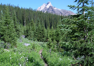
Our training goal for the next day, compared to the preceding days, was a longer hike with fewer steep sections. We decided on going to Linda and Cathedral Lakes, but, because we were not going as far as Monica Lake, which we did the previous year, we started the hike from our cabin instead of taking the bus to the Linda Lake junction.
The first trail segment is called the Morning Glory Lakes trail, and it winds for a long, long time (especially on the return) through the forest on the outskirts of Odaray Mountain.
After a while the path goes around a shoulder and begins to descend to the Morning Glory Lakes. Here is a picture taken as we drew closer to the middle lake.
We continued down and around the left side of the lake, encountering a rich grove of flowers in that sunny, moist environment.
The trail was briefly in the open. Cathedral Mountain ruled the horizon.
We soon faced a choice between the Linda Lakes Beeline trail, which switchbacks directly over the moraine in the photo above, and a more circuitous route via the Morning Glory Valley.
We intended to resolve a mystery, so we knew we were taking the Morning Glory Valley connector. There is a Linda Lake Circuit, a way to circumambulate the lake. This explanation may be clearer if I first provide a map:
The link on the east side of the lake, connecting the northern and southern arms of the Linda Lake trail, had apparently disappeared in our earlier visits. We felt this way because the trail sign where the southern arm and the eastern link should join points only down the southern arm, and a log or two crosses the unlabeled, faint link trail heading north, as if that path is considered 'discontinued.' But we thought we had seen a different indication, last year, at the sign at the junction of the eastern link and the northern arm. We were going to revisit that spot and take any trail south, no matter how tenuous, to discover what now existed.
Arriving at the northeast junction, we inspected this sign. It shows the Linda Lake Circuit heading both west and south.
We headed south. On that narrow trail we had to brush past tree limbs a few times.
We were definitely making our way down the east side of a lake.
As you can see from Google Maps, the main body of Linda Lake is connected to this long, skinny arm.
We paused at a good place for a rest stop. I found the clarity, aquamarine color, and hypnotic waves of the lake here worth a short video.
Clarity, Color, and Waves on the East Side of the Linda Lake Circuit.
The arm of the lake then disappeared, except for perhaps in wetter seasons. We walked through a flowered meadow, and soon arrived at the trail sign for the southeast corner of the circuit.
As you can see, the sign indicates only a passage to the west on the Linda Lake Circuit, with no mention of the east link. A log still blocked the lightly-traveled link. We had resolved the question of whether the east link still existed -- it does -- but not the question of why it seems to have been wiped off the books at this intersection.
After a short walk to the west, we arrived at the shores of Linda Lake. This point gives a wide view of the main body of the lake.
As we made our way along the south shore, I saw this patch of moss, a sapling, and a paintbrush just offshore, and something in its existence in an environment of rock and water appealed to me. It's almost an aquatic bonsai.
The trail passes near the edge of the lake, which can make the ground soft, and then starts to climb a small, rocky moraine. The view of Linda Lake from its southwest corner is one of the best you can get without climbing a mountain.
The structure of the rock pile here -- not too large, not too small -- makes it a favorite of pikas.
We decided to lunch here, and saw a wonderful floor show, including this golden-mantled ground squirrel. He has stuffed his cheeks to overflowing.
Our pika friend stayed busy harvesting as well.
OK, one more pika picture. When they emit their clear, carrying, high-pitched "eeeeep!", they put their whole body into it:
After lunch we marched on, taking the Cathedral Lakes trail, which continues up the Duchesnay Basin.
We paused at the outflow of the largest of the Cathedral Lakes; I took this picture on a footbridge over Duchesnay Creek.
Then it was time to turn around and begin the long walk back to Lake O'Hara. At the moraine where we had eaten, this time there was a pair of hoary marmots to greet us.
The previous winter's deposits were melting in the late July sun, and pouring off Odaray Mountain/Glacier.
Then it was time for the long slog back along the Morning Glory Trail. It was good training; our feet were sore by the time we reached our cabin, but we had been privileged to see gorgeous lakes, flowers, and animals today, under perfect skies.


No comments:
Post a Comment
Comments may not appear immediately as they are moderated by the author to eliminate spam. Please, no commercial links!