
Day 10
On July 20th, Joan and I traversed the Yukness Ledges and Opabin Highline. We chose to do this clockwise, starting up the trail to Lake Oesa from Lake O'Hara. After an hour and a quarter, we arrived at the Victoria Cutoff. By taking this shortcut, we'd save time and energy otherwise spent going on to Lake Oesa and then back to the far end of the shortcut. This photo was taken at the start of the cutoff. Note the alpine trail marker (two yellow stripes on a blue background) at the left side of the large boulder. We'd be following these. (I added a green circle; click on any image to enlarge.)
 After rock-hopping across the outflow stream from Victoria Lake, the next portion was also rocky. This photo looks towards that lake.
 Then the real climb began.
 At the foot of the climb, another trail marker adorned a square block, the first of many marking the way to thread up the slope.
 The view looking back after we'd climbed partway up.
 Four minutes later, we saw these blooms.
 Thankfully, there's a sign where the routes meet. (Photo from 2017).
 The
path winds through rocks, gravel, and roots, depending on which stretch
you're in. It dips up and down through gullies, sometimes with steps,
sometimes not. Joan and I soon encountered a group of young women from the campground on an "alpine circuit" ledge for the first time. We gave them a thumbs-up on the Yukness and let them go ahead. The "Gully," known for its steep dip, had stairs now for most parts, but we could overhear that one of the girls was frightened. But they remained ahead of us and eventually were out of sight.
The
path winds through rocks, gravel, and roots, depending on which stretch
you're in. It dips up and down through gullies, sometimes with steps,
sometimes not. Joan and I soon encountered a group of young women from the campground on an "alpine circuit" ledge for the first time. We gave them a thumbs-up on the Yukness and let them go ahead. The "Gully," known for its steep dip, had stairs now for most parts, but we could overhear that one of the girls was frightened. But they remained ahead of us and eventually were out of sight.


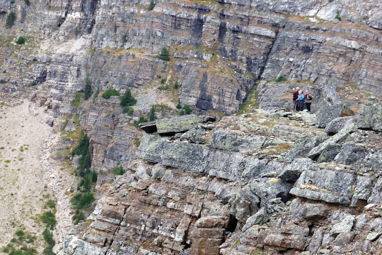
The only constant characteristic of the Yukness ledges is the marvelous nature of the views. Looking back, we saw other hikers, which gave us a sense of scale. (This is also a 2017 image.)
 As we continued along the trail, the Opabin plateau and its prospect (the rocky bit that sticks out in the middle distance) came into view.
 This view back towards O'Hara revealed a relatively benign (if narrow) stretch of the trail. The Opabin prospect was still much lower than we were.
 Eventually we descended through another boulder field, following the alpine blazes, and were deposited next to Hungabee Lake. (Opabin Lake is behind the rise on the far side.)
 Joan and I chose to wander among the elevated terrain in the middle of the plateau. This yielded a scenic lunch spot.
 Afterward, we decided to return to the O'Hara lakeshore via the East Opabin descent, most of which is a rather dull, switchback-filled route but quick. From there, we took the O'Hara loop trail counter-clockwise to the short spur trail for the Seven Veils Falls.
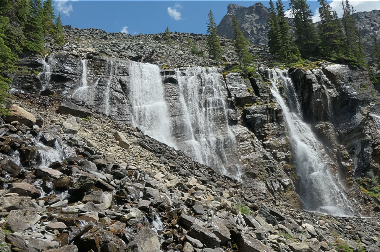
 Much of the water coming down from the heights around Lake Oesa emerges from the rocks here.
 Here's a zoom-in look.
 This was our last full day at O'Hara, but we weren't leaving until tomorrow's afternoon bus (4 pm), so there was one more hike to choose.


No comments:
Post a Comment
Comments may not appear immediately as they are moderated by the author to eliminate spam. Please, no commercial links!