Thursday, February 27, 2020

Iceland: Dettiifoss, Namafyall, and More

On July 24th our NatHab group was treated to a Möðrudalur floor show at breakfast.
I don't think he needs any coffee!
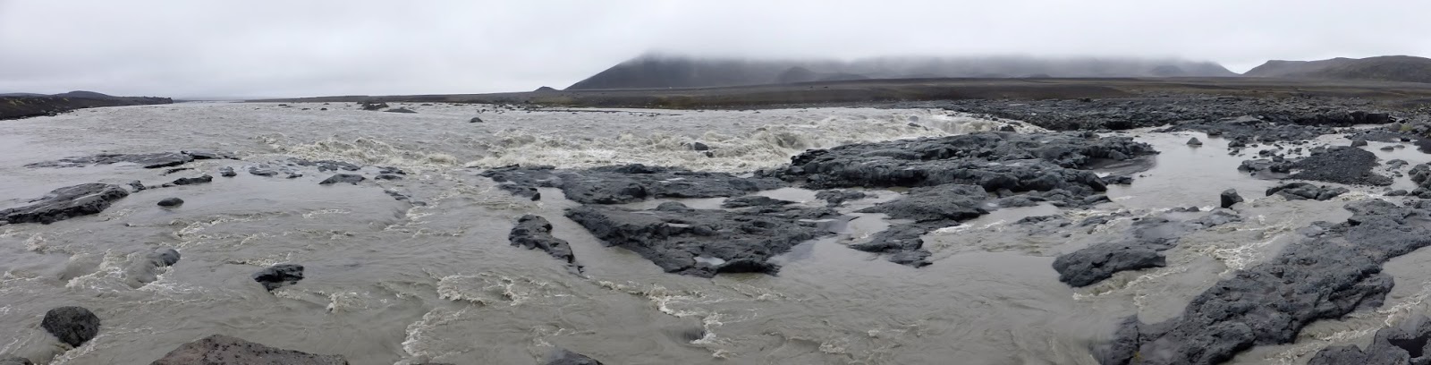
We made a quick getaway afterwards to beat the crowds to the Dettifoss waterfall, one of the top attractions in this part of Iceland.
Katherine was pointing things out, probably cautioning us, but it was hard to hear above the thunderous water.
Looking down with people to provide scale.
Both the volume and agitation of Dettifoss were impressive, almost overwhelming. This video holds clips from two different viewpoints. A short walk upstream from Dettifoss is a scenic but less aggressive waterfall, Selfoss, not to be overlooked. Water spills down from a wide sweep of cliff.
A closer look.
After a brief stop at Selfoss we had to scoot back to the bus and head towards Mývatn, a premiere tourist area; cruise ships even dock at Akureyri and bus people there. Our first stop in Greater Mývatn was the Námafyall geothermal field.
The view was otherwordly.
Steam vents! A strong whiff of sulfur when you're downwind.
Bubbling mud! (More sulfur.)
 
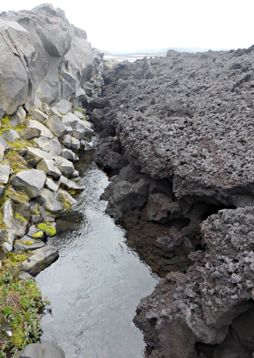
Then on to Grjótagjá we drove, where the stresses of the deformation zone between North American and Eurasian tectonic plates, about 100km wide, can be observed on the surface. Click on the images to enlarge.
One of many rifts in this part of Iceland. Some guides will tell you that here you can stand with one foot on each techtonic plate, but it's a more complicated terrain than that.
The water in the bottom was a popular bathing place -- warm water is always welcome in Iceland's climate -- until the 1975-1984 eruptions of nearby Krafla injected magma flows under the area. Water temperatures originally rose to 60° C, but now are between 43°-46° C, or 109°-115° F.
This section of the rift belongs to a farm, but the landowner graciously allows tourist access at no charge. Thank you. Pick up after yourself.

Off to a generous buffet lunch at the Hotel Myvatn, after which we walked across the road to investigate Skútustaðagígar, a walk through a landscape pocked by steam craters. These formations weren't created by lava eruptions, but by steam explosions generated by subsurface magma heating the wet terrain above it.
The view from an observation point demanded two panoramic photos.

Otherwise it's just a spaghetti strip!


 Birdwatching is a primary attraction here. Plenty of ducks.
An arctic tern. I learned that one way to distinguish it from the common tern is that the arctic's beak is entirely red, while the common's is tipped in black.
Our walk completed, we drove to Sigurgeir's Bird Museum, the largest private bird collection in Iceland. After Akureyri lent the museum a sea-eagle the only bird that breeds in Iceland remaining unrepresented here is the grey phalarope.
Note the water feature in the floor, right.
The museum is named after the young man who started it, but who died early, drowning in Lake Mývatn at age 37.

Next door is a boat museum featuring the Sleipnir.
This vessel has a long history.
There were two different info sheets!
As you can tell, this was a very busy day. The time had come to drive back to the east end of the lake and check in to the Hótel Reynihlíð. Outside sat a whittler.
In the lobby was a conglomerate partition.
 
Front view --- Side view
The scene outside our room included a stone fence and horses. Icelandic horses, for no other breeds are allowed in Iceland.
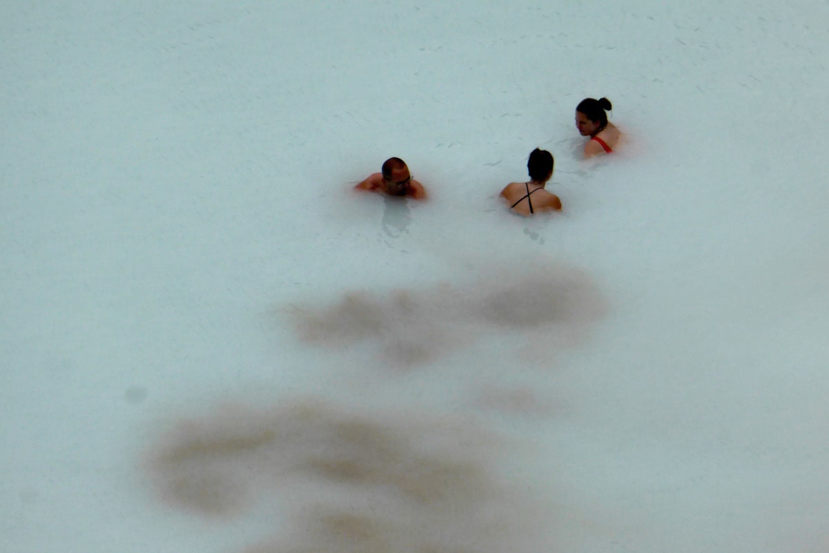
A few of our NatHab group chose to visit a nearby (short drive) geothermal steam bath after checking in, but Joan and I gave it a pass.

We wrapped up with a wonderful dinner at the hotel. For a while a singer was on the first floor of the hotel conducting a sing-along (John Denver, the Beatles, Willie Nelson, etc.), but the event disbanded early enough that it didn't interfere with our collapsing into bed.

Saturday, February 15, 2020

Iceland: Askja Volcano Day

July 23rd was our all-day expedition to Askja, a volcano in the central highlands that last erupted in 1961, and the Holuhraun lava flow of 2014.

Before breakfast Joan and I swung by the Möðrudalur church, built in 1949 by the farmer Jón Stefánsson. Jón built this church in memory of his wife, Þórunn Vilhjálmsdóttir.
A peek into the interior.
We crossed the road and headed towards breakfast. This dog was unperturbed.
The restaurant here is the only one for a long way, and therefore has a varied customer base: campers, lodging guests, work crews. We all managed to cram in.

Our route to Askja covered a lot of rough road, sometimes just a route. Click on the image to enlarge; our starting point and Askja are underlined in pink.
Our NatHab group piled into two off-road capable vehicles. The larger, simply called a "super jeep," held more people but had less visibility than the Toyota land cruiser, which Joan and I rode in. After a short drive south we began ascending a series of humps that culminated at the top of a long ridgeline, our first stop. The sky was overcast all day, but we could still see a long way.
To our right there was a wet, green area, a rarity here. Grass can survive only in areas protected from the brutal wind.
A closer look. Somewhere down there is a hut that sheep farmers use when tracking down their flock.
Among the rocks some arctic thyme grew.
This plant is highly regarded for its medicinal properties and is often used in tea.

The larger water crossings had bridges, but the smaller ones didn't. This photo was taken at our next stop,
a "rest" stop. A very welcome rest stop.
The thick overcast hid the sun, and after many curves and intersections I had no idea which way was which. Also, the magnetic declination (difference between geographic and magnetic north) is about -10½°. After driving for another hour our group reached a broader, more exciting watercourse.
The wide flood became compressed and wilder in the channels it had cut.
 A bridge!
Instruments were hanging from the bridge, thrashing about in the churning waters.
The outflows here originate in the Vatnajökull glacier, and within many, instruments monitor the volume, temperature, and mineral content of the water, offering clues about possible volcanic activity otherwise invisible beneath the ice cap.

Then we arrived at the Askja trailhead. Another group was just ahead of us.
They're looking at this map of the caldera and the trails around and about.
How far is it?
Layers of iron-rich minerals glow in the ejecta from the 1961 eruption.
After crossing the small rise visitors descend into the main floor of the caldera.
On the floor, the view ahead.
One of our guides paused and dug into debris from the monstrous 1875 eruption, which pelted eastern Iceland with toxic ash, killing livestock and spurring a wave of emigration. The tephra even reached Norway, Sweden, Germany, and Poland. Pre-1875 ice was exposed.
Then, out of the mists, we arrived at the Viti geothermal pool, with the main lake, Öskjuvatn, beyond.
Looking at the pool ...
there were swimmers down there.
I didn't bring my bathing suit.
Here's another view of the wall surrounding Viti.
We could spot a steaming fissure near the shoreline.
On the way back our group passed a long sign explaining the history of this volcano. Click on the image to enlarge.
We consumed our packed lunches back at the park "headquarters" and did a bit of exploring afterwards.
  
We spotted a snow bunting, male, breeding plumage. The snow bunting is the northernmost passerine in the world.
 
The day was not yet over. Our excursion continued south to an August 2014 lava flow at Holuhraun, and we investigated the boundary between it and a much older lava flow (1797). The 2014 flow was the largest -- 85 km2 (33 sq mi) and 1.4 km3 (0.34 cu mi) -- since 1783.
The black lava is the newer.
The new lava is of the a'a subtype; it consists of a loose, sharp surface that makes travelling difficult. Beneath that is a dense core.

We're close to the Vatnajökull glacier here, and the terrain is sometimes submerged by jökulhlaup, floods created by subglacial volcanoes.
Click to enlarge -- glacier on the far horizon.
Following a long drive back to Möðrudalur it was time for dinner and a good sleep.