Showing posts with label iceland. Show all posts

Sunday, March 10, 2024

Arctic Traverse: Final Day Excursions

On September 21st, Joan and I awoke to a view of the harbor at Reykjavik, where the Endurance had docked. (Click on any image to enlarge.)
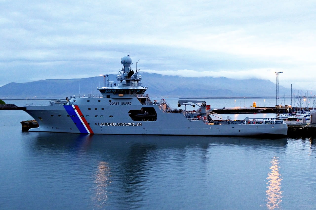
The ship in the foreground is an Icelandic coast guard, or
Landhelgisgæslan, vessel.
Some guests departed early, directly to the airport. This option wasn't available when we made our travel arrangements, which turned out well, as today's excursion will show. There was a choice of tours before being deposited at the international airport, Keflavik. Option 1 was to visit the Blue Lagoon, a famous geothermal spa, while option 2 combined a geothermal power plant, hot springs, and a show of Icelandic horses. Option 3 was a hike (several miles, rough ground) to see the lava flow from the initial 2021 volcano eruption at Fagradalsfjall. Joan and I chose #2.
 
Here's a map that covers most of the region traversed this day. Reykjavik is the urban cluster center-top, while the Hellisheiði Geothermal Power (and hot water) station is the red pin upper right.
We left immediately after breakfast and arrived at the plant. Here's an overhead view from Google Maps:
A gallery allowed us to peek into the works.
A lot was going on here, but all within pipes and generators.
In the back, company parking and more equipment.
The gallery had many exhibits and signs; this is a showcase geothermal power plant.
Research takes place here as well.
After leaving the plant, our tour headed further east to the community of Hveragerði, which has an abundance of hot springs and mud pools. Our group visited one location with a greenhouse and a signed walking trail.
Due to 
Hveragerði's location above an old magma chamber, hot water and steam are everywhere here.
Hverabrauð, brown bread baked in the hot ground for 24 hours, was offered, and yummy. A sign about the process was nearby.
Let's zoom in closer for better legibility.
Next, and not far away, was the Eldhestar ("Volcano Horses") farm and riding center, where we enjoyed a horse show featuring the small but hardy Icelandic breed.
Horse diseases are few in Iceland; therefore, to protect the population, Icelandic law prevents horses from being imported into the country, and exported animals are not allowed to return. Even tack is contraband.
The exterior of the site.
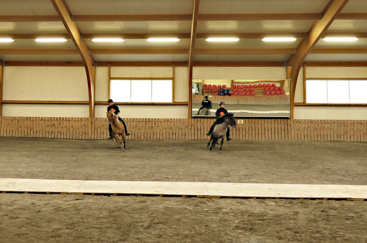
A wooden track held the middle of the show floor, to amplify the sound of the Icelandic horses' unique gaits.
In addition to the walk, trot, and canter/gallop paces typical of other horse breeds, many Icelandic horses can also do the tölt and the flying pace, making five gaits.
Joan and I witnessed many demonstrations during the show. Showing the colors in a circuit around the show floor far,
and near.
Coordinated maneuvers, too.
We enjoyed the meet and greet and pet at the show's end.
Now,  it was lunchtime. We drove down to Selfoss, a town of about 7,000 -- the largest in south Iceland -- where the world chess champion Bobby Fischer spent his last years and is buried.
We had an abundant lunch there, but then it was time to leave; our target time for arriving at the Keflavik airport was 1:30pm.

The cloudy skies began to weep rain as we drove west. We passed the starting point for a hike to the 2021 volcano eruption at Fagradalsfjall, and, after that, through the now-threatened town of Grindavík. There were steady showers when we arrived at Keflavik. The check-in was well-organized. The gate area, however, was chaotic but eventually sorted itself out. When we arrived home and began to unpack, we realized that we'd brought some of Iceland back with us -- our luggage had clearly been out in the rain at Keflavik. No damage was done, though.

What a journey Joan and I had been on from our start in Norway!

Sunday, February 18, 2024

Arctic Traverse: Heimaey

On September 20th, 2022, the Endurance followed a pilot boat through a foggy morning into the harbor of Heimaey, the largest island in the Vestmannaeyjar (Westman Islands) archipelago, just four nautical miles south of Iceland. She glided slowly through the narrow opening on the north end of the island to reach the equally constricted harbor, as shown by the blue line below.
Joan and I had signed up for the Volcanic Hiking Tour, which would take us to the top of Eldfell (red circle), the volcano that erupted in January, 1973, destroying half the town and threatening to close the harbor. For an intensely detailed history of the eruption, try this site.
 
First, our guide showed us a "puffling," or juvenile puffin. The Westmans are a major breeding location for puffins, but the increased artificial lighting causes many of the pufflings to fail to find the sea. Many residents patrol the town to rescue disoriented pufflings; our guide's son would later release this one.
Puffins don't have the famous beak coloration until they are adults.
(Click on any image to enlarge.)
Our walk first took us through the outskirts of the town. Soon, we passed a replica stave church given to Iceland in 2000 by Norway, marking the 1000th anniversary of Iceland's official adoption of Christianity.
The ferry between the mainland and Heimaey arrived before we were out of sight of the harbor. It switched from diesel to electric in 2020.
Our trail gradually climbed at first, with many interpretive signs in multiple languages. This one shows an aerial photo of what the ground we were walking on looked like before 1973.
Vegetation lined the path for a while as we gained altitude.
Our group hadn't reached the cloud layer yet, but looking back, we saw the distinct curtain it made.
On such a small island, any land that is not the airport, the golf course, or a volcano is built upon.
The real climb up the Eldfell's slope began, and we left the vegetation behind. Clouds ahead!
Eventually we reached the rim of the volcano.
Much detritus was thrown out during the eruption.
A traditional way to bake rye bread in Iceland is to take advantage of geothermal heat. It takes about 24 hours. Our guide invited us to check out a hot spot up here on the volcano. Here, Joan checks the temperature.
Some wanted to get a good sniff.
The local guides tell a story about a visit King Juan Carlos of Spain made to Iceland. He was scheduled to inspect a site where a loaf of this "geothermal rye" would be ready to pull out and taste. However, there was a mix-up and no dough had been put in place, so in a panic, a store-bought loaf of bread was re-wrapped and placed in the hot spot before the King's arrival. When he unwrapped it, he said, "I see the heat has even sliced the bread!"
 
On our return down the volcano, we could see the island's airport through the fog.
Our group had time to visit the Volcano Museum at the foot of the eruption, which had fascinating exhibits -- videos, a home excavated after the eruption, and so forth. One house sat adjacent to the museum, an undisturbed reminder.
Back aboard the Endurance, I took this photo of the dock area. Fishing is the dominant economic engine of these islands.
At the mouth of the harbor we passed this sculpture.
A pilot boat escorted us out to sea.
The Endurance sailed down to the volcanic islands of Surtsey, which emerged from the ocean between 1963-1967. Alas, the low clouds obscured much of the view.
Joan and I participated in a galley tour aboard the ship, now headed towards Reykjavik. The preparation and planning for so much time away from resupply is immense. For example, the cooler for vegetables and other perishables is not opened casually and often, as it might be at home. The needs for the day are figured out and the fridge is opened only once to avoid temperature swings within. After all, a given trip might last for two weeks or more.

The next day would bring day tours in the Reykjavik area and then flights home.

Sunday, May 17, 2020

Iceland: The Svalvogar Circle, a Wild Finish

July 28, 2019 was our last day in Iceland with Natural Habitat Adventures, and it was a wild one. Our group would be traveling with Iceland Back Country Tours in two SUVs   capable of handling the narrow dirt tracks on the Svalvogar Circle Tour.
After breakfast in Ísafjörður we boarded the vehicles, and at the south end of the fjord plunged into Vestfjarðagöng, the longest tunnel in Iceland. This tunnel has a Y shape, and at the split the two arms change from a two-lane road to one lane regulated by traffic signals and pullouts. Driving past the fjord of Flateyri, we crossed another peninsula and took our first stop -- at least the first where I took photos -- at Þingeyri, population approximately 250, for a break at the local park,
just outside the town. Þingeyri was the first trading post established in the Westfjords.
Out in the fjord there was a fish farm.
Some folks just can't resist throwing rocks.
After Þingeyri we began our  counter-clockwise journey around the peninsula, and our stops became more frequent. (Click on the image to enlarge.)
A low spot in the Haukadalur valley
harbors marshlands. We spotted a red-throated diver with a chick in tow.
The throat color is clearer in this shot, but the chick is partially hidden.
At the same stop we glimpsed the "French Cemetery." Fleets of French fishing ships roamed the waters west of Iceland in the days of sail, so much so that the British put pressure on the Danes, who ruled Iceland at the time, to prevent a French settlement there.

The road shrank as we left Haukadalur. The track we followed was built when Elís Kjaran Friðfinnsson (1928-2008), a bulldozer driver from Kjaransstaðir farm, took it upon himself in 1973 to carve a road in the craggy mountainside, using a small bulldozer called Teskeiðin or Teaspoon! It's passable only two or three months of the year.

Sheep are a road hazard in rural Iceland, although the total number of sheep in the country recently hit a 40-year low.
It doesn't help if all they do is trot in ahead of you.
The ocean was below our little parade.
Finally the sheep found some better greenery and we left them behind.
A summer cottage.
Then we had a long stop for bird watching and scenic photography.
In this zoom-in picture there's a guillemot, cormorant, and a couple of kittiwakes.
Left middle, bottom, upper right.
Crashing waves.
Many observers.
Looking ahead from our stop. We had a nice leg stretch up to where the SUVs were parked.
After driving around the bend, we reached the lighthouse of Svalvogar, built circa 1920.
Yes, it's time for lunch at the foot of the automated lighthouse.
After a refreshing meal, it was time to cruise down the far side of the peninsula. A stone's throw down the road was an old farmhouse, formerly the home of the lighthouse keeper.

We stopped to admire the layers in this cliff face, the result of repeated lava flows over the eons. The Westfjords are the oldest part of Iceland, geologically speaking, are now slowly eroding while other parts of Iceland are still being built up.
Up in the cleft there's a seasonal watercourse.
Next, we reached a large side valley.
There's an active farmstead here. Social distance is measured in kilometers.
Further along we reached the low point of the tour, so to speak; traversing it is recommended only at low tide.
Our guides told us of a U.S. tourist who took a rental sedan on this route and became stuck here. He abandoned the vehicle, made his way to Reykjavik, and flew home. The rental company called when he didn't return the vehicle on time, and he told them where he'd left it. But the tides had taken it.

Kittiwakes and other seabirds nest on the far side of this block.
But we had to walk gingerly over stone and seaweed to the far side.
Rocks and seaweed.
The kittiwakes don't mind being in close quarters.
Nor were they disturbed by our presence.
This is my best side.
Just beyond, flowers thrived with a source of fresh water.
Driving on, we soon reached Route 60 and turned inland, to cross the peninsula's spine back towards Þingeyri. At the pass we took a break to admire the view.
There were hikers high up, visible through binoculars but only a handful of pixels in my camera.
We clambered back into the SUVs to take the switchbacks down into the valley.
Katherine, our NatHab guide, had a surprise in store. As we approached Þingeyri we took a turn and began to climb Sandafell Mountain, which rises 362 meters, or 1188 feet, above the town. We joined the communication towers.
It's a great view,
and we could see the small airstrip.
Looking down on the town.
We shared toasts with sparkling beverages, and congratulated Katherine on such a fine NatHab adventure.
The day was far from over. We drove back to Ísafjörður, picked up our luggage, and dashed to the airport: we were to spend the night in Reykjavik and take early flights out the next morning. At the airport I took a photo of our aircraft, through a window, after it arrived.
It didn't take long to fly to Reykjavik, about 40 minutes. Our dinner was at a restaurant that had the virtue of being near the hotel, but the drawback of being crowded and noisy. Our group managed to return to the hotel for a few hours sleep before checking out.

We were organized into two groups for the transfer to the airport, the early group and the really early group. Joan and I were in the merely early group. I had intended to claim the VAT (Value Added Tax) refund for the rain jacket I had purchased in Vik, but the line at the refund station in the airport snaked for, it seemed, miles. As it was, after going through check-in, including a brief security interview and queueing for the security inspection, Joan and I had about 20 minutes to catch our breath before boarding started. 

Fortunately, the flight home was uneventful, unlike our trip out, and we found ourselves home with our Icelandic objectives, to see the interior and the Westfjords, well met.