The next day was a transit day between Canmore and Mount Engadine Lodge. These places are less than an hour apart, but we took the long way around and hiked through Pocaterra Cirque and partway to Little Highwood Pass.
The trail to Pocaterra Cirque starts at the parking area for Highwood Pass, 7238'. The more popular Ptarmigan Cirque trail, which we have traversed several times, is just across the highway. For Pocaterra Cirque, start on the interpretive loop trail and then follow a small path, but avoid tramping down the middle of the sensitive Highwood Meadows. After crossing the Meadows, the path begins to climb and split and intertwine; the ground has boggy patches much of the time, and hikers have gone different ways to avoid wet patches. The trail comes together again before you cross the shoulder of a ridge, leave the denser pine forest, and see the Pocaterra Cirque ahead.
Please note that this text is descriptive and not meant as a guide. One excellent hiking companion is Kathy and Craig Copeland's book, Where Locals Hike in the Canadian Rockies.
In the next photo, the trail is heading onward on the far left. The cirque is nestled below the barren high ridgeline on the left, while the greener mountain in the center is the start of Pocaterra Ridge. The valley to the right of the ridge goes down to the highway. One scenic hike is to climb to the top of Pocaterra Ridge and follow it north, up and down intermediate peaks, until the trail mutates from "unmaintained" to "suggested route" and you pick your way a final 2 km down the ridge and through the woods to the road. Our GemTrek map -- and I cannot praise these maps enough, they are the gold standard for hiking maps, and the waterproof ones are worth every penny -- has the notation "Enjoy bushwhacking here!". We did not intend to do this.
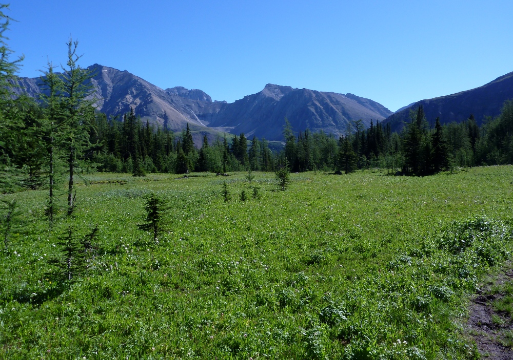
A while later on the trail, there is a meadow split by Pocaterra Creek as it runs down from the cirque. This picture looks back the way we had come.
Passing by a side trail up to Grizzy Col (8550'), we arrived at the cirque, and chose to go up towards Little Highwood Pass, rather than climbing directly up the side of the ridge. Here is the view from shortly after making that decision, looking back down to Highwood Pass. If you click on the photo to enlarge it, you might see the direct trail climbing out of the creek bed.
The vegetation vanished as we walked up the draw towards the pass. Widely scattered snowbanks still persisted up here, at about 8000', despite the intense sunlight.
And then, although we were at Pocaterra Cirque, not Ptarmigan Cirque, Joan almost stepped on a ptarmigan. This is not a colorful turn of speech, for she almost stepped on the ptarmigan. She did not spook or startle (the ptarmigan, that is. Joan, however, was quite surprised).
She called out to her babies, telling them to stay still where they were, partially hidden and protected by the rocks.
This pika paused in his foraging to observe the tableau.
We lunched short of the pass, which is at 8348'. We considered this a good escalation of altitude -- our Grotto Canyon walk reached perhaps 5400', and the Barrier Lake Fire Lookout hike the next day reached 6600'. Reaching 8000' was a good workout for a pair from Ohio. In some other year we plan to climb to the top of that ridge and float in the view.
Coming down, we encountered ptarmigan again. Some were the ones we had seen before, but there was one youngster who had stubby wings and a lot of baby down.
Then we made our way back down to Highwood Pass, and drove to Mount Engadine Lodge. We have stayed at this lodge, an excellent base of operations for exploring the Kananaskis Country.
One important factor in choosing hikes out of Engadine at this time (end of August 2011) was the prescribed burns in the area, ignited an attempt to limit the damage caused by pine beetles. The lodge itself was close to the Buller Pass and Rummel Lake burns:
The map comes from the Government of Alberta website linked to by "prescribed burns" above. You can see how close the lodge is!
The fire professionals had prepared the lodge and cabins against any blowing sparks. In need, a pump would bring water up from the creek, and sprinklers were on the roof of each building. You would be right to expect me to have pictures of this, after two years of blogging, and you will be right to be disappointed that I did not. However, there is this picture of the lodge in the late evening:
I was out in the driveway to see if I could get a decent picture of the fire. It was not the wall of flame that you might expect, particularly because it was towards the end of the operation. Occasionally a tree would ignite and flare up like a piece of paper, burning brightly for a moment or two and then guttering out. The fire, perhaps not as hot as an uncontrolled burn, seemed to strip the trees of leaves, needles, and small branches, but not consume them entirely. Here is my best picture of one of the candle trees.
Another factor was bears. The always-popular Chester Lake trail was closed due to bear activity. Just across the road from the Chester Lake trailhead parking is the Burstall Pass trailhead parking, as can be seen at the bottom of the burn map, and that's where we were going the next day. With our bear spray, as always.
Burstall Pass, to which we had been only once before, years ago, was our "must do" destination for this segment of our trip. We had three days of training behind us, and the weather forecast for tomorrow was good.