Since 2010 I have documented my visits to Fairfield, Iowa, for extended TM (Transcendental Meditation) practice at Maharishi International University, plus occasional Ayurvedic treatments at The Raj. The most popular of these blog posts is here.
I've even written a post about electric vehicle chargers on my route to Fairfield, a subject that was outdated six months later. But I've never written explicitly about the Jefferson County Loop Trail, which circles Fairfield, although references to it are scattered through the last eleven years of this blog. Now I'm going to remedy that.
My photos are from any time in the last ten years, usually in March/April or October/November, and, depending on the direction of the sun, facing the way I'm headed or the way I just came. I will sort them into physical, not chronological, order and hope they make sense.
The loop was constructed in sections, taking more than a decade. (Click on the image to enlarge.)
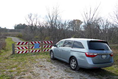
Below is an overall map with parking locations indicated. Parking is vital unless you're on a bicycle and intend to do the entire loop (15.9 miles) in one go. Walks embarked upon with one car require double the distance -- if I walk two miles outbound, I also must walk two miles back to my vehicle.
Where to begin? I suppose mile marker 0.0/15.9 is as good as any; it's at the intersection of Hwy 1 and the Route 34 bypass, where the hospital also lives.Here's a closeup of the dedication plaque.From here let's go clockwise, counting up from mile zero until we close the circle. I didn't cover the pieces of the trail in any particular order, but I've organized the photos to provide the illusion of continuity.
All I had to do was turn around to see the Maasdam Percheron Barns.
These historic barns were saved when the Route 34 bypass was
constructed,and are open to visitors on Tuesdays, Thursdays, and
Saturdays between May and October -- so they haven't been available when
I've been there. (Closed during the COVID pandemic.)
Here is the Mile 1 marker, almost where the trail crosses Kale Blvd.
 |
Note the sponsor's name on the sign.
|
On another day I parked on Kale Blvd. and returned to the marker, turned around, and continued west.
A sign about the trail art, somewhat wrinkled by the elements. Passing the Mile 2 marker. The trail had flattened out, with fields on one side and the Route 34 bypass on the other.A sign about the tree plantings on the route. The saplings aren't mature yet, but then, I haven't seen them leafed out on this stretch, so I cannot say how much shade they offer.At one point I noticed an unusual feature of the fencing separating the trail from the highway. There were spots where the gap between two posts was occupied not by fencing, but by curved rods, slightly flexible.My guess is that their purpose it to allow people or animals to exit the highway by pushing against the curves, which would flex just enough to allow passage. The ends of the rods meet each other and poke inwards, however, deterring passage into the road's right-of-way.A sign of progress.
The intersection with the Cedar View trail was my turn-around point for this day.

The artistic bridge over the bypass.The view north from the bridge; at the far horizon the bypass rejoins the business section of Route 34. Click on the image to enlarge.
For fun, I made a version that's more springlike with the Deep Dream Generator. |
With a nod to Vincent van Gogh
|
Be careful in season.Rejoining the loop trail, long and flat at this point, I encountered a memorial bench.The next stop seemed a long way away.I knew I must eventually turn around and return to my car, to attend a meeting where Dr. Tony Nader / Maharajah Adhiraj Raja Raam would be answering questions. To ensure that I could remember how far I'd gone, I took a few photos along the way. |
I became desperate for landmarks!
|
A big sky shot from another time.I didn't make it all the way to the intersection, so that waited for another day and starting from another parking spot, Whitham Woods. A panoramic view from another year.

I passed underneath 34, which crosses a creek here, and started down towards my previous mark. The creek followed on the right for a little while.Closing this gap called for a commemorative selfie,because I had bagged my last section of the loop. (I did mention that I walked the various segments without regard to continuity.) Once back at the parking area, I discovered that the next mile marker was just a few hundred feet to the east.I covered a further stretch of the Jefferson County Loop Trail from another yet another parking area, so we'll start there in the next post.


No comments:
Post a Comment
Comments may not appear immediately as they are moderated by the author to eliminate spam. Please, no commercial links!