Showing posts with label marv's classic soda shop. Show all posts

Sunday, January 26, 2014

CR2013: Mount Yamnuska

Less than three weeks after returning from our Arctic journey, Joan and I embarked on our annual hiking trip to the Canadian Rockies. This was the year of the huge floods in late June, so Joan and I were anticipating lots of changes, especially in the Canmore and Kananaskis areas.

After flying into Calgary, on August 27th, we rented a car and made a beeline for Marv's Classic Soda Shop in the small town of Black Diamond. We savored and consumed chocolate malts, and then drove to the north end of the Kananaskis valley. The southern approach, more natural from Black Diamond, was closed because of flood damage, two months after the deluge. We then drove down Highway 40 to the Barrier Lake Visitor Center, where we bought bear spray and looked at astonishing photos of flood damage in the area, considered a 500-year event. I believe it.

Our first two nights were spent in Canmore at Canadian Artisans Bed and Breakfast. Here our two travel pigs for this trip, Pigtail and Danny, are introduced to the house bear at Canadian Artisans.

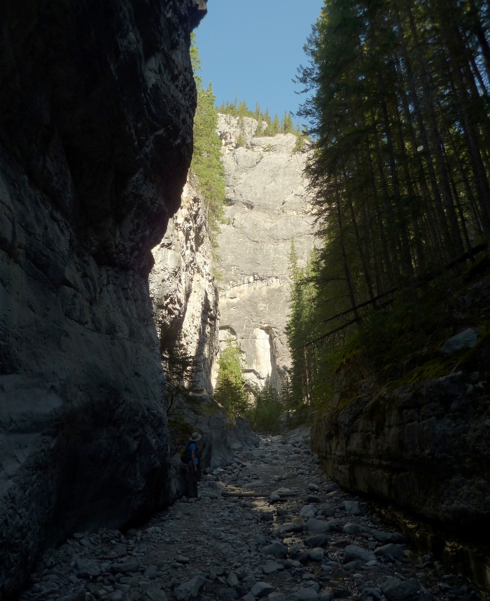
The next day we began our hiking with a repeat visit to Mount Yamnuska, officially named Mount Laurie but known by all through the indigenous Stoney name, which means "wall of stone." We had hiked here once before several years ago, but this time we would go further. The trail begins flat but soon has several short ups and downs as it approaches the foot of the mountain.
Then the trail climbs steadily, at first through groves of aspen.
The trail splits into a hiking route and a route for wannabe mountain goats.
Partway up there is an open, grassy zone and a ledge with the first viewpoint of the hike.
We paused to admire the view without sitting down on the rocks. Of course we had our binoculars with us.
Joan and I ate lunch at the same spot we had in our earlier visit. The trees have thinned out and a rocky face provides a viewpoint and places to sit, or at least lean, and enjoy your sandwich.
We had gone no further on our earlier visit. To continue, you must negotiate the slot you see in the right of the above photo. We checked it out and, at first, decided to turn around, but when we saw others coming back down and others going on, we decided we could do it, particularly if I went first and gave Joan a hand with a tall, slick step. Here is somebody coming back down the slot.
Beyond the slot the trail resumes on a scree-covered surface, and after a short distance you have a choice. By climbing left instead of right, you can reach a viewpoint on a ridgeline without climbing all the way to the mountain's top. If you wish to summit, continue to the right instead. On the recommendation of other hikers Joan and I decided to go to the ridge, and although it's less demanding than the summit, the view from this ridge is wonderful in its own right. And after all, this was our first day out!

Here is one overlapping photo taken next to the knife's-edge side of the ridge.
The hill at the left, looking so innocent, was part of our route up. Zooming in you can see several of the switchbacks.

This video provides a better look at the whole scene.


The wind up here must be fierce, as evidenced by this hardy tree. Today's weather is benign.
Then it was time to go back the way we came, or so we thought. We walked along the ridge for a while, thus not going back the way we came. Then it was time to descend, and there were multiple unofficial tracks to choose among. We worked our way down, and down, and then Joan realized that we were further downhill than the slot. Fortunately it was a only short climb back up to the wide trail, and very soon the other side of the slot appeared.
On the far side of the slot we caught up with a foursome of twenty-somethings. We fell in behind them, and somehow our brains went dormant. The four hikers in the lead took a very steep turn to the right, which, had we been thinking, we knew was much too soon, that we had a way yet to walk through the trees before we would reach the switchbacks in the zoom-in photo.

But we followed them. The route got steeper and became apparent that this was not a trail, but a plunge down an erosion course. Should we try to go back up and regain the trail? I thought not, that it would be too difficult and time-consuming. Strike two.

Our descent was composed of small steps, dislodging dirt and small stones, grabbing at slender trees, and would have been almost impossible, unless sitting down, without our two hiking poles. As it was we had to pause several times to rest our legs, gather our wits and bolster our morale, and plot the next leg of the route. The four in front of us were, every so often, breaking into two groups of two and then converging again. Eventually we lost sight of them.

Finally we reached a gentler slope and vegetation, and then a trail. Not the trail we had come up, but a genuine trail was welcome. At one point we passed an old stone ring that had in living memory contained a fire. The trail began to work up and down and around small bumps and dips in the land.

Two or three times we passed what I'll call "squirrel middens." Squirrels sit at or above these favored spots and strip pine cones (I use the term "pine" in a generic sense, for conifers) with their incisors before gobbling the seeds within. This midden is several feet across, and near the top there is a hoard of cones (click to enlarge).
We finally, and with great relief, rejoined the main trail. My thought was that we should turn right, but another pair of hikers was approaching, so I asked which way to return to the parking area. They must have questioned my sobriety, but confirmed that right was correct.

Lesson #1: Remember where you've already been.
Lesson #2: Don't blindly follow others, but think.
Lesson #3: Don't be afraid to turn back and regain the path.

P.S. The foursome made it safely to the parking area too.

Tuesday, August 14, 2012

CR2012: Arrival

Our 2012 trip to the Canadian Rockies began, as usual, with flying to Calgary. A moose waited for us in the arrivals hall.
We walked over to the rental car building and got in line for Hertz, with whom we had a reservation of many months standing. There was only one person ahead of us in line, which we thought was good, but things were moving slowly. When we reached the counter, there weren't any cars available in our reserved category (full-size). It all depends on when people bring their cars in, we were told; apparently, Hertz expects the drop-offs to happen sooner than the pick-ups, and when they inevitably don't, you wait. We emphasized to the guys at the counter that we wanted a vehicle with a trunk, to keep our luggage secure, which is why we reserved a 'full-size' vehicle oh-so-many months ago. And then we waited. For a bit over an hour, at which time they offered us ... an SUV. Trunkless. Without even a privacy screen to pull over the cargo area. We expressed our displeasure, only to learn that Hertz expects most customers to request an "upgrade" to an SUV. We didn't. We were told that there was no telling how long it would take for a full-size car with a trunk to be available. We said we'd wait, and our frame of mind was not the best. Something always goes awry with the rental car companies at the Calgary airport -- we've tried at least three over the years. We learned to avoid the queueing hell of the Calgary Stampede, or the Labor Day weekend. We had arrived by 11:30am. But nothing helps. An hour and a half into this visit we were fuming at the futility and gullibility of making a vehicle choice when reserving a car. Ten minutes later Gary (praise to him) ran in with the keys to a real car, a Dodge Avenger who we promptly named Mr. Steed. We left and headed south for Okotoks.

At Okotoks we headed west on Highway 7, to reach the Okotoks Erratic, a glacial erratic:

View Larger Map

From the ground, you can appreciate how out of place the rocks are.
And closer up, you see how massive these boulders are.
These quartzite pieces are hundreds of miles out of place, having fallen atop a glacier near Jasper during the last Ice Age. They were slowly carried by the glacier to this point, by which time the glacier had stopped growing and then melted. There are several informative signs along the trail.
Then we drove further down Highway 7 to the small town of Black Diamond, and Marv's Classic Soda Shop. We had stopped here last year, and by this time desperately needed another chocolate malted with chocolate ice cream and chocolate syrup. We've received recommendations for Marv's carbonated ice cream, but it's impossible for us to pass up the chocolate malted.
We then turned north, headed towards the Trans-Canada Highway by a route we'd never taken before. We arrived at the Canadian Artisans Bed and Breakfast in Canmore, our choice for the last three years, and were greeted by our hosts Bob and Val. Canadian Artisans, besides being comfortable and offering astonishingly good breakfasts, has an ideal location within walking distance of both the downtown area and riverside trails. Our pigs (Dr. Maybe, Babelet, and Ruth) got along very well with the host bear in our room.
We ambled down to the Valhalla Pure store to pick up bear spray (not for the cuddly one above), had dinner at the Rocky Mountain Flatbread Company, an excellent place for an informal dinner, and then crashed. It had been a long day, and tomorrow was our first hike.

Thursday, December 15, 2011

CR2011: Canmore, Grotto Canyon, and Barrier Lake Fire Lookout

In late August we took our annual trip to the Canadian Rockies. This entry will cover our hikes in the Canmore area, ones we had not walked before.

It was an auspicious beginning at the Calgary Airport. Hertz gave us the ideal car for this trip, something we had not received in eight prior visits to Calgary and three rental agencies.  The Ford Taurus had a trunk large enough to hold all our luggage, but was not a huge grandfather's land yacht, and best of all, it was not an SUV, which is a battle we've had to fight before. When you are taking a day hike while traveling from lodge A to lodge B, you do not want your luggage exposed to view in the back of an SUV!

We took a long route to Canmore, heading south from Calgary and passing through the small town of Black Diamond to stop at Marv's Classic Soda Shop. Joan and I both had a chocolate malt, and the young man behind the counter chatted with Joan about a trip to Italy he had taken. Then he charged us $5 for the two malts, which listed for $6 each!

We came up towards Canmore through Highwood Pass, which at 7238' is the highest point in Canada on paved highway. South of the pass we passed two young grizzly bears moseying north on the shoulder of the road. These were the first grizzlies we had ever seen in person during our Canadian trips. We had been following the bear situation before our departure, and we knew that it was an active wildlife year. The previous summer was an exceptionally good berry season, so the bear moms had a bumper crop of cubs over the winter. Now, this year, the foraging was not so good, causing the bears and other wildlife to roam widely in search of food.

As before, we stayed at the Canadian Artisans Bed and Breakfast. The guest parking there is flanked by pine trees and the house, as you can see in this photo. Squirrels loved to drop sap-soaked pine cones onto the car from these arboreal perches.
Our Taurus had a rear view camera whose image was displayed in a tiny square on the rear view mirror, and a proximity warning that beeped faster and faster the closer the back of the car came to an obstacle. By the time I parked it as seen above, with the help of Joan's hand signals, the warning was screaming loud enough to make me wince.

Before hiking, we stopped in town to buy bear spray. Good to have in any case, bear spray had also been required to hike some of the Barrier Lake trails, part of our second hike, at different times in the summer. No bear spray, and you got a ticket. Sometimes that trail had been closed entirely because too many hikers and bikers were ignoring the precautions. Fortunately for us, that trail opened before we arrived.

But our first hike was the Grotto Creek Trail in Grotto Canyon. This section remains a fuzzy, low-resolution image on Google Earth, or I'd show it to you. After passing behind a magnesium oxide processing plant, the trail begins to rise and then turns northerly into a gorge. At this point the trail breaks up; it has become just an intermittent alternative to walking the creek bed when the creek is high, and the primary route is up the creek. This is a popular rock climbing location, and it's easy to spot metal hoops hammered into the rock faces. After a while, you arrive at a 'T'.
The right hand of the 'T' is brief, steep, and polished by the boots of many hikers, ending in a waterfall.
Those stone ledges look like an inviting path to the waterfall, but they're treacherous. I took a picture of the waterfall, but  the photo was tilted because of my precarious perch on the stones, and I needed the computer to set it right.
We continued up the canyon, to the left.
Shortly there was a broader spot where the remains of a fire ring or two could be seen, and the creek turned north again. The walls of the canyon sank lower and further apart as we climbed. After lunch we decided to start back, and passed again a huge hoodoo-like formation, made of more easily eroded soft aggregates, but with a cave entrance partway up.
A family had climbed up to the cave entrance, and discovered that going up was easier than going back down. Getting the kids down took some coaching and coaxing.
The Grotto Canyon was an interesting warmup, with plenty of stony footing.

The next day, a Saturday, we hiked to the Barrier Lake Fire Lookout. Having arrived as early as we could to claim a parking spot, there was a chill morning breeze, and we were glad for our jackets, even on August 27th. We hustled quickly across the earthen dam to stay warm, and then the wide Prairie View Trail began to climb. At the first intersection, where the Stoney Trail, paralleling the lake, crossed ours, we were greeted by an ashen-faced mountain biker. He asked, "Which way are you going?" He had just seen a mountain lion, a kilometer back on his trail. Two young mountain lions, a brother and sister, had been killed earlier in the summer due to their lack of fear of humans. Fortunately we were headed straight ahead.

The first leg of the hike winds up and up the side of the ridge, almost broad enough to be a road, with frequent switchbacks. Several mountain bike riders passed us; this leg is part of a popular loop for them. Eventually you reach the ridge line, and a grassy area provides the first viewpoint.
From here you can look up along the ridge line to the Prairie View Viewpoint. The last climb up to the viewpoint is much narrower and rockier, not hospitable to a casual mountain biker.
On reaching the Prairie View Viewpoint we were not alone. Groups of people were savoring the bright sunshine, the warming day, and the view to the east.
The trail we had just come up is visible on the lower ridge, and just beyond several small lakes the Trans-Canada highway winds towards Calgary. Behind us, the top of the ridge beckoned.

I neglected to take a photo of the large reflector that is part of this viewpoint. It was used to bounce radio signals around corners and mountains, and might still be active. However, in researching links for this post, I ran across the blog Hiking with Barry, which has a good picture of the structure in his post on this very hike. Barry did a great job with his photos.

It wasn't clear at first how to proceed towards the Fire Lookout, but we had just to continue west on the rocky promontory until the way starts to climb up the ridge again. This walk was turning into a good training exercise for our lungs, which are accustomed to an altitude of 1,000 feet. The fire lookout is at about 6,600 feet, and 2,000 feet above the lake.

The Barrier Lake Fire Lookout is one of the remaining actively staffed lookouts during fire season. Signs request that you do not peer into the house, interfere with equipment, or otherwise disturb the warden.
However, while we were nearby the warden came out to inspect some of his instruments, and Joan and I (especially Joan) had a good conversation with him. Below the house, other hikers were picnicking on the helicopter pad. There are also picnic tables in the shade just below the summit.
As usual, I was focusing on the panorama. It's a good view up there, of course -- it's a fire lookout. To the west, the town of Exshaw and a large quarrying operation are visible down in the valley of the Bow River. There is a trail and mountain bike route through the wooded valley down to the Trans-Canada highway.
Here's a closeup of Exshaw and the quarry. There is also a long Canadian Pacific train; this is the major transportation route between the west coast and the rest of Canada.
Looking to the northeast isn't bad either.
Then we returned the way we had come, completing an excellent hike. Tomorrow, we would move on to Pocaterra Cirque and Mt. Engadine Lodge.