Sunday, September 6, 2015

CR2015: Peyto Lake and Bow Summit Lookout

July 23rd was a transit day between our stay at Canadian Artisans and the one-night "base camp," Cathedral Mountain Lodge, preceding our next multi-night destination, Lake O'Hara. Joan and I decided to drive up the Icefields Parkway and walk to Peyto Lake and the Bow Summit Lookout.

As we consumed Val's always-scrumptious breakfast at Canadian Artisans, she said, "You should never present Bob with a challenge." He had straightened my bent hiking pole! It seemed a sturdy repair, so we didn't buy a new set at the Canmore outdoor store, Valhalla Pure. The unbent pole worked fine throughout the trip.

Peyto Lake is a major tourist destination, with separate parking areas for autos and for buses, and deservedly so, for the wonderful colors of the glacial waters that shift with every alteration in the angle or intensity of the sunlight.

We checked out the crowded observation deck, and I took the above photo, but this wasn't our primary goal. There is an interpretive loop that heads beyond the deck, and at one point an old road heads off for the former location of a fire lookout tower. We were pleased that some of the spring flowers were still in bloom here; the microclimates vary so much in the mountains!
The fireweed was in all colors, including this two-tone.
This view looks back (north) along the valley of the Mistaya River. The weather was highly variable, with potential rainclouds coming and going. (The Bow Summit is so named because it's the highest point along the Icefields Parkway.) On this stretch we heard several hermit thrushes singing.
This photo zooms in on the valley, with sections of the parkway and lakes further north revealed.
The middle section of the walk was unremarkable, but then we reached the marmots. These two were play-wrestling.
As long as we didn't make any threatening moves or approaches, they ignored us.
There was an adult or two, but the youngsters were much more photogenic. Later on, there were several birds foraging. Not enough markings to make an identification for this one, but if you click to enlarge, you'll see he's caught something.
This view looks north from our lunch spot. The old fire tower site is the open pad in the far center (click to enlarge), but a footpath led on to this location, where we could see both the valleys, Mistaya and Bow, at the same time.
Unfortunately I decided to eat lunch first and take pictures later. By the time I ate the last cookie there was heavy rain to the south, with a high wind driving light rain horizontally in our direction. No pictures to the south today. In character with this changeable day, once we started our walk back the rain dwindled and then disappeared. However, driving south on the Icefields down to the TransCanada after our hike, the pavement became wetter and wetter. We were fortunate to have been well north of Kicking Horse Pass! The town of Field had been drenched.

We spent a pleasant night at the Cathedral Mountain Lodge, a location that makes it easy to catch the morning bus to Lake O'Hara Lodge. They weren't full that night and upgraded us to a larger cabin.

Wednesday, August 19, 2015

CR2015: Canmore and East End of Rundle

On July 21st we flew into Calgary to launch our 2015 hiking expedition in the Canadian Rockies. First, we walked over to Hertz for our Hertz Gold "full-size car." They offered us an SUV, a Jeep Patriot, which we told them was unacceptable. We had three duffels of luggage, which would be in plain sight in the back of an SUV, whether taking a day hike between lodges or leaving the vehicle behind while at Lake O'Hara Lodge or Mistaya Lodge. We insisted on a car with a trunk. After 45 minutes, we were given the keys to a Dodge Charger.

We inspected the Charger carefully. Cars in western Alberta are subject to many physical insults, including gravel roads, and we did not wish to be charged for a ding or crack that was already present when we took possession of the car. We've had to pay for two windshield replacements in our years of car rental out of Calgary.

Mr. Charger already had a windshield chip, 
which we had the Hertz representative note. He said there was a small red dot on the contract diagram which indicated the pre-existing condition, but we got it in writing.

We arrived in Canmore and stayed at the Canadian Artisans B&B, hosted by Val and Bob, as we have for several years. This year, two pigs were waiting for us in our room,
along with Mr. Bear.

The next day we set out to tackle the East End of Rundle route, as we had in 2014. On our first day at altitude this would be challenging, but hey, we'd done it the year before.

First, a pit stop at the Goat Creek Parking area. We're headed up towards the high ridgeline behind the wooded bump.
Mr. Charger took us a few hundred yards back to the parking area on the edge of the canal leading to Whiteman's Pond, at the top of the gap on the right, saving us a trudge with billowing dust every time a car passed by.

The trail leaves from the roadside and immediately heads up.
The first point of interest is an avalanche-explosives warning sign.
The trail switchbacks through the woods, then takes a permanent bend to the north as the underlying rocks break through.
Sometimes there's a trail and sometimes you're looking ahead to spot a cairn (sometimes misleading) or piece of colored tape hanging from a tree, to which you must pick your way. Usually there are no more than two choices based on the boot traffic that has scuffed, polished, or mudded the rock. Here's a view looking back after our first half hour.
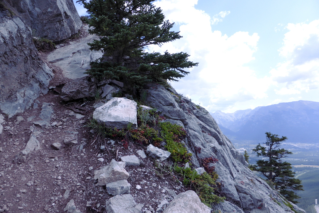
In a couple of spots the route skirts the edge.
After a brief flat spot and viewpoint at the crest of the wooded area, we're switchbacking through scree. In places there are multiple boot-beaten paths visible, and we must choose the footing that appeals most to us. We're using our hiking poles in earnest.

This panorama shows the wooded crest, bottom center, as well as a peek down the Spray Lakes valley.
Joan spotted nine mountain goats across the mountain!
The sky is constantly changing, both over us and down the valley. Will it rain? Who knows? We have rain jackets and rain pants. This photo tries to capture virga, rain not reaching the ground, visible to the south.
We reached the broad meadow below the final climb to the ridgeline, and decide to lunch. Ahead, more scree and the crest. The main trail is visible in the rocks (click to enlarge). This year there were far fewer flowers blooming in the meadow than in 2014; we were a few days later, and the season was running faster.
A young marmot romped through the meadow while we enjoy our break.
Then we resumed our climb. Last year we reached the ridgeline and stopped there. This year, we attained that point and continued to the left for a bit more altitude, with a scree slope on one side and a precipitous drop on the other, reaching a spot at the foot of the rock face towards the left of the earlier photo. The view encompasses both the Bow and Spray Lake valleys. You can see the lunch meadow down the bottom right corner.
Fully zoomed in, my camera captured the zone of the June Canmore natural gas explosion, not far from Canadian Artisans, which would be on the far right of this photo.
After drinking in the panorama we worked our way back down, and spotted several marmots. A young marmot led our focus to an adult; both are in this picture, at either side.
Another marmot snapshot near the top, with one on either side, although you'll likely need to click to enlarge. We save five in total on this trip, three adults and two young'uns.
Then it was time to plunge downhill, first through the scree slopes, and then through the mixed roots and rock outcrops lower down. As we went, it became harder to avoid slips and skids of the foot, even though we made an effort to focus. Dehydration? Low blood sugar? Going further than last year? Not having been at higher altitude in May like last year? All of the above? Still, we were doing well until almost at the end, when my right leg shot out from under me and I rolled downhill a turn and a half. I was OK, but Joan had to break out her first aid kit and wipe blood from small cuts on my face, and bandaid one of them. My right-hand hiking pole was bent, as you can see in this photo taken back at the car.
I would develop a bruise from where I'd rolled over the can of bear spray I was carrying, and a tear in the pant fabric under the bear spray meant that one of my favorite hiking pants was ruined after one day of hiking this year.

We cleaned up well, and had a good dinner at CrazyWeed. We were chastened but ready to keep going.

Tuesday, July 14, 2015

Training @ClearCreek

During July Joan and I took several hikes at Clear Creek Metro Park to train for our next trip to the Canadian Rockies. There wasn't much we could do to prepare for the high altitudes, but we could tramp up and down the ravines and hills of the park to toughen up our legs, lungs, arms, and feet as much as possible. This post will show some of the interesting life-forms we observed along the way.

Birds can be difficult to capture on the camera, being flitty and uncooperative, but I did get some decent images. One of the best is of this female hooded warbler, who hopped around but stayed close to scold us almost continuously. She clearly had a nest nearby.
One of my favorites is the male scarlet tanager. They are common, in the sense of an abundant population, but they're often hard to spot, hanging out high in the canopy. They sound like a robin with a sore throat, as Joan puts it.
Here is juvenile scarlet tanager, still fluffy rather than sleek.
Phoebes had built a nest high in the shelter house at the Barnebey Day Use Area. They had a large brood, as you can see, which had fledged by mid-July.

It's been an extremely wet June and July. We had 23 days with rain out of 30 in June, including 19 straight. July hasn't been any better so far. Not surprisingly the park has a wild exuberance of mushrooms and other fungi. In fact, by July 12th we saw fungi on fungi -- mushrooms coated in mold and other fungal threads.

Here's a really BIG white mushroom.
Nearer the other side of the size spectrum, there's this colony of small tans.
One tree was so mossy from our extended cool, wet summer that it had true mushrooms growing out of it rather than shelf fungi.
Completely different in appearance, this violet coral fungus stopped us in our tracks.
Toads love the super-wet conditions as well. On July 12th we saw ten thumbnail-size or smaller toads on various sections of trail.
They are small and well camouflaged. If they were on the trail we herded them off to the side so they wouldn't be stepped on.
Another creature that we saw was an inch-or-less critter that looked like a very young walking stick, caught on a spider line. Joan rescued it.
One of the meadows by the creek was hosting canada lilies.
Habitat: moist meadows and wood margins. Yup.
My final snapshot is of a moth, perhaps LeConte's Haploa. It's not well camouflaged on these leaves.

In the three days since our last walk we've had rains of 4.1" (only 2¾ at the airport), 0.2", and 0.6", so I'm sure the woods are still wet.

Update 7/18/2015
We returned to Clear Creek on July 16th, after more rain and wind every day since the July 12th hike. The trails were muddier in spots, the streams ran fuller, and there were several "downers" across the trail. Fortunately they were all easy gone around or through.