Showing posts with label le chocolatier. Show all posts

Tuesday, September 3, 2024

Hiking Canada 2023: A Long Way Home and a Surprise

 On July 28, 2023, there was off-and-on rain in the morning. Joan and I packed up after breakfast and headed to Canmore to shop at Le Chocolatier, a fabulous chocolate manufacturer. For a long time we've stopped there on the final day of our Canada visits. Alas, we arrived just after 10am, but they open at 11. No problem, we'll go to the Kananaskis visitor's center and donate the bear spray we purchased there two weeks ago. (They can use it for demonstrations but cannot resell it. And we can't take it on airplanes!) We took the back way, Highway 1A to 1X to 1. When we returned to Canmore, Le Chocolatier was open, and Joan and I loaded up.

We then took Highway 1 east for a few exits and hopped onto 1A for a scenic drive, the early parts of which go through the Stoney Nakoda First Nation. It's a scenic, slower, two-lane route; sometimes, horses are grazing on the roadside. Then, Joan and I enjoyed lunch at Aama, in Cochrane. We sampled yak stew, flatbread, yak momos, and chicken "chow mein" -- noodles with great spicing. Did you know there is more than one yak ranch in Alberta?!

Finally we drove on, returned our rental car, and at the airport hotel prepared for the next day. Or so we thought. The next morning, we walked the entire length of the airport to check in for our 7:30am flight with United. There weren't true check-in counters at the far end, but stand-alone machines and two personnel behind the counter to accept our baggage. We entered our info, and the kiosk spat out our baggage tags (put them on yourself) and boarding passes.

We inspected our boarding passes. Whoa! Our itinerary had been simple -- Calgary to Chicago to Columbus. What we now held passes for was Calgary to Chicago to Dulles to Columbus. It turned out that a crew member for our flight had  arrived late the night before, and given the mandatory rest period for aircrew, we were going to leave Calgary at least four hours late. Needless to say, we had time to kill. At least we had some views (and reading material).
Chicago was hectic, but Joan and I managed to board our flight to Dulles. Approaching Dulles, we could see lightning flashing in the clouds, and you can bet we worried whether our plane would be able to land. Fortunately, it could. As Joan and I marched the length of Dulles to our next gate, it was obvious that many earlier flights had indeed been canceled -- the queue for customer service was as long as half the airport, and folks were sleeping on the floor.
 
Luckily, our plane was still destined to depart. But the gate agents couldn't tell us when: United was still scrounging up an aircrew. They arrived in dribs and drabs, including a pilot that looked like he was fresh out of high school. When we finally boarded the plane, the pilot announced that we had to wait a bit longer because the aircraft hadn't been refueled.
 
Eventually we took off and landed in Columbus. We arrived back at our house at 3:00am. When we woke up, Joan and I were stunned to see that three skyscraping honey locusts had blown down when we were gone.
Fortunately, they had fallen parallel to the yard, not into it or our house. The stairs in the photo belong to a neighbor. Nothing was damaged except other trees, and our bank account for removing the locusts. One still had enough of a trunk that a climbing specialist had to go up at least three stories to dismantle it piece by piece.

It had been a rewarding trip, but with frustrating airline troubles both going and returning.

Thursday, April 6, 2023

Back to Canada: Consolation Lakes and a Driving Tour

Joan and I left Moraine Lake on July 28th, but only after we hiked to the Consolation Lakes.
The trail goes as far as the lower lake.
The kicking-off point was the Rockpile Trail,
but the route to the lakes soon split off to the left. After gradually climbing through the woods, we broke into the open, and the lower lake began to present itself.
Being a close destination compared to others at Moraine Lake, multiple groups of hikers were already there. (Click on the image to enlarge.)
The panoramic view invited us to sit and gaze.
A closeup of the glaciers at the head of the valley.
This was the view downstream, where the lake gradually transformed into Babel Creek.
We two-legged creatures were not alone. Who's this?
A young marmot!
Who was not too concerned about us.

Then it was time to snack, return to the lodge, and check out. Then Joan and I faced an extra day, baked into our schedule because when we made our reservations, the US still required a negative COVID test to enter the country by air. Therefore, we had added a day to take the test. But then, the requirement was dropped a week or so before our departure. We had open time -- the latter part of the 28th, and the 29th.
 
We drove to Cochrane, a good two hours away, and marveled at the explosion of development there. Subdivisions are being built so fast that the mapmakers can't keep up! We checked into our hotel, drove into "old" Cochrane, and had a fabulous dinner at the Jaipur restaurant. We consider it one of the best Indian meals we've ever had. Here's a StreetView screenshot:
On the 29th, we took a driving tour. From Cochrane we headed south through Bragg Creek to Diamond Valley (formerly Black Diamond). At Diamond Valley there are clues to this area's petrochemical past: the Oilfields High School, "Home of the Drillers," and the Turner Valley Gas Plant. Joan and I continued south to Longview, then headed west to Route 40 and north to Highwood Pass, the highest paved pass in Canada at 2,206 meters or 7,328', closed from December to mid-June.
There we stopped for a leg-stretch.

There are several informative signs along the boardwalk.
We were not alone, within sight of many humans taking in the sunshine, and of animal life.
On the other side of the highway, there's Ptarmigan Cirque, a popular hiking destination that we've done before, but not today.
We continued north on Highway 40, and made a brief stop at the Mount Lorette Ponds. There's a surprisingly scenic stroll around these remnants --
they were an oxbow on the Kananaskis River but were cut off when Highway 40 was upgraded.
A view down the length of the ponds. They're fed by freshwater springs.
Next Joan and I stopped at the Kananaskis Visitors Center to donate our bear spray, and drove into Canmore to buy chocolate bars and confections at Le Chocolatier, as much as we had room to take home in our carry-on luggage. With a final drive to Calgary, clotted with traffic due to construction, we reached the airport hotel and flew home the following day.

We'll return in 2023 and, in addition to some of our favorites, bag the hikes requiring more training than we had this year.

Wednesday, November 25, 2020

Canada (2019) Part Nine: Galatea Lakes

Tuesday, Sept. 17 (2019). This was our last hike, the day for us to tackle our "goal" destination after two weeks in the mountains: Upper Galatea Lake. The previous year we'd made it almost to the lower lake, but weather and time had turned us back. We were determined to succeed this time. It would be work; it's a 18.6km/11.6 mile round-trip, gaining 806m/2644 feet to an altitude of 2230m/7316ft.

Joan and I rose early to have breakfast and then grab lunch fixings at the Market Cafe of Pomeroy Kananaskis. We drove out to the Galatea Lakes parking area and hit the trail at 8:00am.

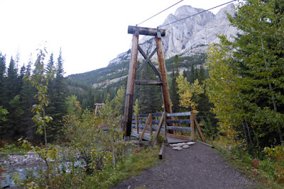
After a brief downhill we reached the bridge across Galatea Creek.

In case you were tempted to ford it --
Shortly thereafter we crossed
a modest footbridge over a tributary flowing down from the mountains; this stream would be with us for miles. At the far side there was a trail sign.
Left green circle, our destination. Right circle, our starting point.
The next section began with uphill switchbacks, followed by repeated crossings of the stream on replacement bridges,
each revealing damage and wreckage from the floods of 2013. Joan and I would eventually cross ten bridges.
This first zone was largely in the woods. Then the trail climbed away from the creek and entered a zone of mixed woods and rock falls. In places the water had cut itself into a deep canyon.
Joan and I noticed,
along a short stretch, several spray-painted purple markings on the trail and finally a purpled stone sitting in the middle of the path. Trail maintenance markings, perhaps? Or hikers from a school with purple colors? Another mountain mystery.

The climb continued with more creek crossings. The way ahead did not yet appear any shorter.

A major landmark was a flat grove suitable for a pause and a bite.

The grove continues to the right of this photo.

Over the last few years Joan and I have discovered the importance of snacks, particularly for me. Last year we made it all the way to Lillian Lake before eating anything, and Joan told me that by the end I was plodding in slow motion. After sharing a chocolate bar with her, I took off so fast she could barely keep up. (My fasting blood sugar is near the low end of normal). This time, we were stopping every 90 minutes or so for a small snack -- usually dark chocolate from Le Chocolatier -- and my efforts were much steadier.

Flood damage is visible most of the way to Lillian Lake.

After climbing a final, stubbornly steep stretch we emerged on her shores.

This photo looks back the way we've come.

In season Lillian is mobbed by overnight campers, but in mid-September it was deserted. She does host, however, a spiffy solar-powered biffy, and most welcome it was.

After another chocolate stop Joan and I continued up wooded switchbacks until we emerged into the rocky zone.

That saddle is Guinn's Pass, even higher than Galatea.
It's still uphill from here! Looking back at Lillian ...

The trail marker where the path to Guinn's Pass intersects.
We approached the lower Galatea Lake.
The route to the upper lake dipped down to the shoreline and then hopped over that far ridge, revealing this view.
Joan and I continued on the path at far right in the above photo, searching for a congenial lunch spot. We chose this one.
The prominence is Mount Galatea, the highest point in the Kananaskis range at 14,500 ft. During lunch we spotted a golden-crowned kinglet, and, high above, a golden eagle cruising around the peaks. Next, a more panoramic view of the upper lake.
Joan and I explored a bit of the terrain. There were several shallow bear diggings, indicated yummy bulbs had been present. Deeper diggings would have indicated that the target was ground squirrels.
The view from the shore of the lower lake on our return.
We spotted our first fellow hikers of the day, two figures ahead of us on the Guinn's Pass trail,
Click on the image to enlarge.
who disappeared from view as we marched on. When we reached the junction Joan and I met two women from Red Deer who also decided to tackle the pass. Then we saw people coming up from Lillian Lake; clearly, the wave of those who start later was catching up to us.
On our way back ...
We paused on the Lillian Lake shore for another snack and biffy visit.
Among the incoming hikers was family of three: Mom, Dad, and a toddler carried high in a backpack by Dad so the kid could see ahead. Balancing that load must be an acquired skill.

A bold chipmunk kept an eye on us, probably a least chipmunk.

The sun played peek-a-boo, sharing time with brief showers that lasted just long enough to persuade us to don our rain jackets. But our return hike was basically dry.

Heading down the valley.
The air grew warmer as we descended. Late-starters were having fun on and around the bridges lower down. Finally Joan and I reached the parking area at 5:15, 9¼ hours after setting out, a pace of 1.15 miles per hour -- including snack stops, lunch, bird identifying, gazing at mountains, and so forth. Because of these factors our hikes are often in the 1¼ to 1½ mph range.

One woman in the parking area, with husband and dog waiting in the wings, asked Joan, "How far is it?" Joan replied,"Where are you going?" Her response, "Where did you go?" Joan: "We started at 8:00!" With that our questioner lost interest.

The following day was our last in this visit, and after checking out we drove down to Canmore to browse shops and art galleries. Of course, we swung by Le Chocolatier to pick up treats for ourselves and friends and neighbors back home. Large interior windows provided a view into the works.

We also spotted a hang glider gradually descending over the town!
Then it was on to Calgary and the airport hotel, where we had dinner with Barry Ronellenfitch, who I met almost two decades earlier at a retreat. The next morning Joan and I flew off on a day-long trip back home.
This Canadian visit was another great success; we do love the mountains. Our plans for 2020 were made over the next few months, but then upended by the coronavirus. Our fingers are crossed for 2021.

Saturday, February 9, 2019

On the 16th Day of Hiking (Jumping Pound Summit)

On September 21st Joan and I ventured into new territory. We had visited Sibbald Creek and the Deer Trail six years ago, but today we drove past them and plunged south on the unpaved Powerface Trail, heading for the Jumpingpound Summit trailhead.
After we turned onto Powderface Trail there was a sign advising "Powderface Trail not suitable for travel, travel at your own risk." It's a long, narrow road that must be shared with logging trucks. Fortunately we encountered only one truck; I steered close to the edge of the road, and everything went OK. Later the Trail widened and even left us a place to park across from the start of the hike.
When we pulled in there was a trio also getting ready, two sisters and a husband. The ringleader, from Calgary, had a daughter who attended the Cincinnati Academy of Music, and the couple lives in Ontario, just across Lake Erie from Ohio, our home state. They set off ahead of us and stayed ahead.

The beginning of the route was flat, but soon turned into switchbacks. Jumpingpound Summit is considered a half-day hike with a distance of 3.4 km / 2.1 miles to the summit with a gain of 417 meters / 1370 feet. Weather permitting, Joan and I hoped to lope along some of Jumpingpound Ridge as well.

At one point there was a side trail leading to a bench and a view. We were again climbing into a region of wet, drippy snow.
We continued up to the ridgeline and turned left towards the summit. After a while we broke out of the trees.
Joan and I started up the summit spur, and soon the trio was converging with us. They had gone a short way past the summit on the ridge trail before deciding to turn around. We fell in with them and it was a short climb to the top.
You're seeing the last few feet of the summit.
The patchy network of bright and dark around us played hob with my camera; nonetheless, clear-cut logging areas can be seen in the right of this photo, just below the clouds. (Click on the image to enlarge.)
From the summit we could see the ridge crest stretching away, beckoning to us,
but the leader of the trio was adamant that her group would go back down. She was concerned that the clouds blowing in would create a whiteout, and although skeptical Joan and I joined them in the descent.
Going back down carefully.
Back on the ridge trail the leader showed us what she thought were grizzly tracks. The snow had melted too much for a definitive ID, but the trio had seen the impressions earlier and in undisturbed snow.

Joan and I stopped for a quick chocolate-bar break as the three went on. Then we started down, down in the drips and slush. Again we had been transported to the Holodeck and the trek had altered itself to make the return much longer than the outbound slog.

We had lunch the parking area and continued to chat with our fellow hikers. Then Joan and I drove south on Powderface, including a couple of muddy hills on which I held my breath, hoping the car wouldn't lose traction. We reached the Elbow River and paved Route 66, and by this time we were in the midst of fog. There were road signs warning "stock at large next 44 km," and we did see plenty of cattle, through mists that waxed and waned.

Our vehicular expedition turned onto 758 and into the town of Bragg Creek, and finally up 22 to the Trans-Canada Highway, where we turned west. On reaching 40 we turned south and stopped at the Barrier Lake Information Centre to donate our now surplus bear spray, and report the drone flight at Lillian Lake yesterday.

The warden at Barrier Lake couldn't take the report herself, but had to call Kananaskis Emergency Services and then hand me the phone to make my report. We learned that not only was a permit required, but permit holders must post notices around their flight perimeter to preserve the privacy of others. We sure hadn't seen any notices!

By the time we returned to the lodge some sunshine had begun to poke through the clouds, and we were able to pull our dinner reservations 45 minutes earlier. Rain and wind began while had our evening meal.

The next morning, our final day in Canada, revealed a couple of inches that had fallen overnight. It had been that kind of September, snowing overnight and melting grudgingly during the day.
The view from our lodge balcony.
Joan and I had time to indulge in a restaurant breakfast before completing our packing. There was a low cloud ceiling, but we hadn't planned on hiking today anyway. We drove into Canmore and our first stop was Le Chocolatier, where we stocked up on chocolate bars and other treats for ourselves, neighbors, and former neighbors. Then on to pick up two tubes of Voltaren, a pain relief cream not available in the U.S., based on two recommendations during this trip. Joan reports that it didn't do much.

We parked in the center of Canmore for browsing, picking up a new GemTrek map (the best!) and a track and scat ID book, and visiting several art galleries. In the midst of this it began to snow and sleet, and after one or two more stops we decided it was time to move on. Snow had already accumulated on the car.

Joan and I thought to visit the Chiniki cultural center on our way back to Calgary, but it was either well hidden, or closed for the season. We scouted out the associated convenience store/gas station at that exit but there wasn't much to see.

We had dinner at the airport hotel with our Calgary friend Barry, and afterwards rearranged our luggage to protect the chocolates in our carry-ons and to put banned items, such as Swiss Army knives, in the checked luggage.

The next morning I took a couple of interesting photos before our plane left. Here's a hazy look at the Calgary skyline:
We spotted this aircraft, painted in the original Trans-Canada Air Lines colors to celebrate 60 years of service, 1937-1997. Trans-Canada eventually became Air Canada.
I'm surprised they didn't repaint the tail for the 75th in 2012.

The weather in the Canadian Rockies was a challenge this September of 2018, but we're still very glad we came.