CW: Fisher Towers and Canyonlands
September 30th started with this wonderful view from our patio at the Red Cliffs Lodge.
Joan and I breakfasted in cool morning air on the deck of the restaurant, during which I kept going back for more of the Best Date Cake Squares Ever.
While most of the Country Walkers group elected to go rafting with Tim on the Colorado (class I and some class II water), Michelle, Joan, and I went with Clint to hike on the Fisher Towers trail.
The trail is notoriously hot in the afternoons, but this morning we were still in the shade.
The route does dip through a few gullies.
Wouldn't want to be down here in a thunderstorm.
The towers are a magnet for rock climbers. Can you spot two near the top of this photo? (Click on the image to enlarge).
From the top of a ridge we could look back at the parking area. The green strip at the base of the far mesa demarcates the Colorado River.
The climbers took turns scaling the final pinnacle.
I don't intend to ever take a route that requires being roped! (Note how slender the pinnacle appears from a different angle, below.)
We started our return journey as the climbers began to descend. Having been to the top did not guarantee them an easy trip back down.
On the way we came across this colorful critter, probably a beetle, but even with an extensive online search I couldn't identify it. It somewhat resembles the reticulated netwing beetle, but the colors and patterning aren't quite right.
Our two groups met back at the lodge for a picnic lunch at the shelter house.
Our afternoon adventure is a trip to the Island in the Sky section of the Canyonlands National Park.
We disembarked from our vans at the Grand View Point Overlook.
And it's a spectacular sight, a product of hundreds of millions of years of deposition, uplift, and then erosion.
Here's a closer look at a portion of these canyons.
Some folks hang out here, drinking it all in, and don't need to hike any further.
But it's an easy walk out to the furthest point of this mesa, and that's what we did. This shot is an example of the trail.
To the west the Green River, the major tributary of the Colorado River, approaches us.
The trail ends at a climbable promontory. The river courses are 2,000 feet below us.
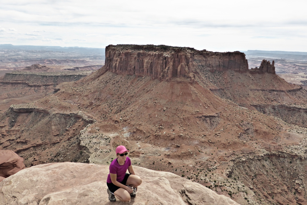
The landscape is vast from this perch.
It makes a good backdrop, too.
Both headed out and on our return, we drove past the Moab Tailings Pile. In 1952 Charlie Steen discovered the largest uranium deposit in the United States near Moab, and now the Department of Energy is overseeing the removal of 16,000,000 tons of uranium mine tailings, covering 130 acres, to a safe disposal 30 miles away. The Pile is a restricted site, of course, but from the highway we could see dump trucks being sprayed down, then carrying their loads to containers which are then sealed and loaded on a train.
For dinner this evening a few of our group journeyed into Moab, but most of us took it easy by eating at the Red Cliffs Lodge, and all had a jolly time.


No comments:
Post a Comment
Comments may not appear immediately as they are moderated by the author to eliminate spam. Please, no commercial links!