


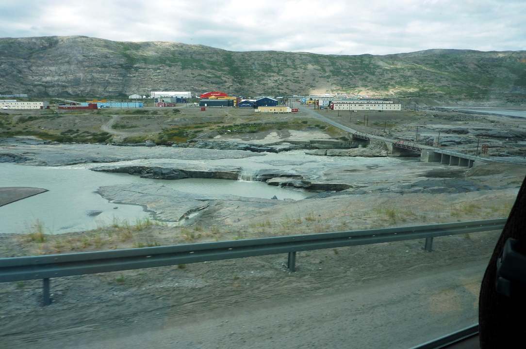
As long as I'm talking about the airport, I'll show those photos now, even though they were taken hours later. In this first shot, our bus is approaching Kangerlussuaq (population about 500) from the south after a late lunch.

We had a couple of stops on the drive to the ice cap. The first was at the wreckage of a U.S. jet aircraft. During foul weather one day in the early 1950s three of four planes (probably Lockheed T-33s) couldn't the find Kangerlussuaq runway.


The river has cut a broad, sedimented valley here, and there are miles to go to reach the ice cap.

After passing through the gate we drove through an area with several lakes.

Photos of caribou taken through the bus window:


Shortly after seeing the caribou we stopped for a leg-stretch and a visit to the shore of one of the many lakes.

The sands of the lake were mantled with gently curving stripes.


We walked the final few hundred feet of approach.


After taking a few steps out onto the ice, I took this photo looking back. The ice is rough and pocked with coin-sized craters wherever dirt has settled and hoarded the rays of the sun.

Looking outward we see the fissured blocks of this arm of the Greenland ice sheet. This sheet stretches 1500 miles north to south and up to 680 miles west to east. It is three times larger than Texas!

Here is my portrait on the ice. I am smiling in this picture. Really.

The ice, water, and particulates at my feet made a wonderful composition.
 While I wandered, admiring the ice and taking photos, a few were curious to see how far they could go in the time allotted (not too far).
 Very soon it was time to return to the buses. It was already noon and lunch and a pit stop were far away, back in Kangerlussuaq. This through-the-window photo turned out very well. It shows how many different micro-environments can exist within a stone's throw of the glaciers.
 As we passed through the area with the jet wreckage, we stopped and were treated to a better look at a musk ox we had glimpsed through binoculars on our way out. He was on a ridge top while the bus was down in the valley, but this picture is worth showing to you.
 We drove through Kangerlussuaq and, south of town, arrived at a lakeside restaurant that specialized in the beer of the Nuuk brewery Godthaab Bryghus (click to enlarge).
 The first order of business was the restrooms. Water bottles had been handed out on the bus ride, but there were no toilet facilities on the way to, from, or at the ice cap. A very long line formed as soon as we got off our bus. Our group self-organized into a single queue that didn't worry about which of the two restrooms was "gentlemen" and which was "ladies."
The restaurant backs onto a large lake.
 Some of us had even brought their own fishing gear.
 A closer look.
 The lunch was a Greenlandic buffet, with lots of meat dishes. Soft or alcoholic drinks were extra, but Joan and I had brought our own water bottles, so no kroner were spent by us.
We forty-four "back-to-back" guests returned to the Explorer before the newly arriving guests, who also transferred by zodiac. This was an authentic introduction to the character of their trip.
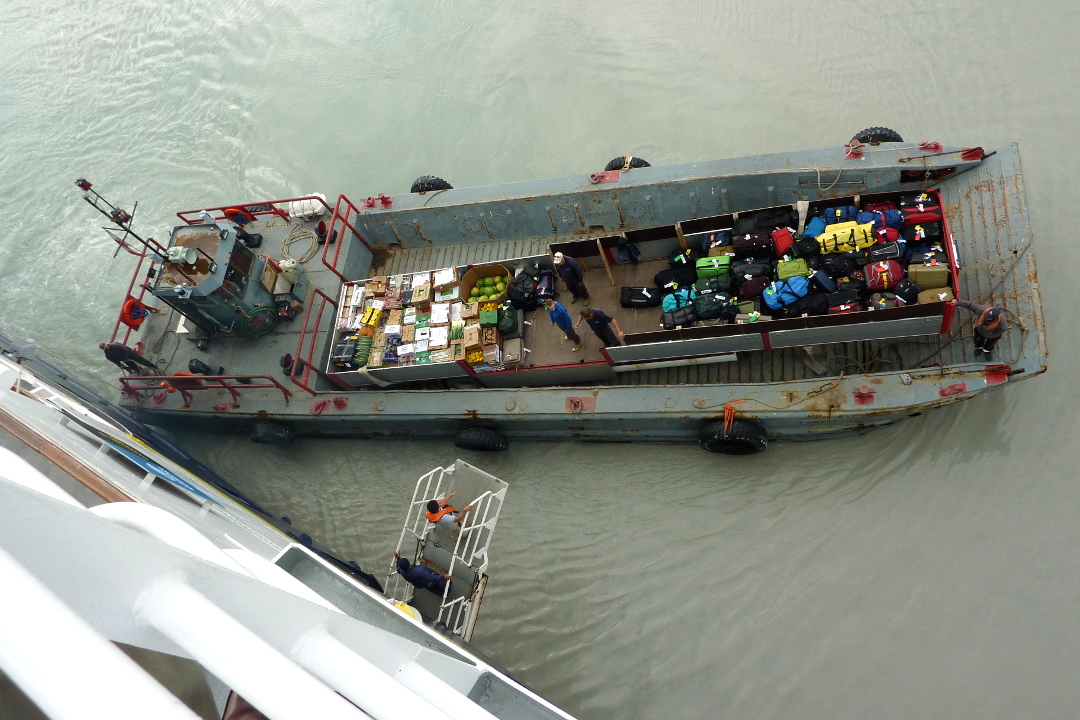
 The luggage and produce for the kitchen were then brought out by a small barge.
 Everything was transferred by hand, and nothing fell into the water.
 It was a busy day for all involved. The Explorer set sail at 6:00, and after the mandatory safety drill, followed by an introduction to the ship, a buffet dinner was served at 8:00. (Dinner is usually served by waiters, and a little earlier, but turnover days are different.)
Sunset was not until 11:32, due to our location almost smack on the Arctic Circle. Joan stayed up until 11:00 admiring the many glaciers feeding into the fjord as we steamed past, but I couldn't keep my eyes open that long.
We were on our way to Sisimiut.


The restaurant backs onto a large lake.


We forty-four "back-to-back" guests returned to the Explorer before the newly arriving guests, who also transferred by zodiac. This was an authentic introduction to the character of their trip.


Sunset was not until 11:32, due to our location almost smack on the Arctic Circle. Joan stayed up until 11:00 admiring the many glaciers feeding into the fjord as we steamed past, but I couldn't keep my eyes open that long.
We were on our way to Sisimiut.
No comments:
Post a Comment
Comments may not appear immediately as they are moderated by the author to eliminate spam. Please, no commercial links!