Wednesday, January 15, 2014

Arctic Journey: Polar Bears Galore, Cumberland Peninsula

Sea ice gathers at the eastern end of Baffin Island in summer, carried down the Davis Strait by the Labrador Current. It lingers here for a long time, and therefore, so do polar bears. By 7:12 AM today, August 8th, I was up on the bridge taking photos.

I took this photo with the sun behind me. There is still plenty of haze above the water/ice.
This one, through a bridge window, looks more into the sun, with a completely different result.
Why are we up before breakfast? Bears, of course. Here, a swimming bear.
After a few minutes he reached the denser ice and hauled out.
He began to walk away from us, and eventually faded into the haze.
The beginning of this video shows how difficult it can be to pick out a polar bear amongst all the ice, especially with haze.  Also intriguing is how the ice tilts and lifts up and down on the ocean swells. The polar bear is perhaps a quarter down from the top and just a bit left of center. When zooming in I almost lost him more than once, because it was impossible to see the bear on the LCD screen of my point-and-shoot camera. At full zoom I finally locate him and center the image.


This next photo is not of the same bear; it was taken 50 minutes later. This bear is approaching us.
Within five minutes he's considerably closer.
Then he reaches the edge of his comfort zone and pauses, not knowing what we are. My, what big feet you have!
Can you guess which side of the ship the bear is on?
Summoning more courage, this bear draws even closer.
After a few minutes more, he's within a few yards of the bow. He's further away vertically, because of the height of the Explorer, than he is horizontally.
Here's another look, from a slightly different angle. Love those feet.
Eventually, he decided to leave, gradually. He would meander away, then turn and look at us yet again and sniff the air, then meander further away. Look at the long neck ... all the better to swim and to grab seals from their breathing holes.
After this first flurry of polar bears, the spotting scope was deserted for a moment.
Our next discovery this morning was a polar bear lounging on a small chunk of ice. We drifted slowly towards him, but I'll spare you the approach shots.
Nearby, among all the common gulls, was a seldom-seen ivory gull. These birds rarely travel beyond the pack ice; this one is the little guy on the left. This is another case where binoculars are essential to appreciation of what you're seeing.
An Environment Canada ice chart depicts many kinds of information, through colors and by the Egg Code. It includes the percentage of sea surface covered by ice, the age of the ice (first year? multi-year?), the size of the ice, and more.
Before 11:00 another polar bear, intensely curious, swam very close to the ship, keeping an eye on us. In this video, you can see that the bears swim with only their front legs; the hind legs simply trail behind.
 
This bear lost interest in us in stages. As he swam away he would periodically take advantage of an ice floe to pop up and check us out one more time.
I hope you're not tired of polar bear photos yet.  I have hundreds ... but just one more, from the afternoon.
A long-standing tradition on both the Explorer and its predecessor, the Endeavour, is to cut a notch on the bridge railing for each polar bear spotted. The spotter has the privilege of making the cut. If the bear is on a kill, the notch is then colored red. If it's a deceased polar bear, the notch is black.
Our afternoon sailing was taking us towards  Saxe-Coburg Island, off the tip of Cape Mercy. During the journey we had the option of attending Tom Ritchie's talk, Surviving Cold Environments: How Wildlife has adapted to the Polar Regions.
What is the first thing we find during our late-afternoon zodiac cruise at Saxe-Coburg? Yet another polar bear!
Needless to say, he attracts a lot of attention. In this age of digital photography, hundreds of photos may be taken in just a few moments.
The zodiac ride, while enjoyable, was also chilly, so the Lindblad staff motored around to each boat in the glögg zodiac. (Glögg is a Nordic version of mulled wine).
The Viking helmets are a humorous touch, especially because we learned early in the trip that Viking helmets never had horns. Check out the guy in the bow; he has improvised a unicorn helmet. As soon as we all had a cup of glögg in hand our providers zoomed off to the next zodiac.
As we toured the island we met several flocks of black guillemot. Click to enlarge -- the red feet are striking.
Our route included the passage between the two islands of Saxe-Coburg.
Steer clear of the ice.
Then it was time for our shift to return to the Explorer. Here, our inbound zodiacs are accumulating.
Somebody has to go in first, but it's not us.
We'll wait our turn out here, among the ice forms.
We had time to change out of our cold-weather gear before dinner. In the evening the National Geographic video Masters of the Arctic Ice was shown, and then Joan and I began our night's sleep, before tomorrow morning's hike.

Friday, January 10, 2014

Arctic Journey: Padloping Island and Cape Dyer

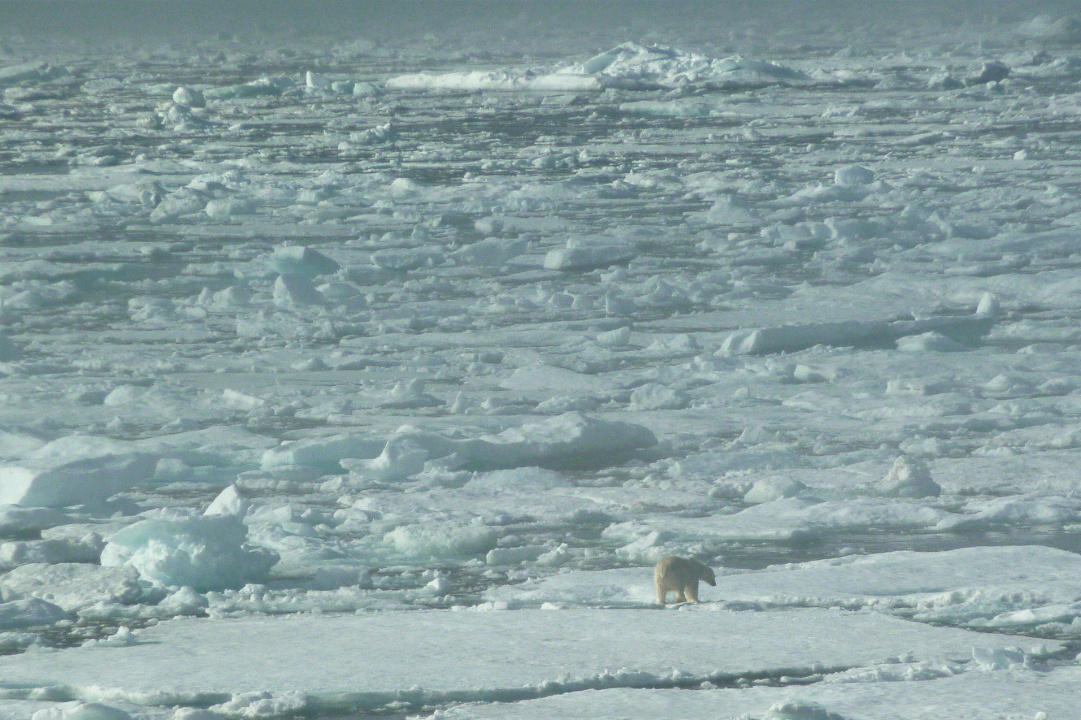
On August 7th, the 20th day of our trip, the first polar bear announcement came before breakfast. I'll spare you the photos I took as we slowly approached, and the bear gradually enlarged and emerged from a cream-colored blotch. This photo was timestamped at 7:22. This is a special situation.
He's on a kill, or what's left of one. The blubber on a seal, the usual foodstuff, would have been eaten first. Opportunistic gulls wait for their chance on the edges of his patch of ice (click to enlarge).
Every so often the bear investigates the view from an adjacent chunk of ice, and the gulls have a few moments to swoop in.
But the bear always comes back. The lure of blood is too strong.
Once or twice he looks our way,
but he always returns to the kill, until he considers taking a dip instead.
Polar bears swim so well, and spend so much of their life at sea (including on ice), that they are classified as marine mammals.
About 90 minutes later, as we approach Padloping Island,
a multitude of bears are spotted. The first is slowly maneuvering above the steep, boulder-strewn shore.
High above, a mother bear and her two cubs try to stay far away from any solitary males, of which there are several visible to us. With full zoom and ruthless cropping, I can get this image:
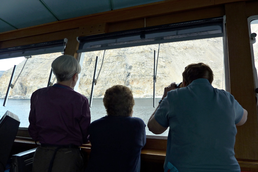
Always take your binoculars with you everywhere you go.

As usual, I've joined the bridge crowd. Many of the best spotters, including Captain Kruess, are there, and are happy to guide you through the landmarks until you discover a bear you hadn't seen.
This bear is sprawled out on a comfy rock.
After a while he came down to the shore and looked us over.

We sailed around the tip of Cape Dyer during lunch and the first part of the afternoon. This quiet time allowed Guest Speaker Captain Fred McLaren to finally complete his presentation, The Evolution of the Arctic Submarine, after three earlier attempts were all interrupted by wildlife sightings. By 4:00 we had come ashore for a hike, across the inlet from the Cape Dyer Airport and a decommissioned DEW (Distant Early Warning) station, being cleaned up by 
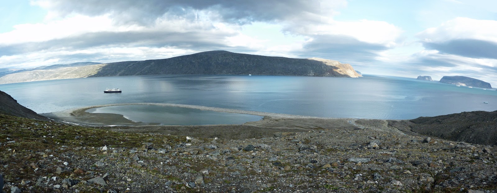
Qikiqtaaluk Logistics. As usual, Joan and I joined the group headed up to a high point. Here is a view, partway up, looking back to the Explorer and our landing beach.
Our turnaround point at the top was near a rock with a multilayered geological story to tell.
From this height we could look across the width of Cape Dyer to the old DEW radar station.
On the far shore is the terminus of the road from the DEW station. The airstrip is between the DEW station and this point.
In this photo we've paused, partway down on our return to the shore. On the far right is our rifle-toting leader, Jason Kelly.
From here we can look downhill to the ravine that separates us from the next hill. Melt water rushes through this rocky stream bed in the spring.
The shadows are growing longer. Although we are smack on the Arctic Circle, it's six weeks after the summer solstice, so today holds 18 hours of daylight and 6 hours of night. The little specks in the next photo, in the shade on the left, both on shore and in the water, are people and zodiacs. We still have a way to go to reach the ship.
In the evening we were treated to a presentation by the National Geographic photographer Chris Rainier, Adventures with National Geographic from War Zones to the Summit of Mount Everest. Needless to say there were spectacular photos and some hair-raising stories.

And then it was time for bed. We thought that today had been an excellent day for bear spotting, but tomorrow would easily top it.

Saturday, January 4, 2014

Arctic Journey: Isabella Bay and Arctic Harbor, Baffin Island

By the morning of August 6th, we had sailed far enough southeast along the northern shore of Baffin Island to re-encounter the phenomena of sunrise and sunset. The day would be, technically, 20 hours long.

Just after breakfast there was a polar bear announcement, and Joan and I dashed to the bridge. A large ice island had been blown close to the shore, and bears were prowling atop that expanse. Eventually six polar bears were spotted. Here are some pictures of our first sighting (click to enlarge).
He approached us, cautiously.
Within a few minutes he reached the limit of his comfort zone,
and turned away to our right, paralleling the edge of the ice.
This did not prevent us from watching his progress. He's the speck just left of center, near the top.
The ship maneuvered to face starboard, where an old bear was resting.
The younger bear continued to the right, and we wondered if he he would go far enough to reach the end of a channel in the ice. This would place him close to the old bear.
The old fella began to take notice, or at least to awaken from his nap. Was trouble brewing?
He decided not to take any action just yet.
He gave us a look, and then laid his head down again.
The other bear continued his march along the channel.
The Explorer pulled up to the edge of the ice near the old bear.
We waited to see what would happen. The older bear continued to rest, and the younger bear continued off to the right. There was no conflict, and eventually we sailed on.

An hour later, as the ship entered Isabella Bay, we encountered bowhead whales, which live only in arctic and sub-arctic waters -- they don't migrate to warmer waters for reproduction. Bowheads were an early whaling target, and the Baffin Island sub-population, once down to a few hundred individuals, is listed as endangered. Recent surveys over the last decade, although they vary wildly, indicate a population rebound to several thousand.  The Canadian government designated this area off Isabella Bay as the Ninginganiq Wildlife Area in 2008, and only subsistence hunting by the Inuit population is allowed.

Bowheads have no dorsal fin, but sport the largest mouth of any animal. They are also known to live at least 200 years.

We started off seeing single whales, and then small groups. Because of the whales' shyness, my best photos were of bolder individuals.
Another look at the lack of a dorsal fin.
Bowheads are not as gymnastic as humpbacks, but do show some fluke when diving deep.
Another guest captured a fabulous shot when a whale crossed the bow of the ship, briefly exposing its head and mouth.
Then it was lunchtime. Soon the Explorer arrived at Arctic Harbor, near the head of Isabella Bay, and the staff prepared for our shore expedition. Here empty sacks await our life jackets.
The various groups reached dry land after a few wet steps.
A low swath of ground connects two high points, and on that spot are the graves of four whalers, the last remnants of a 19th-century British whaling station that existed here.
A few of the photographers, too enamored of obtaining the best shot, had to be reminded not to step on the graves.

Our group headed to the left, first along the beach on the far side of the connecting strand, and then close to the rocks at the foot of the hill on far left. We had a brief sighting of an American Pipit.
Then we began to climb the far side of the hill. Here we see Lindblad naturalist Ian Bullock leading us up, with Stevie Aulaqiaq standing guard in the background.
Ian did a fine job of coaxing us up the hill, stopping a few times to tell us about the landscape, and to let us catch our breath. He also asked if anybody felt it was time to turn around, but all were willing to keep going. Well warmed up, we arrived at the top. A rocky top.
Here's a video sweep from the high point. Our best views were more from the edge of the top, as you will see.


This photo shows the low connecting beach between our hill and the next, where we landed (on the right) and where the graves were.
From our perch we could see that the kayakers were out in force.
Our chosen route back down turned out to be rocky, 
but everyone made it back.

With the sheltered waters and gorgeous weather, this afternoon was the time for the Polar Plunge. Whoever so wished could jump from a zodiac into the arctic waters and emerge quickly onto a platform. In this photo the zodiacs and platform are maneuvering into position.
Some folks jumped in feet first,
and some displayed their diving skills.
Neither Joan nor I jumped into the water.

That evening, after a busy day, we left Isabella Bay and continued southeast, towards the Cumberland Peninsula.