Thursday, October 31, 2013

Arctic Journey: Ilulissat and Big Ice

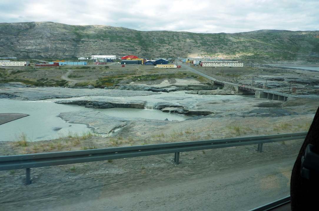
On the morning of July 30th we were approaching Ilulissat. This town, population about 4600 and third largest in Greenland, is about 250 km or 150 miles north of the Arctic Circle. It is perhaps most famous for the Ilulissat Icefjord, a UNESCO World heritage site. The glacier Sermeq Kujalleq, also known as the Jakobshavn Glacier, is one of the few outlets for the Greenland ice cap, and travels at 20 meters per day, although the rate varies from year to year. It pours a prodigious amount of ice into the fjord, producing 10% of all Greenland's icebergs, some of which are almost a kilometer tall.

Thus it should not be surprising that there were icebergs guarding the approaches to Ilulissat.
A zodiac was lowered, as much if not more for taking photographs than guiding the Explorer.
Hmm. Let's try this at a different exposure. So much ice can trick the camera.
Stopping for a photo, perhaps?
Our ship passed through unscathed and Ilulissat spread out ahead of us.
A cargo ship was bound for the big-ship dock in the harbor. Katy and Posy were impressed.
Our groups would go ashore by zodiac.
Several activities were offered, most of them more than once through the day; however, there wasn't enough time to do them all. The choices were an Icefjord cruise, a city and museum tour, the Sermermiut walk, an "airzafari" flying up the fjord as close to the glacier (extra cost), and a Greenlandic food tasting at the Hotel Arctic (only at 4:30). Joan and I did the Sermermiut walk, followed by Icefjord cruise and the food tasting.

Sermermiut
A bus drove us to the head of a wooden boardwalk that protects the area called Sermermiut. This valley was an important habitation site for more than 4000 years, hosting at various times the Saqqaq, Dorset, and Thule peoples.
The archaeology here has merited the status of a World Heritage Site (click on the photo to enlarge).
We were accompanied by a couple of local guides, and other guides were posted at important locations.
From this spot my camera could zoom out into the fjord and take an "ice picture." This was the most impressive ice we had seen since eastern Greenland.
As we walked further, we soon encountered this warning sign.
At the point I felt very much in the presence of, and not just observing, the immense icebergs of this fjord.
One of the guides had accompanied us to this place, and he had snacks and was willing to answer questions.
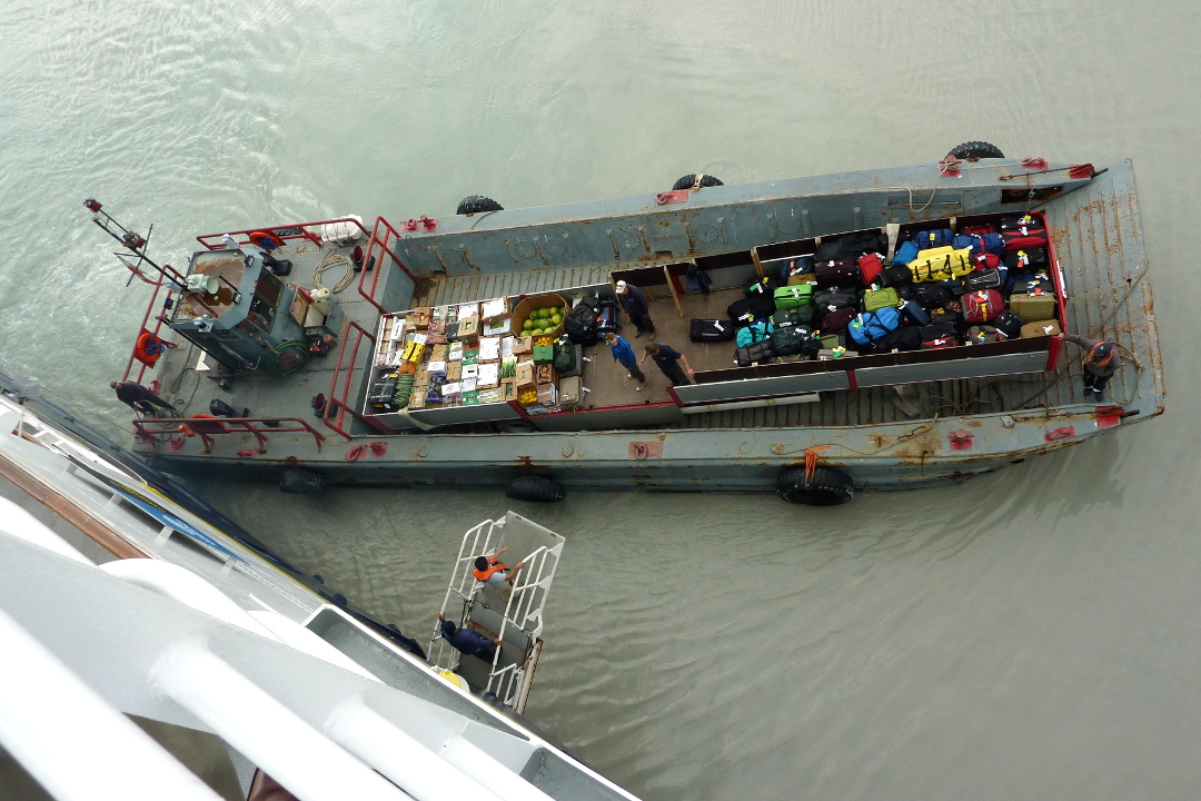
Unfortunately, the schedule was as tight as a python's coils, and Joan and I, not wishing to wait an extra hour, walked briskly to the starting point to catch the bus. We had a few minutes at the dock waiting for a zodiac to take us back to the Explorer and lunch. Near the dock were a few retired, and surprisingly small, whaling vessels.
And next to the dock, a similar sized ship.

IceFjord Cruise
After a quick lunch Joan and I bundled up for a long ice cruise. The small boats eased up to the side of the Explorer very much like the zodiacs, and the guests would step over.
Our boat was a smaller one but had a cabin you could warm up in, which not all did. The views were best outside; in fact, Joan rode on top of the cabin for most of the cruise.
The variety of the ice was astonishing. No two bergs were identical. Some are floating and some are so large that they ground on the terminal moraine at the mouth of the fjord, and remain stuck for months or even years. If you were next to this berg in person, you would feel its size in your bones. The possibility of a section splitting off at any time advises against too close an approach.
For floating specimens another threat is rollover, because the ice below the water melts faster than the part up in the air. Eventually the berg becomes top-heavy and rolls over, making large waves and shedding pieces, and the process repeats again and again until the berg is gone.
In summer the surface of the ice melts and refreezes, forming a glaze. Runoff channels are sculpted by the melt.
Some bergs carry pieces of Greenland with them, scoured out from lateral moraines of the main glacier.
Some of the "grounders" develop crevasses and splits. 


Partway through our meander among the ice giants the captain stopped the boat and gave us a talk, both about himself and about the glacier.
The captain is originally Danish but has lived in Ilulissat for many years (I forget how many). He went on vacation to Sri Lanka some years back and returned with a wife. We immediately told him, "It must have been a shock for her to come to Greenland," and he smiled and said, "We spend the summers in Greenland and the winters in Sri Lanka."

The Jakobshavn Glacier has been the focus of much study because of its dramatic retreat. The captain is showing us, on his map, a version of this diagram.
There is also a pair of dramatic Landsat photos from NASA inspecting the glacial front in 2001 and again in 2010 here.

On our way back to the Explorer we encountered this fishing boat. Notice all the gulls floating nearby?
Whenever the fishermen would throw fish guts out into the water, a frenzy erupted.

Greenlandic Buffet
We returned to the ship and changed for a Greenlandic buffet at the Hotel Arctic. Unlike the earlier buffet at Qaqortoq, there was no whale on offer, a request the Lindblad staff had made based on feedback from guests.
Some closeups ...


and an example of Inuit adaptation of European technology, a rifle hidden behind a white sheet, mounted so as slide along the ice while approaching, say, a seal.
This is the view from just outside the dining room.
On the right-hand side several sled dogs were chained, waiting out the summer. Here's a closeup of one.
The Hotel Arctic also offers five aluminum "igloos" at the end of a boardwalk.
A ship from the Netherlands was off to the side, away from the main harbor, far right in the above photo. Here's a closeup.
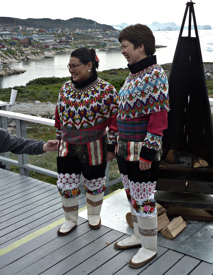
Two ladies were sent by the local tourist office to visit with us in Inuit dress.
A closeup of that beadwork.

Departure One, Departure Two
After the buffet it was time to rejoin the Explorer and sail from Ilulissat. 
Sort of. Our first passage into the ice outside the harbor was a photo-op; the National Geographic photographer Ralph Lee Hopkins flew around the ship in a chartered helicopter taking photos for future brochures, catalogs, etc. We passengers were actors, advised to wear our most colorful jackets and not to look or point at the helicopter, which would spoil the photo.

The helicopter made at least a dozen circuits of the Explorer. Ralph flew high,
Ralph flew low,
Ralph flew eye to eye,
and Ralph flew back to Ilulissat. The Explorer returned to pick him up, and then we left for real. The ice was, as always, fascinating.

On both our ice cruise and on this departure we saw blocks of ice breaking free of a berg and, with a rumble like an avalanche, plunging into the sea. It's hard to capture these on camera because they are over in just a few seconds. I do have this one snapshot of ice a few seconds after smacking the water, taken through the window of the bridge. It is by far not the largest calving that we saw, but you can see the wave front and foam kicked up by the impact of the airborne ice.
Tomorrow, Qilakitsoq, where the Greenland mummies were discovered.

Thursday, October 24, 2013

Arctic Journey: Sisimiut

In the morning our Explorer was still on course for Sisimiut, the second-largest town in Greenland, population 5600. The ship was brimming with new guests who had come aboard at Kangerlussuaq, so the morning was given over to introductions, talks, and decontamination.

Introductions included a presentation by the IT officer about the Internet and phone system on board, an introduction to the Expedition Team, and a Wellness Open House. The talk was Digital Camera Basics for All Cameras. Over the years we've seen more and more Lindblad emphasis on encouraging camera-bearing guests and enhancing their photographic knowledge, be they expert or beginner. The Arctic Decontamination boils down to inspecting and disinfecting as necessary backpacks, walking poles, boots, and the like so as to not transmit alien species to the places we go.

Joan and I had free time, having had our introductions and decontamination at the beginning of our trip, in Reykjavik. As usual we hung out on the bridge and did see some humpback whales, who were unconcerned about our presence.
During lunch we docked at Sisimiut, and I took this picture from the ship. Sisimiut is an important fish-exporting center, being the northernmost port in west Greenland that is ice-free all year. Most of the town isn't visible from the dock.
The crew was taking advantage of the time, location, and weather to do some maintenance of the ship.
We divided into several walking groups. Some groups were taking a city tour, and some were taking a "cultural walk" to the Tele Islands. Joan and I joined the islands walk, which was described as two miles long and might be "uneven in spots." The walk began in town, on a road, which this photo looks back upon.
This section of the walk also gave me a good photo of Greenland's flag, which I find straightforward yet imaginative.
The road ended atop a rocky elevation. Here the various subgroups (photography walk, cultural walks) began to part ways. This picture looks back towards town; our group will be heading off to the right.
Our guide was Anita.
We learned some of Anita's story, which illustrates the challenges that come with the blending of traditional Greenlandic life and the Danish influence. She grew up in Sisimiut, and learned to hunt at an early age. In fact, she became the youngest member of her extended family, at age 5 or 6, to kill a seal. One brother was the youngest, at age 8 or 9, to kill a caribou. She described the annual caribou hunt, a non-motorized event in which the family walks into the back country, and each person has a job to perform. The hunt is a celebratory time for the family; Anita described it as Christmas and Easter rolled into one. It was common for her extended family to bring back at least forty caribou, which is not excessive: the meat is distributed amongst grandparents, aunts, uncles, and cousins, and the next hunt won't occur for another year.

On the Danish side of her young life, she attended university in Copenhagen, and while there was for a time a sergeant in the Danish Army. In fact, she had been scheduled for a tour in Afghanistan last year, but the deployment was canceled. All her immediate family has moved to Denmark because of a lack of opportunities in Greenland, and she will be returning there in January.

The uneven footing of the walk became more challenging than we expected. This is the walk down from the first high point.
The telecommunications links travel into Sisimiut from the seaside towers in metal conduits.
It's much easier than drilling through all this rock.
One of the cultural aspects of the walk -- besides chatting with Anita -- was a set of old foundations for winter housing. Various peoples, Inuit and earlier, have lived in the Sisimiut area for the last 4500 years. Here, Anita explains with the foundation in the foreground.
This is a closeup of another housing site.
Just offshore from us are a number of small islands that are used as sled dog kennels. Sled dogs are working dogs, not pets. In the months that they aren't working, the dogs are kept chained by their owner in a small area, either near town or on one of these islands, and fed only occasionally. The dogs are not allowed to get fat during the summer. Those on the city tour were explicitly warned not to touch the dogs.
A little further on we visited these stone cellars, used to keep food items in the same way that a root cellar would be used in temperate climates. Anita referred to them as "Inuit McDonald's."
We crossed to the next high point, which hosts the helicopter pad and communications towers, across this wooden bridge.
After climbing up to a good viewpoint I recorded this two-part video clip.
On our return to the town we visited the local kayak club. Kayak the English spelling of the Inuit word qajaq which reflects that the lightweight craft is an Inuit invention.
These are local, hand-made kayaks, often constructed with a skin of waterproofed canvas.
After everyone was back on board it was time for the Explorer to turn towards Disko Bay and Ilulissat. At 6:30pm we enjoyed Captain Oliver Kruess' Welcome Aboard Cocktail Party, held at the start of each trip, and then dinner at 7:30pm. Sunset was not until 11:24pm, and the evening light was photo-worthy.

Saturday, October 19, 2013

Arctic Journey: Kangerlussuaq and the Greenland Ice Cap

On the morning of July 28th we were at anchor off Kangerlussuaq, the site of Greenland's largest commercial airport. The airport was created in 1941 as the American airfield Bluie-West-8, part of the United States' activities in the Second World War before Pearl Harbor. The fjord is silty and shallow near its head from sediments carried down by a river originating in the Greenland ice cap.
Zooming in, we can see the modest docks where we will embark and disembark. Even the zodiacs must thread carefully between silt bars, hence the orange markers on the hill to guide craft in.
The forty-four of us who are continuing on board the Explorer for its next trip, Greenland and the Canadian High Arctic, will spend most of this day on an excursion to the Greenland ice cap instead of flying home.

As long as I'm talking about the airport, I'll show those photos now, even though they were taken hours later. In this first shot, our bus is approaching Kangerlussuaq (population about 500) from the south after a late lunch.
This is the hub for Air Greenland.

We had a couple of stops on the drive to the ice cap. The first was at the wreckage of a U.S. jet aircraft. During foul weather one day in the early 1950s three of four planes (probably Lockheed T-33s) couldn't the find Kangerlussuaq runway.
When the planes ran out of fuel the pilots ejected safely, and one jet crashed next to the road, scattering debris.
Of equal note to the berry lovers among us were low-growing blueberries with wonderful flavor.

The river has cut a broad, sedimented valley here, and there are miles to go to reach the ice cap. 
The gravel road between Kangerlussuaq and the ice is 40 kilometers (25 miles) long, the longest road in Greenland, and passes through the Issungua highlands. It was extended into the ice cap in 2000 as a testing ground for automobiles, but was abandoned a few years later. Since 2006 a padlocked gate bars entry into the further reaches except for tourist buses headed for the ice cap.

After passing through the gate we drove through an area with several lakes.

Photos of caribou taken through the bus window:


Shortly after seeing the caribou we stopped for a leg-stretch and a visit to the shore of one of the many lakes.


The sands of the lake were mantled with gently curving stripes.
Our guide explained that the dark bands were garnets. It's not impossible; there is a hill just south of Kangerlussuaq known as Garnet Rock.
As you can see from this window into Google Maps, the road winds its way past lakes and over hills until it arrives at a jumbled mass of rubble-covered ice at the edge of the ice cap.


We walked the final few hundred feet of approach.
The rocks and dirt left behind by melting ice blanket the remaining ice, which is occasionally exposed.
Flowering plants have staked out a toehold in this forbidding landscape. This is probably Thymus praecox, a species of the herb thyme.
The roadway became a path which became a track. Here, almost at the point where we'll be walking on ice, an improvised bridge is set up. Summer is well along and there is a great deal of melt water.
On the way in I paused at a spot where a small melting was visible. This dirty ice face just off the road had a slow-motion, muddy stream trickling down its center. It's just two or three meters tall.


After taking a few steps out onto the ice, I took this photo looking back. The ice is rough and pocked with coin-sized craters wherever dirt has settled and hoarded the rays of the sun.
Looking outward we see the fissured blocks of this arm of the Greenland ice sheet. This sheet stretches 1500 miles north to south and up to 680 miles west to east. It is three times larger than Texas!
Here is my portrait on the ice. I am smiling in this picture. Really.
The ice, water, and particulates at my feet made a wonderful composition.
While I wandered, admiring the ice and taking photos, a few were curious to see how far they could go in the time allotted (not too far).
Very soon it was time to return to the buses. It was already noon and lunch and a pit stop were far away, back in Kangerlussuaq. This through-the-window photo turned out very well. It shows how many different micro-environments can exist within a stone's throw of the glaciers.
As we passed through the area with the jet wreckage, we stopped and were treated to a better look at a musk ox we had glimpsed through binoculars on our way out. He was on a ridge top while the bus was down in the valley, but this picture is worth showing to you.
We drove through Kangerlussuaq and, south of town, arrived at a lakeside restaurant that specialized in the beer of the Nuuk brewery Godthaab Bryghus (click to enlarge).
The first order of business was the restrooms. Water bottles had been handed out on the bus ride, but there were no toilet facilities on the way to, from, or at the ice cap. A very long line formed as soon as we got off our bus. Our group self-organized into a single queue that didn't worry about which of the two restrooms was "gentlemen" and which was "ladies."

The restaurant backs onto a large lake.
Some of us had even brought their own fishing gear.
A closer look.
The lunch was a Greenlandic buffet, with lots of meat dishes. Soft or alcoholic drinks were extra, but Joan and I had brought our own water bottles, so no kroner were spent by us.

We forty-four "back-to-back" guests returned to the Explorer before the newly arriving guests, who also transferred by zodiac. This was an authentic introduction to the character of their trip.
The luggage and produce for the kitchen were then brought out by a small barge.
Everything was transferred by hand, and nothing fell into the water.
It was a busy day for all involved. The Explorer set sail at 6:00, and after the mandatory safety drill, followed by an introduction to the ship, a buffet dinner was served at 8:00. (Dinner is usually served by waiters, and a little earlier, but turnover days are different.)

Sunset was not until 11:32, due to our location almost smack on the Arctic Circle. Joan stayed up until 11:00 admiring the many glaciers feeding into the fjord as we steamed past, but I couldn't keep my eyes open that long.

We were on our way to Sisimiut.