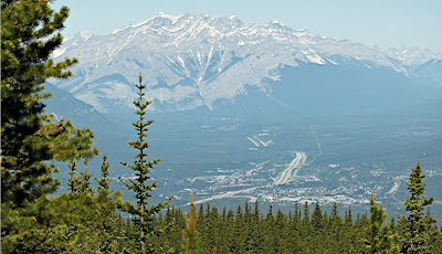
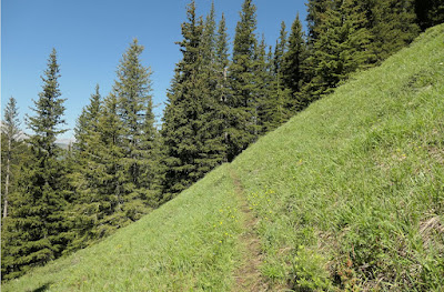
On Sunday, July 7, 2024, Joan and I drove to the Lougheed Parking area to tackle the Centennial Ridge trail again. Two years ago, our goal had been to climb above the treeline for the spectacular views, but our effort had been cut short by rain. Now we'd try again. Although we arrived at this parking area 15 minutes earlier than for yesterday's Heart Creek hike, it was jammed, and we had to park on the side of the road leading to the parking. Well, it was a Sunday.
There are several intersections in the beginning, including those for West Wind Pass and Skogan Pass, but we followed the signs for the Centennial Trail. (Click on any image to enlarge.) The green circles note the parking area and our "decision point" on the trek.Here's a photo of the map at the beginning of the trail. With less clutter, the circles are easier to see.We soon encountered flowers. This year had seen a late spring, so July was still bountiful. Today had more varieties than yesterday because of the much greater altitude gain. Here is a red baneberry, early in its season.For a while the path led us gently up a wide trail beside the creek that, like so many others, had flooded disastrously in 2018.
 |
| No place to park here ... |
We spotted a female bufflehead duck and her two ducklings working upstream.
There's a stretch where it's just an easy walk. |
| It won't last long. |
 |
| That's a 2200 meter altitude line, or 7218 feet. |
And a calypso orchid!Downhill had its own challenges with steepness, surfaces, and fatigue, but we returned without mishap. Thank goodness for hiking poles! Joan and I reached our car a tick before 4:00 pm, footsore but satisfied with our effort, given that we gained ~2350 feet in altitude and it was only our second day of hiking. And the flora was fabulous.
A final odd note before we left was that I had to push forward as well as down on the Versa's trunk lid for it to latch.


No comments:
Post a Comment
Comments may not appear immediately as they are moderated by the author to eliminate spam. Please, no commercial links!