On July 30th Joan and I awoke to see a red crossbill outside our window. The unusual beak (click on the photo to enlarge) allows it to pry seeds out of the cones.
We said our goodbyes at Mount Engadine Lodge, and spotted a morning moose across the meadow. We drove south towards the Kananaskis Lakes area, and Mount Indefatigable in particular. But just a few miles down the road there was a "Ting!" -- from the TPMS (Tire Pressure Monitoring System). A tire was low.
We pulled over and inspected. Visually nothing seemed wrong, so not having a true flat, Joan and I returned to Engadine and enlisted Riley's help. He hauled out the lodge's air compressor but had difficulty finding his tire gauge. Our rental car had an owner's manual but no tire gauge. (In the past we've even had a rental car with no spare, no manual, nothing on hand when we got a flat.) Then he found a gauge and we identified the low tire: driver's side rear. After Riley topped off all the tires, I consulted the manual and reset the TPMS, and then we were on our way. Thanks, Riley!
We left our car at the parking area between the upper and lower Kananaskis Lakes. Mount Indefatigable is in the background; our intention is to hike as far as the shoulder on the right for the view, not to try for the summit on the left.
We crossed the earthen dam to the other side of Upper Kananaskis Lake.
The drums and lumber in the lower left were in the process of being collected and taken away.
The Indefatigable Trail was and is popular, but it has been offically decommissioned, including the removal of viewpoint benches. Why?
The Park is very polite about it: "We request that you consider not hiking ..." But Joan and I wanted to do this just once, having heard much about it over the years from other hikers. I had bear spray, and we were prepared to turn around if we saw or heard a bear.
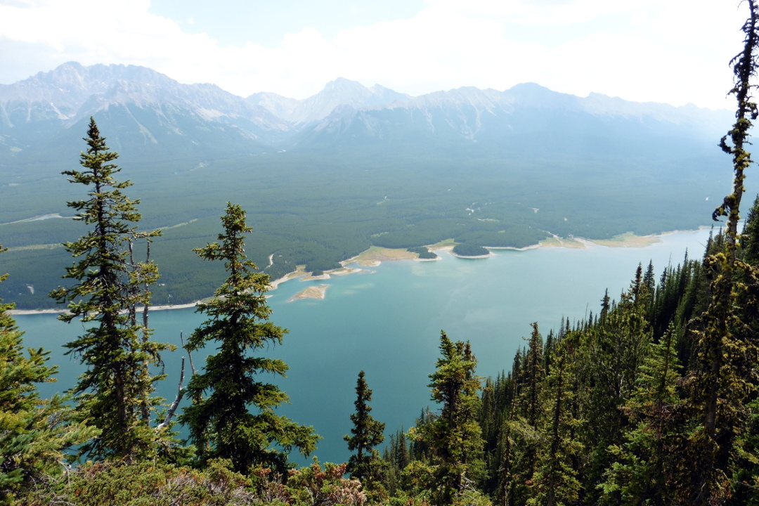
The route starts as a broad, needle-strewn trail but soon narrows and climbs amongst rocky outcrops near the edge of the mountain. Because the trail is decommissioned, it is no longer maintained, and has become braided with uncertain footing in places. The first viewpoint no longer has the Wendy Elekes Memorial Bench, but the view is still great, encompassing much of both the upper and lower lakes.
The trail continued to climb, and reached a fork where the route to the peak heads left. We continued a quarter-mile on the level to the final viewpoint, where we had our lunch. The trees here have grown up to obscure parts of the view, but I took a photo looking northeast,
and one looking southeast.
As we ate our lunch we also kept our eyes on a hawk soaring on the mountain breezes.
On our way back down, we paused at a meadow not far from the top, and I took another panoramic photo.
Clouds are gathering to take a vote on an afternoon thunderstorm.
Zooming in, the camera captured the parking area where we started.
Just a few steps beyond the meadow we encountered a blue grouse, hiding in the shade under a tree. His strategy was to hold absolutely still.
He looked big to us, bigger than the ruffed grouse we'd seen in the past. It turns out that the blue (lately subdivided into dusky vs. sooty) is the second largest grouse in North America, after the sage grouse.
Joan and I continued our descent, passing a few more people headed up. There were scattered drops of rain as we reached our car, but the thunderstorm convened at a different location.
We checked in at the Delta Lodge Kananaskis, now the Kananaskis Mountain Lodge, where they offered us an upgrade to an air-conditioned room with continental breakfast for a modest-enough fee that we accepted it.
Joan and I plan to tackle Wasootch Ridge tomorrow.


No comments:
Post a Comment
Comments may not appear immediately as they are moderated by the author to eliminate spam. Please, no commercial links!