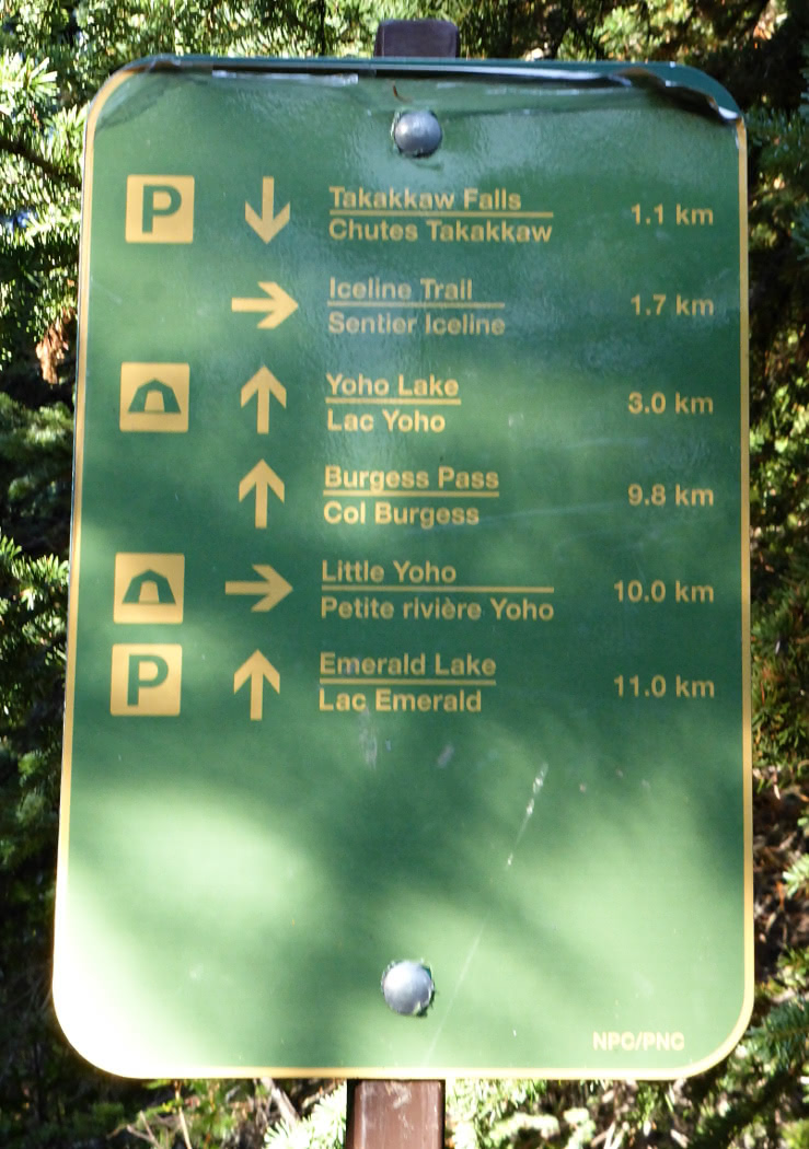
On July 15th, 2024, Joan and I drove up the Yoho Valley road, including its notorious double switchbacks, |
| Click on any image to enlarge. |
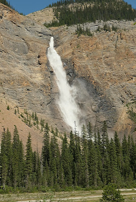
to park at the site of Takakkaw Falls, |
| Takakkaw Falls bottom right, Twin Falls top left. |
and began our hike to Twin Falls and the now-shuttered Twin Falls Chalet, six miles one-way, not counting side trails. Takakkaw is extraordinarily popular,and
was already busy, but Joan and I managed to find a parking spot in the
campground parking area. We brought extra water bottles along, given the prediction for hot weather. A fire ban had been declared because of breezy winds and dry conditions.The first segment of the hike was a gentle grade on gravel and then packed dirt. There are many destinations, but only one way to begin. (Note: the distance to Yoho Glacier is now irrelevant, as it has melted back out of sight.)As the woods crowded closer to the route, we encountered this yellow columbine.We observed our first waterfall from a distance. It was on the other side of the Yoho River, where the summer melt had created white-water conditions.Joan and I did take the short spur to the Point Lace Falls;water flows into the Yoho from the heights on all sides.Continuing on, our next side trip was the Duchesnay Lake spur.It had contracted a lot in the summer heat. Is it not receiving as much melt as before?Naturally, we weren't the only ones on this popular trail. We briefly said hello to a cheerful group of Japanese tourists.As the day progressed, the Yoho grew ever stronger. The glacial sediments remained suspended in the rushing middle, while at the sides they settled, turning the river edges turquoise(ish).Just a few minutes later, we reached the campground below Laughing Falls, whose waters join the main stream. |
| Note the tents. |
The Laughing Falls. |
| Laughing Falls |
The crowds thinned beyond this landmark. Soon, a major intersection appeared. You can choose to ascend the west wall of Yoho Valley for various destinations, or continue north for Twin Falls. After further climbing, with the temperature rising, Joan and I needed the encouragement of seeing the Twin Falls in the distance. |
| Photo at full zoom. |
The trail wound through a long sequence of ascending switchbacks and passed by a spur for the campground. Continuing on, we eventually saw the water from Twin Falls passing through a slit gorge.After one more climb, the falls appeared.How things looked downstream:Joan and I also checked out the now-defunct chalet/teahouse, |
| Click on any image to enlarge. |
sat on a bench, admired the falls, and followed the brief local loop around the site. This photo shows the chalet at its best, back in 2003, on our first trip here. Now, it is in considerably worse shape after various closures and reopenings; the Alpine Club of Canada surrendered its License of Occupation in January 2023.Here is an interesting note which confirms what we'd heard about the history of the falls:
When one channel of Twin
Falls would get obstructed by debris flowing downstream and "turn off," workers would routinely be dispatched to the lip of the falls to remedy
the situation with dynamite. In one such case, they actually succeeded
in completely blocking the channel and temporarily turning the falls
into a single plunge rather than a twin. The problem was, however,
subsequently "fixed" and is no longer a concern today.
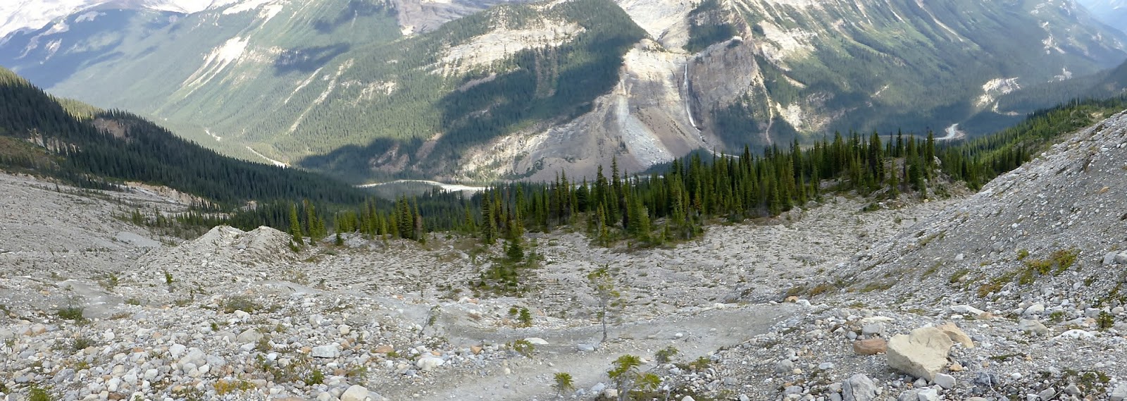
Given the heat and looming return hike, we decided not to tackle the climb to the top of the falls, let alone the whaleback trail that begins there -- the high point in the ridge is ~1300' higher up.
On the way back, around 3:00pm, at the intersection with the trail going up the west wall of the valley, Joan and I encountered a couple studying the sign. The husband immediately asked (I paraphrase from memory):
"Which way do I go for the photos?"
It turned out that, having arrived in the mountains unprepared, this late arrival had sought advice from the visitors center in Field. Nonetheless, he couldn't name a specific destination or viewpoint, but still insisted on an answer in a New York minute. Given that, we couldn't help him.
The temperature continued to climb, and the last mile or two, out in the sun walking on gravel, were particularly wearing. Still, we continued past the campground parking, where we'd left our car, to get a view of the Takakkaw Falls in the afternoon light.
It was crowded. Flocks of people lined the walk towards the viewpoint. I couldn't take an afternoon photo of the falls from the viewpoint due to the constant mist, but before getting there, I took this one.It had been a long day -- 13 miles total -- and returning on the flat, paved viewpoint path, I stumbled and fell. Got back up, embarrassed but uninjured.

 and
was already busy, but Joan and I managed to find a parking spot in the
campground parking area. We brought extra water bottles along, given the prediction for hot weather. A fire ban had been declared because of breezy winds and dry conditions.
and
was already busy, but Joan and I managed to find a parking spot in the
campground parking area. We brought extra water bottles along, given the prediction for hot weather. A fire ban had been declared because of breezy winds and dry conditions. The first segment of the hike was a gentle grade on gravel and then packed dirt. There are many destinations, but only one way to begin. (Note: the distance to Yoho Glacier is now irrelevant, as it has melted back out of sight.)
 As the woods crowded closer to the route, we encountered this yellow columbine.
 We observed our first waterfall from a distance.
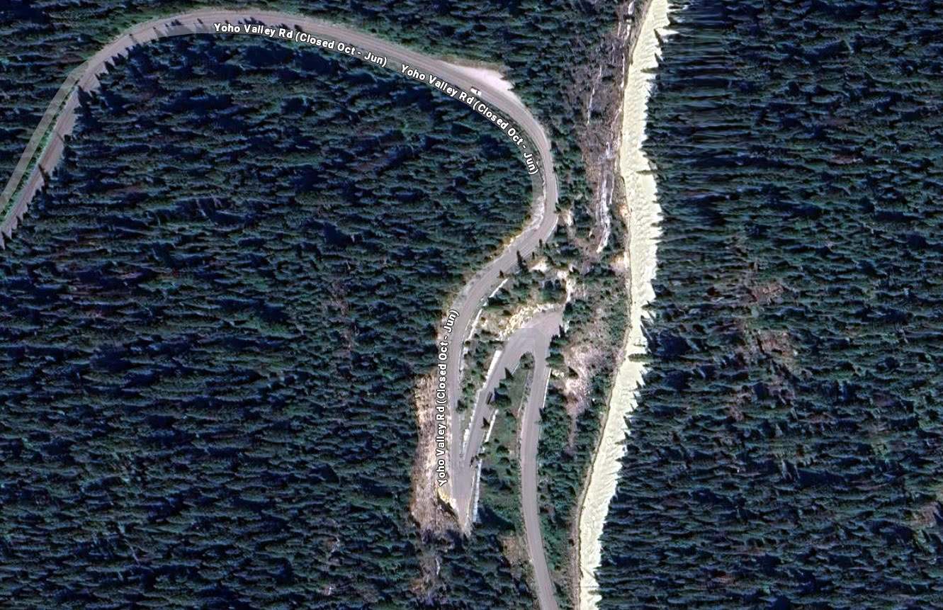


 Here is an interesting note which confirms what we'd heard about the history of the falls:
 It had been a long day -- 13 miles total -- and returning on the flat, paved viewpoint path, I stumbled and fell. Got back up, embarrassed but uninjured.