Showing posts with label ice formations. Show all posts

Sunday, December 10, 2017

East Greenland: Exploring Johan Petersen Fjord

The morning of August 15th was as gorgeous as the day before, so it was a "go" for an all-day expedition to the Johan Petersen fjord. But first we gorged on breakfast. Gotta fuel up!
It's a long, cold zodiac ride from base camp past Tiniteqilâq (Tinit) and across the Sermilik fjord,
so we were grateful for our Mustang survival suits. On the way we had occasions to photograph each other,
and our progress through the fjord.
The zodiac created a strong breeze, so at times I needed to turn away from the bow and face downwind to thaw out.

Here's my "zodiac clip". 


We all went crazy admiring the zoo of shapes, colors, and shadows sculpted by wind, water, and sun.
 And by glacial droppings.
Large bergs can split off from glaciers feeding the fjord, or be driven into the fjord from the North Atlantic.
The clear ice in this pair had been under such compression, such weight of ice in the past that all the air had been squeezed out of it.
On reaching the far side of Sermilik, at the mouth of Johan Petersen, we stopped for a restroom break.
Then our intrepid zodiac drivers ferried us on to the island known to the Greenlanders as "Bad Island," because in earlier days it was impossible to reach due to icebergs.
There we gladly shed our Mustangs and divided into two groups; one for an easy walk and one to hike to the top of the island.
Joan and I joined Drew's group, headed for the summit.
The island (Ingmíkêrfíkajik on the map) has no paths, but plenty of shelves and ways to climb from one to the next.
Embedded mica (the blown-out white spots in the photo) was common in the rocks. Click on the image to enlarge, as usual.
Drew pointed out various botanical features, arctic plants that survive by clinging to the ground. I even tasted crowberries. We were thrilled to get a quick glimpse of a gyrfalcon, which Drew spotted zipping over us. The raptor flew so fast that even if my camera had been out and on, I couldn't have captured a photo.
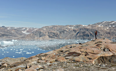
The broad top of the island is spectacularly placed.
Looking across at the Brückner Glacier.
Zooming in on the ice there.
Looking at the glaciers at the head of the fjord.
Too soon it was time to start back down.
The landing zone is in sight. Here we would spread out and enjoy a generous picnic lunch, including hot soup. On these outings the NatHab team kept us well fed, including pick-me-up snacks between meals.
We hadn't finished exploring. After lunch our zodiacs headed towards the head of the fjord and the Kagtilersorpia glacier, with its ice tongues and waterfalls.
Every one of us was having a great time.
Joan and I were in Julius' zodiac. Julius was born and raised in Tinit, but took advantage of Greenlanders status as Danish citizens and attended university in Copenhagen. (Although attending the university was free, room and board was not.) He put us to shame by being trilingual in English, Danish, and Greenlandic.

We admired layered strata and intruding flows exposed by glacial scouring.
Julius returned from a scouting expedition on the right bank. It looked good to forge ahead.
A couple of the waterfalls were new this year, according to Julius.
Katie, our bold mountain goat of a guide, went ashore at the waterfall at the tip-end of the fjord. Look for the little red jacket on the rocks just left of the bottom!
We were truly lucky. Ours was only the second NatHab group to make it all the way to the end of Johan Petersen; the others were deterred either by ice blockades or terrible weather.

In fact, the conditions were so good that our zodiac fleet took a new route back via Ikâsak Stoklund fjord, known as the "iceberg graveyard." From the map it's clear that any iceberg that squeezes through the tight gaps into that fjord will have a difficult time squeezing back out.
The icebergs came in complex shapes and sizes. It's a good thing we had digital and not film cameras ... so many pictures to take!
 Now how do you suppose this one got created? It looks gritty/dusty on top.
 Here, part of a berg split off, and with its center of gravity shifted, the berg's old waterline is now exposed at a 40º angle.
We had one rest break on the long journey back. Some of us accumulated back or bottom fatigue spending so long in the zodiacs, but it was well worth it.

And needless to say, we devoured the savory dinner back at base camp.

Monday, March 18, 2013

Ice Dreams in the Hocking Hills

In mid-February Joan and I visited the Hocking Hills area of Ohio, staying at the Inn and Spa at Cedar Falls. This post won't be a description of the Inn ... Tripadvisor does a good job of reviewing that excellent place ... but it will report on the surprising winter walks we took.

Our first stop was at the Hocking Hills Regional Welcome Center, where we collected brochures and visited the Pencil Sharpener Museum. Then, before even arriving at the Inn, we hiked at Old Man's Cave. Click on this map, which shows the location of the Inn and of the parking for Old Man's Cave, to enlarge it. (Thank you, Google Maps!)
We bundled up and each of us used two walking sticks, which were very useful because we encountered a landscape of frost, ice and snow as soon as we descended into the gorge.
There was both melt water and air flowing under many of the ice sheets. The combination sometimes looked like bubbles, other times like tear drops. Here is a short video clip; at first it's not in focus, but as the zoom pulls back the camera finds the right settings.

We moved upstream along the gorge until the path began to climb towards the rim, but then, a set of rocky steps appeared. The path was narrow and the stones were coated with ice and angled uphill. Even with two sticks apiece, it was too slippery for comfort. Joan and I turned around and proceeded along the trail in the gorge's depths towards Old Man's Cave. By this point my hands were aching from the cold, especially because we had been stopping and gawking so much. I removed my ordinary gloves and switched to thicker outdoor mittens, which helped a lot.

To reach Old Man's Cave we needed to cross an arched stone bridge, shown here in a picture taken later. Joan and I would have been crossing from left to right.
The surface of the bridge was ice-covered, and had already been traversed by a few people, slickening the surface even more. After taking a few tentative steps we decided to continue down the gorge to the lower falls, where we could easily cross the stream and then climb to the rim and approach Old Man's Cave from above, and on the other side.

The lower falls was enchanting too.

As planned, we climbed to the rim and then reached the spot for descending to Old Man's Cave. Partway down, it looked like this, with fascinating rock formations. Clearly we were on the lee side of the gorge, with hardly any snow or ice underfoot.
Lower down, Joan provides some scale.
After visiting the cave our route was back up to the top, where we crossed the stream again, above a stepped bridge we had gingerly used earlier on our way downstream. The sharp edge between the icy and clear zones on these steps was curious.
Crunching along in the thin snow, we reached the upper falls.
Joan provides some scale yet again in this closeup. From here the parking area was within sight.
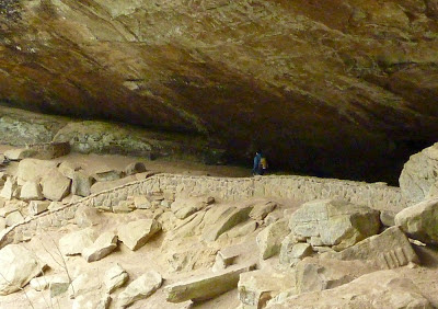
That evening at the Inn we saw a fox hunting in the snow, partly obscured by the desiccated summer vegetation. The light was low, and I was taking photos through a window at maximum zoom, but this image is intelligible if not artistic.
After breakfast the next day we both enjoyed a massage at the Inn's spa, which we highly recommend. Afterwards we drove to Conkle's Hollow, where, with the sunshine brightening, we soon encountered more ice staircases (click to enlarge). 
Towards the end of the hollow we crossed a shallow stream by carefully placing our weight on the translucent sheet of ice above it, or on strategically placed driftwood. At the hollow's end there was the familiar arrangement of ice created by falling water above ice created by fallen water.
Looking back at the way we had come in, it seemed a different world.
This wide view of the left side of the hollow reveals icicles in the deeper recesses.

Back at the car we had a snack, and then drove on to Ash Cave, which was a short walk from the parking area.
Zooming in on the large mound of ice beneath the falls,
Looking at it from the other side.
I couldn't resist taking a picture of the dangling ice from behind.
The ice mound beneath was intriguing, with a constant spray of water showering onto it.
Our next stop was at the Ash Cave fire tower.
We climbed to the top,
where this was the view. Not bad for February!
Our final stop for the day was at Cedar Falls.
These falls were pretty, but difficult to approach closely in the icy conditions.
There is a trail connecting Cedar Falls and Old Man's Cave, part of the Buckeye Trail, a cross-state hiking path. This section is dedicated to Emma "Grandma" Gatewood, a founding member of the Buckeye Trail Association, and three-time Appalachian Trail thru-hiker. Joan and I had time to hike about halfway to Old Man's Cave before returning. The trail had been rerouted in sections due to fallen trees (last summer's derecho?) and wear-and-tear. Sometimes the trail offered two choices, and which one was preferred wasn't always clear, but it was impossible to get lost.

We had seen a lot of ice by this point, but one formation seized our attention. First we noticed the frozen spray from above coating nearby branches.
Then the mystery of this ice mound grew as we studied it more closely.
Where the spray was currently falling there was a forest of tall, crystal spires, center in the photo above. To the lower right there are frozen flows, terraces of ice. Then, looking back into the walls, the half-caldera, it became even more astonishing.
In the foreground the ice is chunky, like demolition rubble. Then we have the land of vertical shards. But most interesting is the mound revealed as a row of separate columns of ice topped by a polished and terraced cap. Wouldn't you love to see a timelapse video of how this came to be?

We returned to the Inn at Cedar Falls for dinner and a good sleep. There was no rush the next morning, for freezing rain had fallen overnight and we decided to give it time to melt. By the time we departed the roads were in good shape, and we explored some of the county roads in this area. Laurelville, population 528, was our lunch goal because we needed to try out the Ridge Inn Restaurant. It was good, very good; perhaps we should have skipped breakfast! As it was we drove away with a half dozen of their fabulous donuts, which have just the right texture (not full of air, not too thick) and, again, just the right amount of sugar glaze. Too bad it's at least an hour away from our house.

The weather had cooperated for our visit, which doesn't always happen in February. We were able to take each desired hike, and visit both the Inn & Spa at Cedar Falls and the Ridge Inn Restaurant for the first time.

And our luck with the timing of the visit, to see the ice formations at the most interesting point in their evolution, couldn't have been better.