Outside the office was a monument including the wiphala, a checked flag representing the indigenous peoples.
 |
| On the right is the Chilean flag. |
Carlos paid our entry fees and we merged into the rush of tour buses headed for the Salt Cave. We joined an existing tour group to transit the cave; the beginning was more of a deep defile eroded in the salt than a cave.
The shape began to twist and come more cave-like.
At one point the passaged narrowed and I had to pass my daypack up to Joan to shuffle myself through. With daylight in sight a boulder had to be surmounted.
People are disappearing ... this must be the way.
It's a climb to get out. The land around us rose while we were in there!
Looking back after emerging.
Carlos is enjoying this.
 |
| King of the Mountain? |
The Tres Marias are curious geological formations created by erosion of salty clay, stone, and gravel.
 |
| A few bits have been broken off by clumsy tourists. |
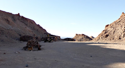
Passing through some of the abandoned site.
More shots, with rusting equipment.
On our way to the sunset view we saw many different vehicles, including loaded motorcycles,
and self-propelled two-wheelers (click on the image to enlarge).
 |
| Immensely difficult to stay hydrated? |
Along with many others.
Wind kept blowing sand over the top of that dune.
Carlos took this picture of Joan and me exploring the far eastern end of the ridge.
The view to the west from that eastern end.
 |
| And the trail goes on. |
The witching minute grew closer; however, some of the large tour groups had left already, reducing the crowds.
Sunset photo #1. At this spot we're almost exactly at 23º S latitude, just north of the Tropic of Capricorn, and so technically in the tropics. The sun is heading almost straight down.
Zooming in,
and pulling back.
The refracted evening light glowed on the volcanoes to the east.
We drove in the deepening dusk back to San Pedro. Carlos, Joan, and I picked a smaller, more local restaurant for dinner, which worked out well.
But we had to plan for an early rising the next day. Joan and I settled on a 3:30 rising for a 4:30 breakfast and the targeted departure time of 5:00. Why so early? Because everybody leaves early to arrive at the El Tatio geysers; apparently they are not nearly as dramatic later in the day.
It would be a rugged drive.


No comments:
Post a Comment
Comments may not appear immediately as they are moderated by the author to eliminate spam. Please, no commercial links!