CR2016: Down and Up to Grizzly Col
On the morning of August 4th the weather was good, but the prediction included a chance of thunderstorms in the afternoon.
Today's hike headed for Grizzly Col, the pass in the ridgeline just east-southeast of Copperstain Mountain.
This meant that we would descend ~300 meters, or 1000 feet, from the lodge before starting a 486 meter (1600 foot) climb up to 2386 meters, or 7830 feet.
At our first stop we inspected the Lodge's dam. Joan and I had encountered various electrical generation schemes at different "helicopter" lodges; Talus Lodge originally had a liquid-fueled generator that shut off at 9pm, but now has solar panels that minimize the use of the generator; a run-of-the-river micro-hydro generator at Mistaya Lodge, supplemented by solar panels, can handle lights and battery chargers but not hair dryers, just as at Talus; here at Purcell Lodge there is a diversion hydro generator that can handle one hair dryer with prior warning.
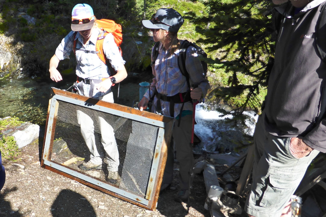
Halfway down the 1000 foot descent we visited the dam that supplies water to the hydro generator.
The dam provides a pool from which some of the water continues over the creek bed, and some of the water is piped to the generator at the bottom of the hill.
Screens keep debris out of the water fed to the pipe.
They periodically need cleaning.
 |
| But not today. |
It's a long run of pipe down to the generator hut, and sections need replacement from time to time due to tree falls and other damage.
We had seen both spare and mangled pipe glistening in a small meadow from the top of Copperstain, and would again today.
The generator hut is small,
and the maintenance log unofficial.
Sarah adjusted the feed valve half a turn, but a few minutes after we departed she received a radio call from the Lodge that the power had dropped to 1 bar out of 8. The "hammer" that protects the generator from overload might have dropped. She ran back, restarted the system, exercised the valve wheel, and the power returned.
On reaching the bottom of the hill our group saw the site of the original owner/builder's yurts and a still-functioning outhouse. Then we started up the valley of Krummholz Creek, hoping to reach Grizzly Col despite the forecast thunderstorms. The early trail was in the woods, which thinned as we climbed; the trees spread out and the flowers and rocks became more alpine. The cloudiness increased.
In this photo we've already gained altitude. Back the way we've come the Lodge is near the top left, and halfway down the pipe "farm" is visible in a clearing (click on the image to enlarge).
More hiking ensued, followed by our lunch break. The col was in sight ahead, but it'll still take some effort to get there. Kristin and Sarah were keeping a wary eye on the sky.
Our group pushed on. After a cool-down and water break below the pass, Kristin said it was turn-around time, but if we wanted to "run up to the pass" we had ten minutes. Say no more.
 |
| We made it! |
Up here the snow lingered on the north slopes and in shaded pockets. There was a hiker in the middle of this snowbank.
 |
| Looking south. |
Two panoramas, the first looking from the northeast (at right) to the northwest.
Overlapped by this panorama looking from the northwest (right) to the southwest. The peak at right is Copperstain.
The descent back down to the valley was not as difficult as we had dreaded, and the rain held off. The climb back up to the Lodge was a slog and I suffered from end-of-the-hike letdown, but then there was surprise champagne in honor of Sandy & Kelli's 15th anniversary (observed) as we arrived at the lodge.
That evening it was time to pack. Tomorrow would require multiple helicopter flights to swap the guests and some of the staff, and exchange garbage for supplies. Joan and I volunteered to be on the first helicopter out.


No comments:
Post a Comment
Comments may not appear immediately as they are moderated by the author to eliminate spam. Please, no commercial links!