Sunday, February 10, 2013

European Odyssey: Islas Cíes and Baiona

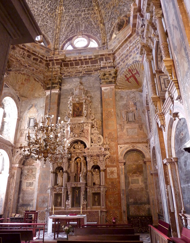
After two days visiting internationally known Spanish museums and cathedrals, on the morning of October 4th we were landing at do Faro, the largest island in the Cíes Archipelago, which is part of the "Atlantic Islands of Galicia National Park." Because of the lateness of the season the island was almost deserted, which suited us well. In this photo the zodiacs have begun disgorging passengers onto the dock. It was another wonderfully clear and sunny day.
We were greeted by rangers and local guides, who handed out literature and gave us a quick review of the rules, none of which were surprising, and the walking options. In Spanish the park is officially known as the "Parque Nacional Marítimo Terrestre de las Islas Atlánticas de Galicia," which is a mouthful. This sign has a modified spelling compared to the handouts, perhaps of a more Galician or Portugese flavor.  We are only 15 or 20 miles, as the crow flies, from Portugal.
Joan and I joined the group setting out for the lighthouse, Faro de Cíes.
The first section of the walk was gentle and broad.
We soon came to a point where the island's two sections are connected by a thin strip of beach, which separates a lagoon from the Vigo estuary to the east.
A causeway separates this lagoon from the open Atlantic to the west, but the lagoon fills with each high tide. 
Google Maps helps to illuminate the geography of this isthmus.

Our group passed through the now-empty campground, and then the path began to ascend; to reach the lighthouse we would need to gain 175 meters (about 575 feet).
There were intriguing erosional features along the way,
and as we climbed the view to the south island, San Martiño, opened up.
We were inspected by a European robin (not a relative of the American robin).
After another few curves the lighthouse came into view. Lots of switchbacks lay ahead.
They were not steep requiring only a dollop of patience. Those who were in a hurry and arrived first provided a sense of scale for this photo (click to enlarge).
From the lighthouse terrace the world was revealed. Here the photo is aimed to the north,
and here more to the east. If you click to enlarge, you will see our ship, the Explorer, in the center of the image, just peeking out from the edge of the hill. A remnant fog bank obscures the upper estuary.
Joan insisted that a picture of yours truly was needed. I'm an odd sight with all the straps: daypack, binoculars and binocular harness. And the camera pouch on my belt.
On our way back we took a side trail that led to a bird viewing area.
There was an impressive keyhole rock nearby.
The trail leads to this observatorio de aves -- a bird blind.
In breeding season there would be great numbers of nesting seabirds to watch, but in October there is hardly anything except the cliffs and the sea, which are impressive in their own right.
From just beyond the observatorio there was a view that included the causeway, lagoon, beach, dock, and ship.
When looking at the world that was close instead of far away, we saw these lizards,
as well as some noisy gleaners.
We continued our walk back to the dock, and lunch was held on the ship as it glided over to Baiona (or Bayona). The spelling "Baiona" is more prominent when googling, so I'll use that.
In the photo above, the Parador de Baiona is on the right and the harbor in the center. Another map will be handy here; the ship's zodiacs shuttled to the wide concrete dock near the bottom of the map.


Joan and I decided to explore the grounds of the Monte Real Castle, within which the parador is located. The perimeter consists of two or more lines of historic fortifications.
Here we approach the entrance along with others from the Explorer and local tourists.
A sign pointed us to the "start of the route of the walled fortress." 
It proved to be a pleasing walk around the crest of the ramparts, and Carol Knott, a staff historian from our ship, became an unofficial guide for a small group of us. Early on, we were looking back at the town over some of the oldest battlements.
The Explorer was almost in a line with the portal of the fortress.
Autumn flowers were blooming between the stone walls.
Being atop these walls created excellent viewpoints for photography. Here is my best picture of a hórreo, a stone granary typical of northwestern Spain, of which there are many types. This one is no doubt not storing corn, but such a useful structure could be adopted for many uses.
We continued around the peninsula, and I took this photo of a tree framed by the stones and the sea. Small lighthouses inhabit shoals near the horizon.
Defending the fortress against attack from the sea is a 16th Century cannon. It has been restored at least once, but it's difficult to protect the metal against corrosion for long.
Then Joan and I dashed back to catch a zodiac for the ship. We needed to freshen up and change our clothes for the dinner our group was to enjoy at the parador.

Arriving back at the parador we discovered that the staff hadn't expected that our group would actually arrive at 6:30 (or even earlier), which is barely past lunchtime by Spanish or Portugese standards. We had a pleasant wait on the terrace while the staff set up drinks and hors d'oeuvres,
and after that we consumed an excellent dinner during which I took no photos.

This day was an excellent wrapup of the Spanish portion of our journey. Tomorrow, Portugal.

Saturday, February 2, 2013

European Odyssey: Santiago de Compostela

After sailing from Bilbao for an afternoon and night the Explorer arrived at A Coruña (in Galician, or La Coruña in Spanish), and we again disembarked early in the morning for a bus ride, this time to the pilgrimage site of Santiago de Compostela.

Our day was dedicated to Santiago de Compostela, so the buses didn't stop anywhere in La Coruña. I took this picture of the Tower of Hercules, originally a Roman lighthouse, through the bus window as we zoomed by in the twilight.

Saint James is the patron saint of this province, Galicia, and tradition has it that his remains are buried at the Cathedral of Santiago de Compostela. Religious pilgrims have been drawn there since the Middle Ages, along a route known as the Way of Saint James. For us it was only a short walk from the bus drop-off to the central plaza of the cathedral complex. Again, we broke into several groups, each with a local guide.

On the way to the cathedral we passed by the Church and Convent of San Francisco; all except the facade collapsed in the early 18th Century and was rebuilt.
Then there is a mostly pedestrian street along which are many shops offering free samples of St. James' cake in the hope that you will buy more. Although not a good picture, this photo shows the final street into the square and the low light of morning.
The speed limit is 20 km/hr, but few vehicles can manage it. Would you like to be this bus driver entering the main square? Patience is a virtue.
Pilgrims are allowed to traverse the Way of Saint James by bicycle or on horseback as well as on foot. Walkers and horseback riders must travel a minimum of the last 100 kilometers on the route to qualify for the Compostela, bicycle riders 200 kilometers. As a cyclist myself, I can say that this favors the bicycle riders unless the roads are very bad. The riders  in this photo could be pilgrims or ordinary tourists.

The square (Praza do Obradoiro) is surrounded by institutions and architecture, but is dominated by the cathedral. Pictures of individual buildings don't do it justice. Here is a Google Map link to the square.

And here is a video of modest quality  -- the morning sun was low in the sky -- of the Praza. I hope it will complement the above map.


Our guide took us on a walk around the exterior of the cathedral before taking us inside. Here is a picture of the former Monastery of San Martín Pinario, now a seminary. It is just north of the cathedral, as shown in the prior map.
The scallop shell is the emblem of the pilgrimage and of Saint James, and it is displayed everywhere.
In ways large and small.
Then it was time for our guide to take us into the cathedral for a tour. On walking in we received our first glimpse of the censer known as the Botafumeiro, reputedly the largest incense burner in the world, and its support structure. We will see it in action later, at the end of the pilgrims' mass.
The eye of God looks down on the censer from the top.
Many of the original masons' marks are visible. The stonemasons were paid by the number of pieces they completed, hence the marking system.
This figure caught our eye, and was explained to us, but I've completely forgotten who it is ...
Behind the central altar is a massive work dedicated to Saint James, whose statue is almost lost at the bottom of the canopy (click to enlarge).
There is a side door that allows people to walk behind the statue of Saint James and briefly place their hands upon it. This is a popular tradition, and there was a long line of persons waiting to perform it.

The organ is not where you would necessarily expect one.

The cathedral has chapels and relic chambers in every nook. Here we see the reliquary for the bones of Saint James.
One of the side chapels.
And another.
At the end of the tour our guide took a side exit and we came out upon Silversmith's Square. We would later return to the square and the shopping street you see heading away to the west.
The square, of course, had its own intriguing statue.
Our guide then led us to this small courtyard at the University of Santiago de Compostela. The statue is of Alonso III Fonseca, a late 15th/early 16th Century archbishop, politician, and scholar who was a major supporter of the University.
From this courtyard I took a photo that included three flags; from left to right, of the European Union, the province of Galicia, and of Spain.
The guided portion of our visit ended here. Joan and I wandered back towards the cathedral to attend the latter part of the mass for pilgrims. I took a few pictures, including this one of the southern arm of the cathedral, taken from the east.  To the left, just outside the photo, is the Silversmith's Square described earlier.
We entered the cathedral, which for this mass was as always packed with humanity. In this photo we have entered the south arm of the church from its southern entrance; the speaker is facing left.
The mass itself was in Spanish, but there were several languages used by different priests afterward to greet, honor, and advise the pilgrims in their native tongues. For those onlookers who were far away from the altar, modern video screens were employed.
For many of the guests the highlight of the mass is at the end, the swinging of the Botafumeiro. The use of a swinging incense burner dates, by tradition, to the 11th Century. Pilgrims would arrive unwashed after a long journey, and therefore at the end of every pilgrims' mass the cathedral doors were and are thrown open, and one of the largest incense burners in the world is swung back and forth by a team of handlers. Today the odor of the attendees is not a problem, but the swinging of the Botafumeiro is very popular. I made a brief video clip showing both the large arcs that the censer makes, and how at the end it is wrestled to a stop.


After the mass it was time for our group to reunite for lunch at the Hostal dos Reis Católico, originally a royal hospital, and now a parador (government-sponored inn or hotel). It forms the north side of the main square.

Before we sat down to eat there were appetizers in one of the courtyards,
and a Galician dance troupe performed for us.


Indoors there was an excellent meal,
and entertainment from tuna singers, originally college students who sang and played instruments to earn an income while in school.
Their tunes inspired some of us to join in.
There was some free time before we would leave, and Joan and I chose to visit the cathedral again.
It was surprising how deserted it was now that the mass was over. Perhaps everybody was at lunch. There was no line at all for walking behind the altar and touching the statue of Saint James, and Joan and I were happy to take the opportunity to do so.

When we boarded our buses and left Santiago de Compostela we did not return to La Coruña. The Explorer had sailed onward to the small town of Muros, visible in the lower left corner of the map that started this post.
As you can see from this photo the tide had washed over the low portion of a ramp, near to where we boarded our zodiacs. It didn't affect our operation.
Everybody was feeling good, but tired after a long day.
The extensive abalone farming at Muros stretches along the estuary.
After dinner aboard ship everyone with a camera, and many without, rushed outside to marvel at the marine sunset.
This day had been one of civilization, with cathedrals, universities, and over a thousand years of history to explore. Tomorrow morning would be wholly opposite, dedicated to the natural world.