Tuesday, August 30, 2022

Back To Canada: Sherbrooke Lake

The next day, July 14th, was a transition day, but Joan and I spent the first half checking out a few things in Canmore before departing. We returned to Uprising for coffee and pastry, then walked past the old RCMP building and the knock-your-eyes-out peonies there. Continuing south and east, we walked through the Spring Creek development along the boardwalk, and then crossed the bridge for a quick inspection of the ongoing development anchored by the Malcolm Hotel. It's astonishing how much money seems to be pouring into this town!
 
Our next step was the Thursday market (farm goods, art, and more). It had been in downtown Canmore for a long time, but with the conversion of that area to either no autos, or paid parking, the market is now held at the civic/event center, called Elevation Place. Here's a map with the high points of our walk highlighted in red. (Click on the image to enlarge.)
We purchased some fruit and pastries at the market for our travel lunch, and then returned to Val & Bob's place to bid them farewell and load our luggage in the car.
 
The goal of our afternoon hike was Sherbrooke Lake, which we had last visited in 2016. Since then, a barrier had been built to prevent eastbound traffic on the Trans-Canada from attempting to cross westbound traffic to reach the parking area.
Further, a sturdy, gated chain-link fence stretched around the back of the parking area, deterring wildlife from a death-defying crossing of the Trans-Canada. Here we consumed our goodies from Canmore, and then set out, an uphill climb. After the initial rise, the routes to Sherbrooke Lake and Paget Lookout diverge. We'd visited Paget Lookout in 2012, but were in the mood for a less strenuous walk today. Lots of other people were on these trails, a sharp comparison to our Centennial Ridge hike the day before.
The final approach to Sherbrooke was muddy in spots, due to the late spring melt, but manageable. Here's a look back as we approached the lake.
Several other groups had reached the waters first and taken the best viewing spots. Joan and I continued up the trail, which parallels the lake. It took a while to find a decent spot for a sit.
I haven't used the Deep Dream Generator for a while ...
The mountains on the far side still had some snow cornices.
The trail, in a less maintained condition, hikes on to Niles Meadows. For us it was time to turn around.
 
It being a late spring, there were still flowers to identify. Here's a western meadow rue, which is a dioecious species, where male and female flowers are found on separate plants. This is a male.
It was a short but steep drive down Kicking Horse Pass to our overnight stay, at Cathedral Mountain Lodge. The next day we'll drive back up the pass to begin our visit to Lake O'Hara.

Friday, August 26, 2022

Back to Canada, Centennial Trail

Joan and I began July 13th by revisiting the Uprising bakery in Canmore for breakfast, where we had a long chat with the greeter/order-taker/coffee-maker, Carolina, from the Czech Republic. Then we geared up for our "assault" on the Centennial Ridge Trail, starting at the northern end (many writeups start at the southern end.) Click on the image to enlarge.
Joan and I both knew we were not in shape to get as far as Mt. Allan; our goal was to get above the treeline for some inspiring views before we turned around. It would also be a great training hike, all uphill on the way out.

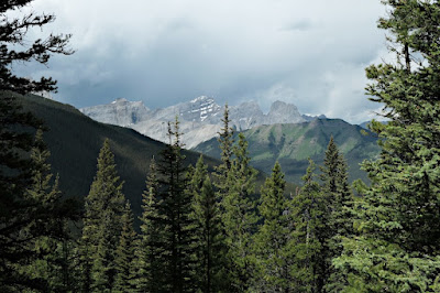
The view from the parking area. We will be hiking off the left side of this image; the high peak in the center of this image is Mount Lougheed. The weather was promising.
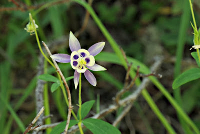
With the late spring, many flowers were still in bloom, including this blue columbine.
The initial segments of the trail had been damaged, or gave views of damage, from the floods of 2013.
Parts of the route are old horse trails, wider than a footpath.
With lots of greenery and no vistas for the first several miles, we did not dash along, but took time to inspect flowers and critters.
A bashful blue clematis ...
After the first mile the trail became incredibly steep, climbing the spine of the ridge. We paused frequently to get oxygen back into our muscles. And, at each curve in the path, one of us would yell out "Yo, bear!" to advertise the approach of humans.
 
More flood damage.
And a calypso orchid!
The birds were avoiding my camera, but we heard both the varied thrush and Swainson's thrush.
 
We kept climbing. Eventually, still in the woods, we could catch glimpses of Pilot's Knob to the east.
Stubbornly, the treeline kept refusing to appear. Clouds began to pile up to the west. We heard some rumbles -- perhaps they were passing jets? No, distant thunder. Still, we hadn't reached the treeline yet, and we pushed on.
 
It became clear that wet weather was moving in on our right, but not on our left. Would it hit us?
Joan and I started making agreements -- we'll go to the next switchback, the next corner, and re-evaluate. We must be close to the treeline. Finally we conceded defeat, and put on our rain gear just as showers hit us, binoculars and camera stowed away. We turned around and began our descent.

The rain let up for a while. We stopped at one of the few sites where there was a flat spot next to the trail, and saw that others had been there before us; a log was conveniently located for sitting, and charred embers marked a small campfire.

We were enjoying lunch in this cozy spot when we heard voices, the first in hours. Then two trail runners, skinny men in skimpy outfits, appeared, headed downhill. Then a third came along, and seeing us, started in our direction until he realized his mistake and turned around. Startled, we deduced that these guys must have started at the southern end, run up from Ribbon Creek to Mt. Allan, and been up above the treeline during the lightning and rain. (There had been unbroken spider webs across the trail on the way up, so they couldn't have started from the northern end before we did.) Yikes!
 
Down and down we continued, hard work on the knees and shins. Then, more thunder! The last third of the return was a walk in steady light to moderate rain all the way back to the car. As we drove back towards Canmore, the rain stopped, and then the pavement was suddenly dry. Back at Bob and Val's, they said it hadn't rained there at all. Mountain weather!
 
Joan and I cleaned up in time for dinner at Crazy Weed, where the limited staff was running at full speed to keep up. An early highlight was the labneh appetizer -- honey roasted eggplant, golden raisins, walnuts, dill, mint, zaatar & lemon, served with warm flatbread. We barely had room for the Thai chicken (Ben) or Chef's curry (Joan).

The next day would not be so strenuous.

Tuesday, August 23, 2022

Back to Canada (at last), Bow Valley Trail

The covid-induced pause in travel meant that Joan and I hadn't visited the Canadian Rockies in almost three years. We resolved to try again in 2022, and persevered through obstacles: Delta changed our schedule from Columbus to Calgary so drastically that we switched to United, and until the U.S. dropped its requirement for citizens to pass a covid test if returning by air (but not land or ferry), we had a backup plan to reach Calgary by driving to and from Toronto and flying between Toronto and Calgary. In the end, we flew to Calgary on United without any hitches or delays (departing Columbus at 6:00am), despite a warning that the Canadian customs terminals might not be "up."
 
In Calgary it was our first time renting a car from Enterprise, whose price quote was 1/4 that of Hertz and 1/2 that of Avis. We were thrilled to not wait in a check-in line, but be escorted to directly to our car and review all the necessary details (how big a scratch counts as damage, etc.) right there.
 
On our way to Canmore we stopped at the Barrier Lake Center to purchase bear spray and a Kananaskis Conservation pass, a new fee for vehicles parked in the area. There is no physical pass; the license number of your vehicle is entered in a database which the rangers can check as they patrol the parking areas.
 
Then we continued on to Banff to snag our physical Parks Canada passes (cheaper as two seniors rather than a family), and finally returned to Canmore, where we were staying with our friends and former B&B hosts Bob and Val. Canmore was originally a blackened, dirty coal mining town; the mines closed in 1979, and the town has recovered as a tourist and second-home destination. It's also sitting in the middle of a wildlife corridor, so grizzlies, black bears, and elk are not uncommon.
 
We fell into bed and slept for nine hours after a dinner at Rocky Mountain Flatbread and an evening walk north on the wide trail along the Bow River. That walk included seeing an osprey nest, a Franklin's ladyslipper, and a round-leaf orchid.
 
The next day's hike was south down the Bow Valley Trail / Trans Canada Trail. It was a sunny day and warm, with a high about 82°F, or 28°C, but the humidity was so much less than Ohio's!
After a breakfast at Uprising (wraps, pastries, good coffee) we crossed the bridge to the Trans Canada Trail and I paused to capture the Bow in full flood; spring came late in 2022 and the river was full of snow melt.
We were quickly greeted by a chipping sparrow.
This route is used by hikers, bikers, casual walkers, commuters, anyone and anybody. A look at the Bow from the edge.
The trail crossed a smaller stream.
Zooming in, a piece of wood looked much like the Loch Ness monster.
Soon the trail threaded between a housing development rising on the south side, and a woods on the north. Female elk were lying down in the woods, taking it easy in the shade and chewing their cud. The longer we looked, the more of them we saw. The cyclists zooming past, of course, saw nothing. They were also unlikely to hear the Swainson's thrush that we did.

The next stretch typifies the Canmore sprawl, with new developments springing up between the mountains and the river.
After a few minutes I took this photo looking back.
The road goes ever on ... to the cluster of development at the next highway exit.
Why is such an expansive meadow here?
It's reclaimed coal strip mine land, planted to have something there, and to prevent old mine tailings from eroding into nearby lands and rivers.

A side loop further along took us closer to the Bow through much less developed terrain. (Click on the image to enlarge.)
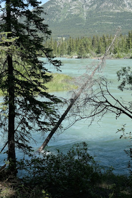
This tree will be carried away sooner rather than later.

After about three hours we turned around, when the trail entered a developed area. Along the way we'd seen numerous species of flowers. Here, a Lewis/blue/prairie (pick your common name) flax.
This is a vetch of some sort, but there are so many ...

This yellow clematis, a vine, is an invasive and considered a noxious weed. Pretty though.

How the crowds had increased by the afternoon on this sunny Tuesday! We saw various watercraft ... first, three males in a small inflatable raft towing a small inflatable circle -- imagine a doughnut three feet across -- paddling only with their hands. On the Bow in flood. Yikes!
Then, upright paddlers with paddles. And a coach.
By the time we reached Canmore, the crowds were out in full force, whether sunbathing, cycling, walking, or taking photos.

That evening we had dinner at Sauvage, a new restaurant since our last visit here. Sauvage offers 5, 7, and 10 course tasting dinners, both vegetarian and non-vegetarian. Wine pairings are also available. Recommended, but go hungry!

After today's warm-up, the next day's hike was more ambitious. Next post!