Thursday, June 27, 2019

A-C-B: Valle de la Luna

Carlos, Joan, and I returned to the Valle de la Luna about 4pm on October 27th.
Outside the office was a monument including the wiphala, a checked flag representing the indigenous peoples.
On the right is the Chilean flag.
The volcanos did not seem far away.
Carlos paid our entry fees and we merged into the rush of tour buses headed for the Salt Cave. We joined an existing tour group to transit the cave; the beginning was more of a deep defile eroded in the salt than a cave.
The shape began to twist and come more cave-like.
At one point the passaged narrowed and I had to pass my daypack up to Joan to shuffle myself through. With daylight in sight a boulder had to be surmounted.
People are disappearing ... this must be the way.
It's a climb to get out. The land around us rose while we were in there!
Looking back after emerging.
Carlos is enjoying this.
King of the Mountain?
A short descent and walk took us back to the parking area. Carlos' strategy was to now drive to the end of the tourist road, to the Tres Marias, and then drive back, stopping at intermediate points we'd bypassed, timing ourselves to arrive at an observation point in time for the sunset.
The Tres Marias are curious geological formations created by erosion of salty clay, stone, and gravel.
A few bits have been broken off by clumsy tourists.
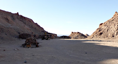
While retracing our path Carlos parked to visit an old mining site, a small hike. This photo looks back to the road after the first leg.
Passing through some of the abandoned site.
More shots, with rusting equipment.

On our way to the sunset view we saw many different vehicles, including loaded motorcycles,
and self-propelled two-wheelers (click on the image to enlarge).
Immensely difficult to stay hydrated?
From the sunset-view parking area we climbed to an extensive ridge, flanked by a huge sand dune, to await the sunset.
Along with many others.
Wind kept blowing sand over the top of that dune.
Carlos took this picture of Joan and me exploring the far eastern end of the ridge.
The view to the west from that eastern end.
And the trail goes on.
We returned to the saddle between the two high points in the above photo. The sand made a soft warm spot for this dog, who was not impressed by the changing light.
The witching minute grew closer; however, some of the large tour groups had left already, reducing the crowds.
Sunset photo #1. At this spot we're almost exactly at 23º S latitude, just north of the Tropic of Capricorn, and so technically in the tropics. The sun is heading almost straight down.
Zooming in,
and pulling back.
The refracted evening light glowed on the volcanoes to the east.
We drove in the deepening dusk back to San Pedro. Carlos, Joan, and I picked a smaller, more local restaurant for dinner, which worked out well.

But we had to plan for an early rising the next day. Joan and I settled on a 3:30 rising for a 4:30 breakfast and the targeted departure time of 5:00. Why so early? Because everybody leaves early to arrive at the El Tatio geysers; apparently they are not nearly as dramatic later in the day.

It would be a rugged drive.

Thursday, June 20, 2019

A-C-B: Laguna Chaxa

The first half of October 27th was spent visiting the Laguna Chaxa, or, Chaxa lagoon, about an hour south of San Pedro de Atacama. This spot is part of the vast Salar de Atacama, the largest salt flat in Chile.

As we parked this German "rolling hotel" caught our eye.
The main walkway led out to the lagoons in the salt flat.
A sign (encountered later on a side trail) about the lagoons.
This area hosts both the most and least common flamingos living only in South America, the Chilean flamingo and the rare Andean flamingo, listed as Vulnerable. However we saw plenty of Andeans today.

The Chilean flamingo is distinguished by pink "knees" and the lack of a black triangle at the back.
The Andean has yellow legs and the distinguishing black patch.
The flamingos feed by scooping through the water and mud for salt-tolerant critters such as brine shrimp.
Smaller birds will hang around to grab a tidbit stirred up by the flamingos.


Feasting at the snack bar.
When the flamingos are done, the lagoon bed is full of tracks.
Other birds have their own ecological niche here, such as the Baird's sandpiper.
Youngster!
I love the black headband on the Puna plover.
The Andean avocet is a larger bird, but the only ones we saw today were snoozing.
Not all the inhabitants here were birds.
I haven't tried to identify the species!
This view looks back at the parking, other buildings,
and the volcanoes in the background.

I don't know if it was the heat or the salt, but my camera developed the habit this day of taking pictures on its own if left on; I had to delete quite a few. Fortunately this didn't persist through our journey.

After our long wander we had lunch in the shade, back at the buildings. Carlos, our guide, had brought sandwiches along from the hotel, and they were good. A portly guide from another group was sitting at the next table. He was very jolly, telling us about his family and the success so far of his plan to lose weight.

Then an scheduling issue arose. The detailed itinerary that Trogon Tours had sent Joan and me, the better part of nine pages long, had led off today's description with "two spectacular high Andean lagoons: Miñique and Miscanti, turquoise-green lagoons some 4,300 meters above sea level." Joan asked about these, and Carlos seemed surprised. He said that if we went there, we wouldn't get back to San Pedro until after dark. Our thought was, why hadn't we gone there directly and skipped Chaxa?

The root of the problem was that Carlos was filling in for the guide originally assigned to our trip, who had injured his back. We had the detailed nine-page itinerary, but Trogon had not given him a copy. He was operating with the bare outline (hotels, etc.) that Trogon had given him, and had no inkling that we'd been promised either Miñique and Miscanti by the back office.

Joan explained that she had been particularly interested in these lagoons, but we understood that Carlos hadn't been given sufficient information, which wasn't his fault. Carlos told us the three days in Bolivia would have multiple high lagoons in addition to the huge Uyuni salt flat, so we shouldn't miss anything, and Joan and I decided that was OK.

Carlos had an idea for what we might do instead. After lunch we drove back to the outskirts of San Pedro where he inquired about the best time for the Valle de la Luna (Valley of the Moon). This wasn't listed our itinerary, but it is one of the major tourist sites of the area.
The answer was to begin later in the afternoon, in order to finish our visit with the sunset. We returned to the hotel, where Joan and I had time to re-hydrate and for our afternoon meditation (not a given on this trip), and then back to the valley we three went.

That visit will form the next blog entry.

Wednesday, June 12, 2019

A-C-B: Mountain Passes, Salar de Olaroz, and an International Border

October 26th was a day with a long drive, but lots to see. Carlos would drive us from  Purmamarca, Argentina, to San Pedro de Atacama, Chile, where we would spend the next three nights.
Highway 52 took us west. Our first stop was for birding at a likely looking spot; Carlos was eager for us to see a giant hummingbird.

At first we were merely pulled over on the side of the road.
From here we could look down into a small valley on the right, barely visible in the photo above (click on the image to enlarge). Also in the photo's left are switchbacks with cargo traffic.
Joan and Carlos peer down into the wash.
A wren was nesting in the arms of a cactus.
On the other side of the highway, a weathered corral.
Carlos took his Toyota down a dirt road into the wash. Perhaps he'd been here before, or perhaps he'd spotted foliage that hummingbirds favor, but while there we spotted our giant hummingbird.
 Another brown-backed mockingbird, to bookend the one we saw yesterday.
We also saw the glittering-bellied emerald hummingbird, and the sparkling violetear hummer! These were flitting about too fast for me to grab a photo, but in the binoculars they were spectacular.

We had a long way to go and it was time to shove off. Ahead loomed the long, switchback climb to the next pass.
Those light-colored terraces are our route!
We pulled off at an observation point, not yet quite at the top, looking back the we we'd come.
On the narrow road you have to respect the truck traffic.
Think twice before trying to pass one.
Arrival at the high point.
We paused while another group alternated taking pictures at the marker. Finally, Joan and the piggies had their turn, catching their breath at 4170 meters / 13,680 ft.
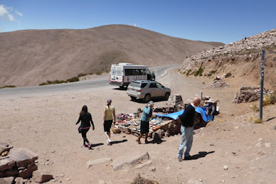
Joan and I gave the souvenir table a cursory glance; we're not in acquisition mode these days.
Minutes after we left the pass our first vicuña posed near the road.
What a delicate physique!
The vicuña is an ancestor of the domesticated alpaca, and prized for its wool. Poaching caused a decline to only 6,000 animals in 1974, but the population has rebounded to about 350,000. A roundup is held every year, and animals with more than 2.5 cm / 1 inch of fur are shorn. (That amount of growth takes about three years.) These wild critters travel in small groups.
It's amazing they can sustain themselves in this landscape.
More driving followed, and the clock ticked into the afternoon. When the salt flat Salar de Olaroz came into view,
our stomachs were reminding us that lunch had been delayed. Carlos pulled into the last opportunity to grab a bite before entering the salar, despite not being familiar with the establishment.
It turned out to be a great place. The food was excellent, homemade and fresh, and the tables in the shade were comfortable. The owner had recently installed modern restrooms, very welcome even if the water pressure was feeble.

Many groups had stopped here; unknown to us, this is a popular motorcycle touring route. Many visitors had created a custom decal honoring their trip and these blanketed the windows of the restaurant.
Those blocks are made of salt.
Fortified, we made a quick visit our first salar. (Later in the trip we will spend days on salars.) A thick layer of salt creates a solid ground, but underneath is an inland sea of brine.
Salt sculptures rose here, including this llama.
The salt on the surface is dirty from windblown dust and detritus, but evaporation ponds
turn the brine into tidy white granules.
In the last few years a plant has also been operating at this salar to concentrate the brine made available by the salt drilling, which is then processed to generate lithium carbonate, a precursor for lithium-ion batteries.

The next stretch of time was spent driving; we were not quite halfway to San Pedro. At one town we stopped for some brief birdwatching, including Andean geese,
and replenishing our gasoline before entering Chile.
These poles are also plastered with tour decals.
Driving on we finally reached the Paseo de Jama, a broad pass (we're at 13,000' again) on the Argentina/Chile border. The border stations of the two countries are combined into one indoor facility here. The three of us visited one window for the paperwork to exit Argentina, then another to enter Chile, and then a third for Chilean customs.

Fourth, there was vehicle and luggage inspection. Chile is very stringent about avoiding the importation of pests or invasive species, through agricultural products or otherwise, from the other side of the Andes. No animals are allowed, but fortunately the inspectors grinned when they saw our pigs. I had some chocolate-covered coffee beans in a baggie, which had to be explained. Joan was quicker on the draw than I was, and described them as "chocolate candies," thus avoiding any mention of coffee beans.

Just before or after entering Chile we saw our first flamingoes (there are several species in the Andes.) Click on the image to enlarge.
Our route wiggled, ascending and descending between 14,000 and 15,000 feet through a lunar landscape. When the line of volcanos including Licancabur came into view, Carlos knew we were getting close to our destination. The volcanos straddle the border between Chile and Bolivia.
The summit is 5916 meters or 19,409 feet.
The sun was low when we began the long descent into the town of San Pedro de Atacama, down to 7,900'. Such an altitude difference is a struggle for trucks going up, and a hazard going down! We arrived at dusk, to discover that Carlos' GPS was confused by the maze of narrow and one-way streets. (San Pedro was founded in 1450.) He persevered and found our hotel, the Terrantai. In this old part of town the front doors were practically in the street; parking was a block away, in a fenced and locked plot. We later learned that the Terrantai was opened in 1996, the third hotel in San Pedro de Atacama.

It was dinner time. We three couldn't quickly find the restaurant Carlos had in mind, based on second-hand directions, and chose one close to the hotel. It was somewhat noisy and tourist-y, but the food was OK and we were tired enough to be fine with it. Joan and I collapsed into bed.