Over the last decade Joan and I had read about the hike to the top of Ha Ling, just outside Canmore, a peak named for a Chinese man who won a bet in 1896 by climbing to the top, planting a flag, and returning, all in about five hours. We'd never tackled it. Never considered it seriously. It's steep -- you gain 2300 feet (700 m) in 1.6 miles (2.6 km) -- and you reach 7900 feet altitude, which is gasping territory for those of us that spend most of our lives under 1000 feet. Plus, this would be only our second day of hiking. This photo should give you an idea of the challenge; it's adapted (I punched up the contrast and white balance) from Wikimedia Commons under Attribution and Share-Alike licensing; the original is by Kevin Lenz in 2006. Ha Ling is the blunter, left-hand peak.
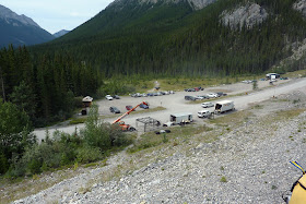
We decided to give it a go and see how far we got. It would be good training, for both legs and lungs. At 10:00 we were the first car at the parking area, but across the road, something unusual was happening. Equipment, people, trucks, cranes. (This photo was taken on the way back, and other cars had arrived.)
We were puzzled by all the industrial-looking activity. Was the trail up there? We fished out our guidebooks and consulted them, then, with our initial notion confirmed, walked up to the industrial zone. There we were met by a friendly escort person. A movie set was being constructed, and although hikers were allowed through to the trail, we must be accompanied. A fake entrance to the Cheyenne Mountain nuclear bunker was being built! (The real one is in Colorado.)
There is a small plaque at the beginning of the trail.
The trail is briefly a gradual climb,
but then begins a relentless ascent through the trees.
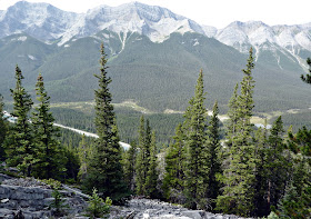
This map link provides an overview of the trail's route. There are portions in this first two-thirds where rockslides have opened up a view through the trees.
The trail grows steeper and the trees sparser until you emerge onto the scree slope. At the point where the trail turns sharply left I took this photo towards the top. Joan and I were thankful that we both had two hiking poles.
Slowly and steadily we continued on. Then we were at the top, and the first ones there! The far side is a sheer drop popular with technical rock climbers. Joan and I sat on the edge and drank in the view; here's a video clip with some wind noise.
This photo zooms in on Cougar Creek in Canmore. The darker grey thread is the normal watercourse; on either side are the gravel, rocks, and boulders that replaced the washed-away creek banks, yards, and decks (click to enlarge). During the June 2013 floods in this area the trans-Canada highway was cut in several places.
Others soon began to arrive at the top. Some were shocked by the drop-off at the edge, but everybody was pleased and grateful to have made it.
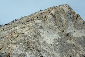
Joan and I ate our lunch and then started back down. Looking back, I took this photo, which provides some scale and shows the popularity of a late start in this part of Canada.
We made it back to the car without mishap, and arrived at Mount Engadine Lodge in time for tea. As almost always happens, a moose appeared at the slough around suppertime.
After dinner, which was fabulous as usual, the award-winning Canadian singer-songwriter Cara Luft performed for the guests at the lodge. This was a "Sing for Your Supper" engagement, not a formal "Music in the Meadows" concert.
Her friend Karla Anderson, who also performed on the CD "The Engadine Sessions: Come to the Mountain," joined in for a few songs.
Then it was time to retire and prepare for another day of hiking tomorrow.


No comments:
Post a Comment
Comments may not appear immediately as they are moderated by the author to eliminate spam. Please, no commercial links!