Tuesday, March 6, 2012

CR2011: Atlas Coal Mine

Our next two nights were spent in Drumheller, Alberta. After leaving Brooks, we spent much of the transit day at the Atlas Coal Mine, a National Historic Site. Blessed with an abundance of easily reached sub-bituminous (heating) coal, the Drumheller valley saw 139 mines registered between 1911 and 1979. Demand for this coal declined and then disappeared after the discovery of oil and natural gas in Alberta in 1948.

The mine and museum are immediately next to the Red Deer River, just on the other side from the highway to Drumheller itself.


This picture is of a bridge across the Red Deer near Dorothy, shortly before reaching the Atlas. We took a short side drive across it to a viewpoint higher up, and saw a white pelican on the riverbank as a bonus.
The museum offered three different tours, and we bought tickets for all three. (A fourth, the ghost tour, was in the evening.) With any tour, you gain admission to the modest collection of buildings that would have been found near the mines; that is, residences and such.
Miners the world over and of all eras lived in cramped conditions.
The compact information center had some introductory information. (I should note that the museum is run almost entirely through donations and by volunteers.)
A model of the tipple at the Atlas Mine gave an idea of how it might have looked when new.
Next, we inspected the mining machinery out in the yard. These are pieces that somehow escaped being treated as scrap iron; they fill an area that can't be captured in a single photo.
An occasional plaque describes some of the equipment.
The battery powered locomotive, in person.
We were tickled to notice the prominent role of a once dominant Columbus firm, Jeffrey Manufacturing.
For our first guided tour, we walked past the tipple ...
to the lamp/shower house, where the miners would begin and end their working day. In this photo, our guide is demonstrating the proper technique for lighting a carbide lamp.
Later in the history of the mines, battery-powered lamps replaced the open flame of carbide. The miners resisted the change for a long time, because a carbide lamp could be recharged with calcium carbide and water in the dark of the mine, but if a battery died, then what?
From the lamp room we walked to the conveyor tunnel, which carried coal from the mine's mouth to the tipple. Here is an exterior shot of the tunnel.
On the inside, our guide walked us though the conveyor's operation and the tunnel's history. 
Originally the miners were forbidden to walk through the conveyor tunnel to reach the mine, regardless of the weather. The slope of the hill was treacherous, but the mine ownership wasn't interested in spending money on a stairway. Injuries ensued. The manager ridiculed the miners' concerns until the day he decided to show them how safe the hill route was. After falling several times, he allowed the miners to use the conveyor tunnel.

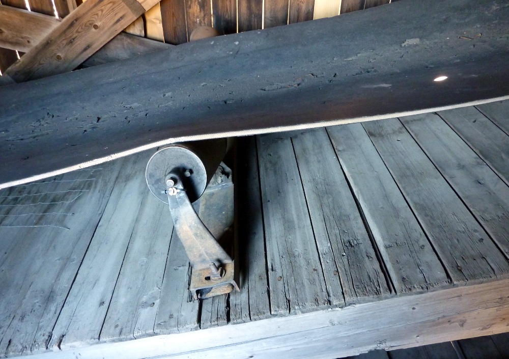
A closeup of the conveyor mechanism.
At the bottom, the conveyor dumped the coal lumps into the tipple mechanism.
 The motors driving the belts were at the top.
We emerged from the conveyor tunnel to an overview of the museum grounds and the river.
Our next tour was a coal car ride from the equipment yard down to the lamp house.


At the lamp house for the second time, on the next tour, the emphasis was different. Here we see where the miners would change from their "street" clothes into their work clothes; the street clothes would then be raised up to avoid dirtying them with coal dust when the miners returned.
One wall was covered in a sketch depicting a populated changing room.
Next to the changing room was the shower room. Normally just for miners, on Sundays the families could come for a hot shower -- for a small fee. Matrons would stand guard when the women showered.

Then it was time to climb up into the tipple and see how the coal was sorted and loaded into trucks. After being dumped from the conveyor the coal would pass over shaking grates with openings of increasing size. Coal that would pass through the smallest holes would burn very quickly, and brought a lower price. Who wants to stoke their oven or furnace every few minutes? Conversely, "right-sized" coal fetched a higher price.
The sorting mechanism needed constant human attention, to ensure proper operation, and to weed out any rocks mixed in with the coal. The operators stood on a narrow wooden platform next to the shaking, clanging grates.
Mining for heating coal was seasonal work. In a cold winter, the mines would be working continuously. In a mild winter, the miners might have work only a few days a week. For six months of the year, the miners were on their own to find whatever employment they could scrounge up, such as farm labor. In any case, working in an unheated tipple in subzero weather was difficult. One solution was to bring heated bricks to stand on, not enough to stay warm, but enough to ward off frostbite.

The seasonal nature of the work may have also caused a fire that burned down the original tipple sometime in the 1930s. The story told is that some of the miners calculated that if the tipple burned at the end of the season, they would have employment rebuilding the tipple. In any case, the tipple did burn down once, and only once.

In the next photo you are looking straight down at the curving slide that carried the sorted coal down to the next level.
Later in the history of the mine, a new marketing technique took hold: to distinguish Atlas coal that of other mines, in a last step it was sprayed with paint. The output from the Atlas mine was daubed orange, and branded as "Wildfire Coal." Competitors quickly followed suit, with alternate brand names and colors.
Finally the coal was ready for delivery.

After a long stay at Atlas, in the bottom right on this map, we continued up the road towards Drumheller (click on the map to enlarge).

 We stopped at the official, protected site for viewing hoodoos.
Nearby was a plaque about another one of the 139 mines in the area, and the labor problems in the valley.

Our next stop was the Last Chance Saloon. I didn't take any photos there, but we had an ice cream at the adjacent grocery. Then we moseyed on to the suspension bridge in Rosedale.
It was definitely a see-through deck.
The difference between the lower, developed shore and the bluffs was striking. The precarious availability of water dominates everything out here; the annual precipitation in Drumheller is about 14½ inches. Here in Columbus, Ohio it's about three times that.
Here's an overview of the entire bridge.
Afterwards it was on to grab some information at the visitor center in Drumheller, check into our motel, and dine at the Athens Restaurant. Tomorrow we would drive a scenic loop and spend time at the Royal Tyrrell Museum.

Tuesday, February 21, 2012

CR2011: Dinosaur Provincial Park

We settled into our motel in Brooks, Alberta, for the night. Dinosaur Provincial Park awaited us, only a short drive away. This park is a World Heritage Site, and one of the major dinosaur fossil beds on the planet. It rates several mentions in the March 2012 issue of Scientific American, in an article discussing the density and distribution of dinosaur species on the late Cretaceous continent of Laramidia.

The drive north out of Brooks is pure prairie, flat and simple. There is no hint that anything unusual, let alone as dramatic as a badlands, is lurking nearby. The early morning air is cool. Then, there is a parking area with flagpoles and signs, seemingly in the center of nowhere. This is the entrance to the Park, and the site of the Prairie Trail, a brief (300 meter) but instructive walk. Here is a Google Maps view of the area, with the trail to the left of the parking area.


The view of the badlands includes the Red Deer River peeking out just above and to the left of center.
The sign about the Prairie Trail (click to enlarge).
The parking area and the short walk, at this early hour, were being visited by at least a dozen western meadowlarks, which sound nothing like the eastern species, at least to my ear.

Also resting here is the Siska Glyphstone, guarded by steel tubing.
A sign details the history of this stone.

Then it was time to drive down into the badlands, to the visitor center, and purchase tickets for a guided tour.
Having arrived for our visit after the Labor Day weekend, the guided hikes or other such programs weren't being offered, but there was one bus tour today, and only one. We arrived early to make sure we would get on it.
In the badlands erosional features dominate the landscape, including gullies and hoodoos. Here is a photo montage of some of them, both from the bus tour and from later walks.

At our second stop, we were free to wander (in a limited area) and look for fossils, which our guide knew were there, having been discovered many times by many visitors.
Then it was time for an explanation of fossil preparation, which required a volunteer.
The fossil bones are taken, still largely encased in rock, to laboratories for careful extraction. Protecting them in transit from their remote bedding sites are several layers of burlap and plaster, a technique over a hundred years old.
As you can see from the strong shadows and blue sky, the sun was blasting down on us, and the temperatures were rising. It would reach about 93°F today. The bus was not air-conditioned; if it was supposed to be, today it was just recirculating the air. Our guide handed out plastic bottles of water with a squeeze handle, so that you could create a fine mist above your head. Back in Ohio, a land of 85° temperatures and 85% humidity, this technique would be futile. In the arid plains of Alberta, it does surprisingly well at cooling the air around your face for a few minutes. Also we were frequently disembarking from the bus, and the bugs were not out today.

The next stop was a small locked shed of concrete blocks, to which our guide had the key. Inside was a corythosaurus skeleton, left as it had been discovered.
Our guide did a great job of explaining how these bones arrived, jumbled, at this spot. If you needed a review, there was a detailed wall panel.
Here is a better look at the bones.
Continuing on, we passed the camel formation, a pair of hoodoos that resemble a dromedary (D for one hump) camel.
When we arrived back at the visitor's center, we decided to walk the Coulee Viewpoint Trail (0.9 km) first, before the day got any hotter, and to investigate the center afterwards. From that trail, there is a panoramic view of Little Sandhill Creek.

A plaque describes the ice-age forces that created these coulees (click to enlarge).
Further metamorphosis was performed by the interaction of water and clay.
The trail let us explore high points and low.
The visitor's center is very well done, including a theater and a reconstruction of an early fossil-hunter's turn-of-the-2oth-century campsite. There is a gallery depicting a pack of small carnivorous dinosaurs attacking a much larger prey.
For the next stage of our visit we returned to our car and took the self-guided driving loop, with several stops for exhibits and hiking paths. The first stop was the Badlands Trail (1.3 km).
The black blob you see in Joan's hand is an umbrella, partially closed for the photo op. We called them sunbrellas, and they ward off the relentless afternoon sun magnificently.

This trail has some ups and downs, but it's scenic!
One of the reasons that the coulees of the badlands are so treacherous is the high proportion of bentonite in the clays, probably sodium bentonite.
If you were down in the coulee and it started to rain, you were at risk for flash flooding -- with no way to climb the slick sides. Yet another reason these are "bad" lands.

Along the public loop road there are two fossil houses, where special items are protected from the elements but available for viewing through glass. I took pictures only at the "headless hadrosaur" fossil house.
I've combined two of the signs there:
Next was the Trail of the Fossil Hunters (0.9 km). This out-and-back trail takes you to one of the original fossil dig sites in the park.
The small structure at far left is the distant second fossil house. The trail gently climbs from there to avoid rough terrain, and then, just right of center in the photo, turns and winds towards the dig site.

Our final walk was the Cottonwood Flats Trail (1.4 km), for which I have no photos. This trail takes you through the cottonwood trees, voracious consumers of water, that depend on the flooding habits of the Red Deer River. Again, Google Maps reveals the trail:


When the course of the Red Deer shifts, established cottonwoods wither for lack of water, and new ones must spring up. The germination of the cottonwood seeds depends upon their landing on the mud of the riverbanks just as the spring floods recede. It's a Goldilocks situation, because the ground must be wet enough, but not too wet.

Then it was time to return to Brooks to rehydrate and rest. Tomorrow, Drumheller.

Sunday, February 19, 2012

A Hawk in the Bush

This Friday Joan and I set out to take a walk in the unseasonable February sunshine. A few steps from our front door, Joan spotted a Cooper's hawk sitting in a tree next to the house across the street. We admired his or her plumage through our binoculars, and slowly walked closer to him, a few steps at a time, down our driveway.

He launched from the tree and plunged into the bushes in front of the neighbor's house. Clearly he was hunting something he had seen or heard, and probed on foot for his prey.
This day his hunt wasn't successful. To get a better vantage point, he flew to the top of the low juniper bush visible on the far right of the above picture. We continued to approach, and the hawk was unfazed. This was clearly a suburban hawk! Joan and I came as close as the near sidewalk to him.
With a more severe cropping of this photo, you can see a chartreuse band of tissue where his beak meets his head. Also, the pupil of the eye in the sunshine has contracted, and the pupil in the shade has not.
After meditating on the scene, unblinking, for several minutes the hawk flew off. We were thrilled at the serendipitous timing of our neighborhood walk!

Wednesday, February 1, 2012

Jean Branch 3/23/1924 - 1/26/2012

My mother, Jean Branch (Nelson), passed away last Thursday, January 26th, 2012. I will post a photo essay after sorting through family pictures and scanning the keepers, which might take a while. For now, I'll copy and paste the obituary from the Knoxville News-Sentinel.
BRANCH, JEAN NELSON - age 87 of Knoxville, TN passed away at her home Thursday, January 26, 2012. She was a talented water color artist and a longtime member of the Covert Coloring Society. Jean was also a world traveler with her husband Neal during the 1980s and 1990s. She is preceded in death by her husband of 66 years, Neal Branch; brother, Edward Nelson; and her parents. Jean is survived by her two sons, Mark and Benson. A wonderful mother, wife and beloved friend of everyone who knew her, she will be greatly missed by all. "Do not stand at my grave and weep, I am not there, I do not sleep. I am a thousand winds that blow; I am the diamond glints on the snow. I am the sunlight on ripened grain; I am the gentle autumn's rain. When you awaken in the morning's hush, I am the swift uplifting rush of quiet birds in circled flight. I am the soft star that shines at night. Do not stand at my grave and cry. I am not there; I did not die." At her request no services are planned. In lieu of flowers the family requests that donations may be made to the American Cancer Society , 871 Weisgarber Road, Knoxville, TN 37909. Arrangements by Cremation Options, Inc. (865) 6WE-CARE (693-2273).