Pages

Saturday, July 31, 2021

Hummingbird Nest Events

In an earlier post I documented the construction of a hummingbird nest in the pear tree just behind our house. This post will complete the story; click on any image to enlarge.
July 5th

July 6th

July 7th

July 8th


July 9th

July 11th

July 13th -- feeding chicks!

July 14th

July 15th, caught her with beak open

July 16th -- clearly two chicks

July 17th

July 19th -- feeding

July 19th -- chicks resting in nest

July 20th

July 21st, growing chicks

July 23rd

July 24th -- empty, and edge torn in places
Unfortunately, "that darn circle of life," as Joan would put it, had struck overnight. A predator had raided the nest. Hummer nests have a long list of threats, such as squirrels, snakes, chipmunks, rats, corvids (jays, crows) and other larger birds, etc. We surmise, because it happened  during a warm night on an flimsy branch, most likely it was a snake that took the chicks. Joan and I mourn the loss.
 
The mother hummingbird has not returned to the nest. Several hummers continue to squabble over our feeders, and Joan has spotted a hummer gathering nesting material at the edge of the woods, but they fly off into the trees and we cannot see where they go. We have our fingers crossed for another nesting session somewhere in the pear tree next year.  

Monday, July 26, 2021

Big Trip, Day 2: Buzzardroost Rock and Eulett Wilderness Preserve

On June 6, after breakfast at the Murphin Ridge Inn, Joan and I had two hikes on our agenda: Buzzardroost Rock and the Eulett Wilderness Preserve.

Buzzardroost Rock

Buzzardroot Rock is a spectacular viewpoint above Ohio Brush Creek, part of the Edge of Appalachia Preserve.
Both Buzzardroost and the nearby E. Lucy Braun Lynx Prairie are, in addition, Natural Landmarks.
There's also a prairie on today's route. The combination of the roost and a prairie has been so popular that the trail has been split to reduce damage to the prairie, by diverting some of the traffic. Joan and I went out via the prairie, and returned via the ridge. (Click on any image to enlarge.)
Early on we spotted this fascinating goatsbeard (
Aruncus dioicus).
An open patch in the woods revealed this tall meadow-rue (species
thalictrum dasycarpum) with male flowers.
After gentle climbing we reached the split.
Into the prairie we went. Just a few minutes later we spotted this impressive antelope horns milkweed.
Looking up the prairie.
Oh look, a butterfly!
Continuing on, we rejoined the ridge trail, hearing scarlet tanager calls but catching only glimpses. As we approached the ridge's end we arrived at the new, safer boardwalk approach to the roost. In particular, this sturdy structure bridges a deep crack in the promontory before reaching the observation deck.
This image of the roost is a screenshot of an introductory clip you can view here.
My panoramic photo from the roost.
The placard at the roost.
This shot looks back the way we came.
On our return we kept to the ridge rather than retracing through the prairie. Near the split the sky began to sprinkle, so Joan and I donned our rain jackets as a preventive measure. This cut down on my picture taking, but here is a young wood toad I couldn't pass up.
Alongside the ridge trail there are a few precipices,
but this one has an old safety wire:
The sprinkling stopped before we reached the intersection with the prairie trail. Then Joan and I halted abruptly when we spotted a black snake stretched across the path. I tapped it gently with my hiking stick. It gave a tiny twitch but refused to move. It was playing dead. We could hear a group coming our way and worried that someone with an unreasoning fear of snakes, no matter how harmless, would try to kill it. As they approached we pointed out the snake and stood near. Some were taken aback but they eventually all made their way past the snake. Then, to our surprise, as the vibrations of their footfalls faded, the snake deemed the threat gone and began to move. It wriggled to the far side and disappeared. I wish I had a photo for you.

The rest of the return was less eventful, and it was a very short drive to the Eulett Wilderness Preserve.

Eulett Wilderness Preserve

The preserve and its loop trail are at the end of a narrow gravel farm road.
This sign describes the involvement of the Eulett family, the Cincinnati Nature Museum, and the Nature Conservancy in creating and managing the preserve.
Joan and I grabbed a sheet indicating numbered spots along the trail and set off. The trail is not as intensely traveled or maintained as Buzzardroost.
After several minutes Joan and I realized that we had set out in the wrong direction with respect to the numbers -- counter-clockwise rather than clockwise.
We did not wish to backtrack.
There are no posted numbers on the trail itself; one must rely on the descriptions. This meant I had to reverse all the directional phrases on the trail sheet: climbing became descending, left became right, entering became leaving. I managed although sometimes I erred and read the description of a section only as we were passing out of it.
 
A small prairie appeared not long after the above blockage, and hosted many flowers, including this paintbrush.
We climbed and descending through gorges, past a section where, earlier, lady slippers had bloomed, and through a denser blockage than the first. Then Joan spotted this creature lurking in a decomposing log.
Seeing only its head, it might be a broad-headed skink or a five-lined skink; the male of both species sport a red head during breeding season.
 
This contoured land was shaped by water acting on sandstone. The most impressive bluffs were obscured by foliage, but this lesser section will give you a taste.
The damp environment encourages fungi of all kinds, including these fingers.
As we ascended on our return to the parking lot the ground became drier. At the top, we noticed this plaque for the first time.
The Eulett Wilderness Preserve was an interesting and uncrowded place to visit. Just be prepared for possible detouring around or clambering over an occasional obstacle.

Saturday, July 17, 2021

Big Trip, Day 1: Cedar Falls and Davis Memorial

 Joan and I hadn't ventured out on an overnight trip -- sleeping somewhere other than in our own bed -- for some time. You know why. But with vaccinations in our arms and things looking up, in June we embarked on a six-day trip filled with hikes.

 On the first day, we drove down to Adams County, Ohio, and visited Cedar Falls and the Davis Memorial State Nature Preserve.

Cedar Falls.

There are several "Cedar Falls" in Ohio; this one is part of the 20,000 acre Edge of Appalachia Preserve, managed by the Nature Conservancy. (Click on the images to enlarge.)
A flower called "blue-eyed grass" near the start of the trail.
Early on, a wide path and a bridge.
The boulders here support more vegetation than you'd expect.
On through the "boulder garden."
We were surprised to see this American Colombo; it's a species that blooms once after several growing seasons and then dies. Joan and I have seen it only rarely, but today we came across this bloomer and quite a few still in the vegetative state.
Colombo on the right.
A closeup of the bloom.
Sometimes weaving, sometimes climbing, the trail ended at an observation platform.
The view of the falls. The water volume varies widely, dependent on recent precipitation. In summer the forest soaks up much of the flow.
A bit closer.
The bright slab in lower right of the photo crashed into the creek from the surrounding cliffs in 1997.
The cool ravine harbors northern white cedar, a remnant of the period just after the last Ice Age. It's rare in Ohio.
Today was hot, at or near 90° F in southern Ohio, and the deck was in direct sunlight, so Joan and I did not linger, but walked back until we found a congenial, shaded spot to sit and eat our snacks.

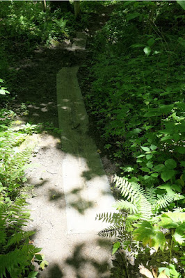
The trail employs several styles of bridge to cross muddy spots or streams.
Relatively new.
Rubber mats.
A gorgeous spider. Walk too fast, and you will miss a lot.
If you don't care for spiders, how about toads?
Next to the parking area sit the remnants of an old grist mill,
built in 1842 and originally powered by water, then by steam.
Even preceding that, in 1811 the second iron furnace in Ohio was established here.

Davis Memorial

Joan and I had time to drive on to the Davis Memorial preserve for a shorter walk. We had been here before, but often in a group gathered at the north entrance. Today we chose south.
The trail soon began to wind downhill. Then, firepinks!
Down to the creek level, where we encountered sandstone bluffs.
A thimbleweed, anemone virginiana.
More firepinks.
There's a minor geological fault here.
Joan and I couldn't easily pick out the fault itself, but the far side of the creek was full of interesting shapes.
Then we climbed back up to the car and drove to our home for the next three nights, a cabin at the Murphin Ridge Inn. They even have electric car chargers (one Tesla, one J1772), which I took advantage of each evening to recharge my Pacifica plug-in hybrid.

We looked forward to more exploration the next day.