Pages

Thursday, September 17, 2009

Shekinah Festival

The second Saturday in September is always the date for the Shekinah Christian School festival. Being a private school, this festival is the one and only major fundraiser for the school year. I became aware of it through my hot air balloon activities (1990-2001), through Dave Beachy, another Central Ohio balloon pilot with ties to the Mennonite community. There would be a dawn hot-air balloon liftoff, with the commercial pilots taking riders and the private pilots (such as yours truly) doing their part to enlarge the spectacle.

As we drove the last two miles to the school, ground fog built up. You could see straight up, but the trees at the edge of the field were misty and sometimes invisible. Not good for flying. Technically, the FAA requires one mile visibility for takeoff. (Takeoff for a balloon wouldn't be that difficult -- it's the prospect of not seeing a fence or power line on landing that's the worst.) Joan and I visited with the pilots and crew; some were friends we had not seen in years; some had joined the Central Ohio Balloon Club after we stopped flying. As the sun hit the dew, the fog grew taller, but not thinner, for another hour. The balloons didn't take off this year, but some adventurous power parachutists didn't seem to mind the fog. Once the worst was over, there were 5 or 6 parked there.

There's always a lot going on at this festival. The first thing we did (it was 7am) was buy coffee and long johns. Think of a pastry the shape and size of a hot dog bun, filled with pastry cream and with your choice of chocolate or caramel on top. Something to get your engine going.

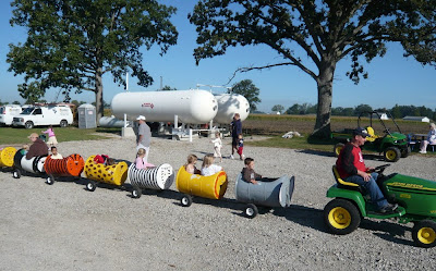
There are pony rides, petting zoo (it's very kid-friendly!), kiddie trains, quilts on exhibit for later auction, all kinds of foods for sale (including on-the-spot apple butter), fire engines, and a general auction tent with items from the silly to the exquisite, all donated for the school fund-raiser. A simple ten-foot mound entertained the younger set and provided a stage for family pictures. I provide snapshots of just a few of the possibilities.


As for the balloons, maybe next year!

Undervolting, Part 2

An update on the undervolting front. The PHC team has now used LaunchPad to provide a PPA (Personal Package Archive) that contains a standard Ubuntu desktop kernel recompiled so that the CPU frequency modules are run-time loadable and not built into the kernel. This meant that I could add their repository to my list of repositories, and then use a command line tool (apt-get) or GUI (synaptic) to automatically install that kernel. Sweet! I did so, and it installed properly, but the BIOS on my motherboard did not convince the PHC version of the acpi-cpufreq module that it was capable of supporting the calls to alter voltage assignments ("no such device"). Apparently this happens with some less-well-implemented BIOSes.

Fortune smiled, however. The old pathway (downloading the kernel source, modifying the deprecated but still active speedstep-centrino module, and recompiling & installing said module) worked just fine. The PHC PPA included a source repository, so the source I downloaded with apt-get was the source for the modified kernel I was running.

Now I'm back where I was before Ubuntu 9.04. Not the latest and greatest PHC mechanism, but undervolting nonetheless. I hope that my next system (five months away?) will be able to use the PHC acpi-cpufreq module. However, every choice affects everything else ... if I want to go with a 64-bit system, or a kernel with Physical Address Extension (PAE), in order to use more than ~3.2 GB of RAM, will the PHC team supply a corresponding kernel? Or will Ubuntu take the CPU modules out of the kernel for the 9.10 release? Stay tuned!

Wednesday, September 16, 2009

Kindersley-Sinclair Col, There and Back Again

We got up early, purchased snacks at the coffee shop, and got to the Kindersley parking area at 7am. First ones in the parking lot, not bad! We crossed the road, read the bear warning notices prominently posted (nothing new), and headed into the woods.

The shady trail began by switchbacking up through woods. It was cool, and we kept a brisk pace. (We did stop for an amazing stand of lady slippers.) After about an hour and a half, the trail flirted with an avalanche field, filling the meadow between our side of the valley and the other with large gravels, weeds, and tall shrubbery. After a few minutes, the trail (or what we thought was the trail) petered out. If we had lost the trail, where was it going to pick up again? Our guidebook mentioned that the trail "skirted the edge of an avalanche field." Not wishing to lose ground by going back until we hit the trail again, we cast about for the trail in the field. No go. Then we decided to climb a draw on the other side (the closer side to where we were by then), and started up. There were a few brief patches of false trail, but it wasn't until we gained some altitude and looked back and down that we saw a section of the true trail ... on the far side, the original side. Trying yet again to outsmart the terrain, we tried to beat our way to the trail by following the contour, cross-country. We were quickly disabused of that possibility, because although the pines, willows, and other vegetation were not technically a laurel hell, they were impenetrable, and the hillside was given to sudden steep patches. Back to the draw, and then down, across, and up -- including a hand-and-foot scramble -- and we made the trail again. We had lost an hour to perhaps an hour and a half. Joan and I made a vow that this embarrassing lesson would be our secret, and that our first choice, in future, would always be to refind the trail by backtracking.

And we were now no longer the first group on the trail. As we scrambled up to the true trail, I saw another hiker heading up it. (It turned out to be another couple.) Now another digression -- Canadian hikers seem to be prone to late starts. Perhaps this is because it stays light so late in summer way up there. But were were almost always the first or second party on a trail. Today we would be the second to the top (woulda been first if we hadn't lost the trail), and we encountered at least half a dozen parties headed up as we headed down in the afternoon. Just sayin'.

We had a brief rest stop at Kindersley Pass, and met the couple that had gotten ahead of us. (Kindersley Pass is the pass at the head of the valley to the next valley north, outside the national park. Kindersley Col is the low spot in the ridge that allows you to cross to the next parallel valley (Sinclair Creek) to the east). Then a bit more climbing, and the view opened up down the ridgeline to the col and the knob beyond.


We crossed some sections of trail with packed dirt or dirt and stone that weren't level, but tilted with the slope of the hill. Our walking sticks were reassuring on those stretches.

We went about halfway up to the knob from the col and had lunch. Three bighorn sheep were taking it easy on the eastern slope of the ridge below us. If we had not been a bit tuckered from our detour, maybe we would have gone to the top of the knob. Even so, the views were spectacular! I've constructed three panoramas to show you the 360° scene of mountain range after mountain range. Be sure to click on them to see the larger versions. I would have made a single 360° panorama, but on the computer screen it would look like a piece of spaghetti.

Looking east:
 
 
Looking north:
 

Looking southwest:

On our way back down, we encountered a couple that had spent extra time in the avalanche field, much as we had. They told us of their adventure, and said that they had helped yet another couple get out. Joan and I felt so much better -- we weren't the only ones! -- and so I am free to break our vow of silence. We also encoutered a spruce grouse and one of its chicks that was trying to hide in a tree, and had a good look at a varied thrush.

At the parking area, we chatted briefly with a couple we had met coming up, almost at the col, as we started down. They had taken the shorter, steeper way back and arrived first. Asked about that route, they had a one-word answer: "steep." Sounds like returning the way we came was a sound choice.

Our voices were a touch hoarse from the calling out to the bears, but it was worthwhile -- we hadn't seen any. Might have heard one, though, most of the way back down; it might have been a bear walking around some little distance up the hill, or might it have been our imagination? We'll never know.

Monday, September 14, 2009

Dog Lake and Kindersley-Sinclair Plans

After our hike to Ball Pass and stay at Kootenay Park Lodge, we drove down to Radium Hot Springs, at the southern end of Kootenay National Park. On the way we did the Dog Lake hike. Dog Lake was mostly just a leg-stretch, but we did find some colorful flowers and critters. Isn't it intriguing how the wood lilies don't form a bowl with their flowers, but sprout a see-through array?
And near the lake there were colorful flying critters (dragonflies?)

Then on to Radium Hot Springs, and the Parks Canada information center. We had been planning to hike to the Kindersley-Sinclair Col the next day, but the existing trail information stated that there was a bear warning for the trail. How serious was the warning, we wondered. There are occasional bear sightings at Lake O'Hara, but at other locations, such as Moraine Lake, there are often restrictions (hikers must be in a group with a minimum size of four or six, for example). What was the scoop on Kindersley-Sinclair? Even having looked at the map several times, we couldn't see any other truly interesting all-day trails at this end of the park. We were fretting about what to do, and hoped that a park ranger could clarify the situation.

At first the ranger was steering us elsewhere, but as we chatted -- discussing our Ball Pass hike, and Lake O'Hara -- she became more comfortable with our conditioning and experience level. The final advice was to make plenty of noise, so the bears could mosy out of the way, and to carry bear spray. Where to get bear spray? Almost any convenience store/gas station. We stopped at one on the way to our B&B/inn, and got a canister (it was behind the counter and we had to ask). We scouted out the coffee & pastry shop down the street, which opens at 6am, allowing us an early start. The shorter route (up Kindersley valley and then down Sinclair and then along the road back to Kindersley parking) is 10.1 miles, but the Sinclair valley portion is very steep, so we planned to return the way we came, making it about 12¼ miles -- with a 3500' elevation gain. Ball Pass had been a 2900' gain, so tomorrow would be our biggest day in the Rockies this year.

Saturday, September 12, 2009

Hawk Creek/Ball Pass & Kootenay Park Lodge

After our Stanley Glacier hike we checked in at the Kootenay Park Lodge. It's in a perfect central location for the long, narrow Kootenay Park; to drive to hikes in the middle of the park from either the north end (Castle Junction) or south (Radium Hot Springs) would be tedious and time-consuming. The complex has an information center/general store, a restaurant, and individual cabins that, although they are kept up, predate WWII. (I could not stand entirely upright in the shower, being 6' 3".) The owner is in the process of obtaining permits for and building modern cabins, but the bureaucracy of Parks Canada can be slow, and financing is difficult. At the information center you can read about the 2003 forest fires that came within 100 yards of the lodge.

The next day we tackled the 12½ mile round-trip to Ball Pass via Hawk Creek. Our guidebook warned that the trail might be less than interesting because of the 2003 fires, but we found it intriguing. New pines were already up as tall as 6' or 7', and with the abundance of sunshine, wildflowers were everywhere. At dinner that night we hauled out the flower book and counted at least 72 varieties of wildflowers, including orchids, that we saw on the trail.
 
We stopped a lot for botanical inspection.

Roughly halfway up the evidence of the 2003 fire petered out. There were a few steep stretches in the second half, but our anticipation (having read the description) was worse than the reality. We were accustomed to finding a pass to be short; that is, as soon as you stop going up you take two steps and then you're going down. Ball Pass has a lovely meadow with peaks on either side. Here's the meadow looking back:

Here's a zoom-in on a glacier hanging on one peak. We saw two small avalanches off this glacier while we ate lunch. 

Here is the vista from our lunch spot, looking east towards Shadow Lake and beyond.

Travel Health Services

Some destinations (not Canada!) require vaccinations. Previously we have used Rardin Family Practice, associated with Ohio State University, which has a travel nurse. Given a destination they will look up the official recommendations regarding vaccinations and other preventive medications, such as anti-malarial pills. Recently we went to them again, and found that they fell short of our needs:
  • They do not offer rabies vaccination.
  • They will not write an antibiotic prescription.
The antibiotic policy is a change from a few years ago. For some destinations it's impractical (or worse) to expect the traveler to dig up a local doctor and purchase the local version of a drug, or so we think.

After checking the web, we found Travel Health Services. They are members of the International Society of Travel Medicine and local to Columbus (not a chain). We've seen them three times in the last few weeks and can highly recommend them: professional, friendly, and knowledgeable. A booklet specific to your destination is prepared prior to your first visit, and all the recommendations are reviewed with you. We learned something new; even though hepatitis B vaccination is usually discussed in the context of tattoos or sex tourism, neither one of which is our thing, it can also come up in medical care. For example, a doctor giving you a couple of stitches could nick a finger and expose you to their blood. According to Suzanne, hep B is 15 times more transmissible than HIV.

If you have any travel medicine needs or questions, we can highly recommend them.

Friday, September 11, 2009

Kootenay National Park and Stanley Glacier Hike

After leaving Lake O'Hara we drove to Kootenay National Park, a long and skinny park. It derives from the first motor road to cross the Canadian Rockies, finished in 1920. Originally to be built by the province of British Columbia as the Banff-Windermere Highway, the road was built by the federal government after BC ran out of funds due to World War I. In exchange, BC granted the federal government the land five miles to either side of the road for a national park.

Our first day's hike was Stanley Glacier, a popular destination (and it was a Saturday). We got a chance to chat with lots of hikers, from locals to Japanese tour groups. The hike starts up from the road to reach the lip of a hanging valley and passes through terrain that's been burned by forest fires three times in recent history: 1967, 2001, and 2003.
After reaching the mouth you continue on up the valley, gaining altitude as the vegetation thins out and then disappears. Here is a view looking back towards the road, with the classic glacial valley U-shape:
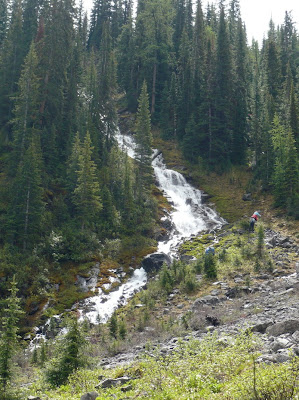
Along the way, there are waterfalls on the steep southern wall:

Going on past the terminus of the official route, the dominant feature at the head of the valley is an island in the sky. Walking there, the landscape is nothing but scree with a beaten footpath or two, and you must watch your footing and cease walking to do your gawking. Ahead, there's an outcrop of harder rock, the top of which forms a micro-plateau nourished and cloven by glacial meltwater.
Up close, the "island in the sky" is a lush respite from the rocks. We had lunch there and were well content; we didn't climb on up to the glacier (seen in the photo above) but began our return trip, and I took the picture looking back. Our outbound route was on the southern side of the valley, return was on the northern side, which had a more trodden path. (The two routes reunite at the marker for the official trail.)

Thursday, September 10, 2009

Lake O'Hara (Wildlife)

Lake O'Hara has critters to view as well as scenery. Some, such as bears, we stay away from and have not actually seen. Birds, especially in spring, make wonderful melodies but do not sit still for long. Here are some of my better shots, among the several years we've been there. Some shows, such as wrestling marmots, we've seen only once:

We assume that this is a springtime territorial or mating behavior. Here's a closeup of the hoary marmot in its native habitat:
 
We were accosted on one hike, as we rested and ate lunch, by a fearless pika.

At the top of Odaray Grandview, we were once inspected by a raven perched on a marker cairn:

I am just as glad not to have that bear photo. We've seen plenty of bear sign (recent scat, overturned ground) and that's plenty.

Wednesday, September 9, 2009

Lake O'Hara (Hiking)

After leaving Kananaskis country, we stayed at Lake O'Hara for five nights. Our trips to the Canadian Rockies revolve around when we get in to Lake O'Hara. It is a fragile subalpine and alpine environment (the lake is at 6700' or so, accounts vary); Parks Canada accordingly limits the number of persons that can be there at one time, including the lodge, cabins, campground, and day trippers. (It's a 7-mile fire road from the parking area to the lodge). This limitation means that if you want a spot at the lodge or cabins -- we always go for a cabin -- you must apply by the end of September for a spot the next year, and by the end of the year you will find out when Alison has been able to schedule you. Tip: flexibility helps a lot!

I would have never heard of Lake O'Hara except that Joan was there a few times in the mid 1970s with her parents. The occasional telling of that story made it sound like a mythical Shangri-La. Then, in 2002, Joan discovered that it had not morphed into another Emerald Lake (huge parking lot, non-stop tour buses arriving). She managed to get us accepted in 2003; she had specified that mid-July through mid-September was OK (remember the first rule: be flexible), and we got an offer for the first week of July. Taken!

Here are some hiking photos from Lake O'Hara in 2008 and 2009 (we can't do all the hikes in a few days). First, a view of the cabins from the mouth of the lake:
A view to the lake from near Wiwaxy Gap:


Along the Huber Ledges alpine route:
 
A view of Lake Oesa from Wiwaxy Gap (zoom):

A scene on the Opabin Plateau after a light snowfall (early July):

Approaching Lake McArthur:

A panorama from Odaray Grandview, with Lake O'Hara to the left, and Lake McArthur to the right:

A view back to the lake (hidden by forested ridges) from Last Larch Prospect:

It's an absolutely spectacular location.

Saturday, September 5, 2009

Smartgo app

I've downloaded a new app for my iPod touch, Smartgo. It's a $2.99 app, but well worth it. I played go while in school, but haven't played in over 30 years, and this app has lured me back in, and humbled me. In order to cope with Smartgo, I've ordered two beginner's go books. The iPod/iPhone version of Smartgo seems very polished, and even includes sample problems to get you warmed up. If you are already a player, there's Smartgo Pro.

Here is a short video. My apologies for the image quality, but I'm taking images of an iPod screen using a still camera with basic video capability.


Friday, September 4, 2009

More Kananaskis Hiking

After Black Prince, our next day's hike was to Chester Lake and the adjacent Three Lakes valley, which, depending on the time of year, may have two to four lakes as you hike up to the head of the valley. An easy hike from the road, Chester is a favorite among families and fishermen. The bears also enjoy it in the springtime for the glacier lilies (they dig up the below-ground bits) and ground squirrels (ditto).

The link at the beginning of this post has a great aerial view of how you hop over a slight ridge to the Three Lakes Valley, and how it's all laid out. Here's a July 2008 view from near the top of the valley:

This upper valley is fertile ground for fossils -- corals and crinoids:

The next day was a big hike, Tent Ridge, directly across from Mount Engadine Lodge. We prefer the Tryst Lake route; see the lake in the lower right? You follow an unofficial but well-used trail to the lake, and then make your own way cross-country up the ridge to the saddle:

but it should be noted that Tryst Lake is a great destination in itself, with somewhat less arduous hiking available on the ridge south, rather than Tent Ridge:

Others take a route that starts out, near the Mount Shark helipad, in a maze of cross-country ski trails, and eventually climbs a scree slope:

It was a Saturday -- the first good-weather Saturday in July, in fact -- and we had company climbing from the saddle to the ridge. Two years earlier, we had gone to the old communications station on the south knob,

but this time we followed two hiking groups to the north height:

And the view for lunch was pretty darn good:

The next day was our final Kananaskis hike. After checking out of the lodge, we visited Karst Spring. The route to the Spring starts out on boring forest-road/cross-country-ski trails, but then you take a boardwalk across a marshy border of a small lake, where you can spot carnivorous butterwort plants, and then a hike up to the spring. There's a lot of limestone in the area (karst topography) with subterranean waters that burst out of the side of the mountain at this most dramatic spot (low-res video):

Wednesday, September 2, 2009

Intruder Alert

We have a birdcam set up to monitor our birdbath, which is on a pedestal except in winter, when it's on a railing of our deck. We see a lot of the usual suspects -- cardinals, nuthatches, goldfinches, robins -- as well as the occasional catbird or carolina wren. It's a treat when we catch a warbler, such as this yellow-throated warbler:

and even a robin can be exciting when we've got an action shot:
 
Here in the ever-more-crowded suburbs, there is often a non-avian intruder, fearless and nonchalant:

Tuesday, September 1, 2009

Kananaskis Country Hiking

On our way to the lodge, we hiked (for the third time) Ptarmigan Cirque. It's a great high-altitude (starts at 7200') warm-up for the hiking to come. In spring (in early July, we qualified as mid to late spring visitors) the glacier lilies were still putting on a show. In general, the botanical vernal show all depends both on the microclimate and the altitude, and we were lucky:

It doesn't take long to get above the tree line, and the higher reaches of the cirque stretched all our senses after spending most of the previous day in airplanes:

On the second day, we planned to hike to Black Prince Cirque, a new destination for us, known for some steep stretches. Our invaluable guidebook by Kathy and Craig Copeland pointed out that after the initial lake, the trail was unofficial, and one landmark was "two dead larches to the left". So we were approaching this hike as a challenge/with some trepidation. But it turned out that we were not alone: a busful of senior Calgarian hikers, the Evergreeners, arrived as we were putting on our gear. Their bus displayed the sign, "Recycled Teenagers." We were not alone at the low lake where the official trail returned and the cirque trail headed on:

Crossing an avalanche slope:
 
Climbing one of the steep bits (certainly the slipperiest):
Despite the occasional drizzle on the return, a good time was had by all.

Kananaskis Country and Mount Engadine Lodge

The first part of our Canadian Rockies hiking trip was spent in Kananaskis country. It is well known by most Canadians, but most folks from south of the (Canadian) border haven't heard of it. We have always stayed at the Mount Engadine Lodge, half an hour south of Canmore and away from the beaten path of the Kananaskis Country resorts with their golf courses and ski runs. It's a great base for hiking in a region that's not overrun with tourists, and has good accommodations and wonderful dining. The lodge overlooks a meadow with a stream, with a mud wallow just below the deck of the lodge. What smacks each new visitor is the wildlife, preeminently, the moose. Virtually every evening one or several moose come to the wallow to sink up to their knees (and sometimes their chest) in the mud and slurp up the mineral-laden water. The swamp may also be visited by elk and deer; beaver can be occasionally seen in the creek; coyote and cougar have been seen in the area (and there's plenty of bear sign on some of the hikes).

Here's a section of the creek:
 
And here's a portion of the wallow:
And one day, the moose left via the parking lot of the lodge:
 
Highly recommended! And here's a photo from last year, taken from the rental car window while driving up to the lodge: