Saturday, May 27, 2017

CR2016: Ptarmigan Cirque

Moose were already visiting the wallow below Mount Engadine Lodge the morning of August 9th. Early on we saw three males, and later a female and a youngster. One fellow bore an impressive set of antlers,
and a younger one wore a starter set.
Today was a transition day; Joan and I planned to hike Ptarmigan Cirque in the morning, and buy chocolate and drive back to Calgary in the afternoon. We hoisted our luggage into the car and set off, and spotted one of the earlier moose browsing on the side of the road.

The parking area for the Ptarmigan Cirque trail, among others, is at Highwood Pass, the highest paved road in Canada at 2206 meters, 7239 feet. The cirque trail adds another 700 feet or more, depending on how far the hiker goes.
Early in the day the sky overhead was a transparent blue.
Landing approach into Calgary
We weren't the first to arrive. It's a popular family destination.
After a short walk leading to an interpretive trail and other destinations, including Pocaterra Cirque, Joan and I crossed the highway and began to ascend.
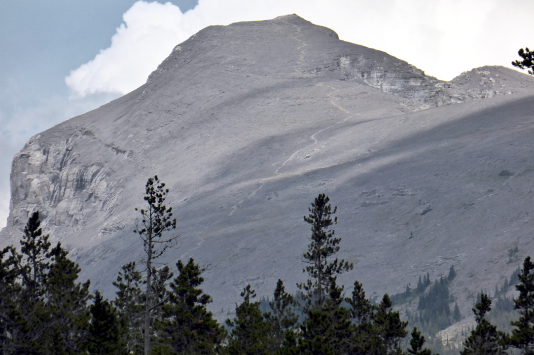
Folks find the first mile steep
The straight trail split, becoming a loop around the cirque that separated the incoming and outgoing traffic much of the way.
After many switchbacks we emerged from the trees, the trail became gentler, and wide views opened up. This photo is pointed south.
Joan and I were curious about various small flags we saw planted in the meadow. Fortunately there were a couple of explanatory signs; it's all about Columbian ground squirrels.
Looking up to the head of the cirque on a gorgeous day.
As Joan and I drew closer to the loop's apex we saw that a large group (11+) had gone off-trail for a long stop. They were the oblivious owners of several poorly-taught dogs, all of whom were yapping without pause, echoing through the cirque.
There was no temptation to linger within earshot. A more adventurous group took a spur route deeper into the cirque (click on the image to enlarge).
In this view, the inbound trail is on the far right and outbound is left.
Joan spotted a group of mountain sheep moving up the north flank of the cirque, drifting away from the humans who continued to stream in.
We returned to our car and drove to an overlook on Highway 40, where we had lunch. On the way we saw that King Creek Ridge, which we'd hiked the year before, was off-limits due to bear activity. A family of three that had also been staying at Mount Engadine Lodge arrived at "our" overlook.

We stopped at the Barrier Lake Visitor Center to donate our bear spray, which cannot be taken onto an aircraft. At the center it could be used in demonstrations, but not resold. We were told there was a shortage of bear spray in Canmore!

And of course we had to stop at Le Chocolatier in Canmore for chocolate goodness to take home. We enjoyed watching the chocolate being worked before driving on to Calgary.

Joan and I again had dinner with Barry Ronellenfitch at our hotel restaurant, as we have for several years. He asked if we were flying Delta. Three days ago Delta's operations center in Atlanta was down for three hours due to a power outage and backup failures. We used Barry's phone to check our flights and everything was supposed to be OK now.

The next morning came all too early, because the flight was scheduled to leave at 8:20 and we would need to go through check-in, security, and U.S. immigration and customs. Check in was smooth although the flight was listed as running late.

Earlier in the summer Joan and I had signed up for Global Entry, which would greatly speed our transit through the hideously overburdened Calgary infrastructure (an airport overhaul was finished late in 2016). However, there was a Canadian official who was verifying that everyone had filled out the U.S. customs forms before permitting them to enter the customs area. He wanted to see proof of our Global Entry status before allowing us through without standing in line; however, we didn't have any. The Global Entry program states that carrying your GE card is not necessary, but in Canada the equivalent program, Nexus, requires showing the card. After some discussion he allowed us through with the warning that if our Global Entry didn't work we'd go back to the end of his long queue.

There were four kiosks at the Global Entry portal. Two were obviously out of commission. We tried the other two twice each, but they timed out at the point that they should have taken our photo. Fortunately, the U.S. passport officer saw our dilemma and waved us forward. He said the kiosks often don't work, and we had a good chat while he scanned our passports on his own equipment.

To enter the pre-check security line Joan and I again had to explain about not having our Global Entry cards. Canada doesn't care about the airline's pre-check designation on the boarding pass. The Swiss Army knife in my mini first-aid kit, which I overlooked when repacking, was confiscated at the x-ray scanner.

At our gate there were more delays. First, not all the kinks had been worked out of Delta's aircraft allocations since the outage three days ago. Second, the customs computers in Calgary had just gone down, for an hour. Finally, the flight crew had arrived late the night before due to weather, and they had a minimum number of off-duty hours to observe before flying again.

There was a long line at the gate and I joined it; this was like the old Soviet Union -- see a line, get in it! When I reached the head of the line it was obvious that our Minneapolis connection was in peril, and the agent put a hold on two seats on a later flight.

There was a delay getting the baggage loaded, perhaps an aftereffect of the customs computers crashing. In the end, we left Calgary 2½ hours late.

In Minneapolis Joan and I dashed to the Delta help desk. There we saw a couple of self-serve work stations labelled "miss your flight?" (or the equivalent). We scanned our old boarding passes and new tickets (not boarding passes) for a later flight printed out.

The Minneapolis gate staff were also harried; it had been a long three days I'm sure. I was rebuffed when I asked about getting boarding passes corresponding to our new tickets, but Joan was more charming and fixed that problem.

It had been an exhausting day by the time we arrived home in time to catch a few winks in our own bed. Our trip was a long and enjoyable one, and we remain proud of our ascent of Windtower.

Note: If you've made it through all eighteen of these posts about Canada 2016, I congratulate you. And admire your stamina, or, was it pacing? Thank you for your attention.


Wednesday, May 17, 2017

CR2016: Chester Lake, Three Lakes Valley ... and a Grizzly

On Monday, our penultimate day of hiking, Joan and I decided to visit the ever-popular Chester Lake and extend that journey up the Three Lakes Valley. This was our first visit since the floods of June 2013 damaged the parking area and lower reaches of the trail. Perhaps because it was Monday, the re-groomed parking area for Chester was empty when we arrived shortly before 10.
The day trippers from Calgary haven't arrived yet.
The lower reaches of the trail had been re-routed; there was a different starting point, and the first section was now a one-way loop.
It took a while for our well-used muscles and lungs to warm up after yesterday's climb of Windtower, but we settled into the hike. The route at first is a small road,
but eventually becomes a path after passing through a zone of old logging roads and cross-country ski trails. Mostly it climbs but sometimes it's level. In this photo Joan and I are approaching the last bump or two before reaching the lake.
Almost there. Most of the glacier lilies near the lake had been dug up, being a favorite treat for grizzly bears.
Chester Lake is popular for a reason. It's not too difficult to reach, and it's gorgeous. OK, that's two reasons.

There is also a formal "rest facility" here, the tubular toilet.
Joan and I did not linger but went around the left-hand shore until we reached the side trail leading to the Three Lakes Valley. After rising from the lakeside the trail passes by rock formations known as "Elephant Rocks."
The trail swung to the right and continued to climb after it entered the Three Lakes Valley. After fifteen minutes we encountered a lookout, a hoary marmot.
Here we are about to reach the first lake.
The first lake could be a destination in itself. This photo was taken from the up-valley side.
 The trail goes up a steep gully after the first lake, OK if dry but treacherous if wet or if snow lingers. Joan and I were glad for our poles. From the top, the lake looked like this.
From this point the route was a mix of visible trail segments and cairns. It wasn't possible to become lost, however, because the valley was narrow and it was obvious which way was up. But the horizon was close, as this photo shows, looking back.
The geology in the valley was full of striations, folds, and fossil corals.
We found this body of water, which is either a seasonal pond or the second lake.
Or a seasonal lake?
Joan and I decided to climb over one more rock band and discovered the third lake. Here we stopped and ate half our lunch.
Some algae here!
On our way back, still in the rocky zone but passing by a low, wet area with vegetation, we encountered pikas chasing each other away from choice spots. We counted at least three; it was difficult to photograph running pikas, but when they were on lookout (for a few seconds) or browsing, I had a chance.
I caught this one in mid eeep, the pika alarm call. (Click on the image to enlarge, and check out the lips!) 
A wind-ruffled fur photo. 
Further down, the guard marmot was still on duty.
As Joan and I descended to lake #1 we encountered our first other hikers, a party of three with a guide. The wife of one, not present, had lived in Columbus and so he was familiar with locations such as Broad St. and Bexley.

Down at the Elephant Rocks we circumambulated the impressive rocks on the other side of the trail and polished off what was left of our lunches.

We soon met a solo guy who inquired whether he was on the way to the Three Lakes Valley trail; Joan told him he was on it! He'd intended to go to Headwall Lakes, whose trail also leaves from the Chester Lake parking, but became turned around.

More people were at Chester Lake, with even more arriving. The cow parnsip was in full bloom and covered by buzzing flies.
Shortly after leaving the lake we met a man who was standing guard as his wife and daughter were taking an off-trail pit stop. He was skeptical of the bear warnings (we saw one covering the whole of Kananaskis the next day), having seen no scat, which he said he often saw while cycling Back East.

Fifteen minutes later I came around a bend in the trail and saw a grizzly at the next bend, headed our way. This was the first in-person in-the-wild meeting we'd had in fourteen years of hiking. I halted abruptly and said, "bear;" Joan was expecting "grouse" or something more prosaic. She started chatting at the bear, to let it know we were humans, and she reminded me to pull out the bear spray on my belt. I belatedly started talking too. The bear, of a size that made us think it was his first year away from Mom, swung his head back and forth. He took a hesitant step or two in our direction, wanting to stay on the trail rather than beat cross-country, but then he turned and trotted uphill through the woods. We were a bit rattled, of course, but the rest of the walk down to the car was uneventful. We reported the encounter back at Mt. Engadine Lodge.

Our last night at the lodge was a fine one. Joan and I certainly had a story to tell!
The moon was high in the sky when the sun set.
Time to go pack ...


Thursday, May 11, 2017

CR2016: Windtower! (Third Time's the Charm)

Yesterday's rain bequeathed Sunday with clouds blanketing the valley where Mt. Engadine Lodge nestles; at times the far side of the meadow would disappear. By breakfast the fog had begun to rise a bit, while the forecast was for a 40% chance of 1-2 mm of rain.

Joan and I decided that today we would tackle Windtower, which had thwarted us twice before, in 2014 due to a late start, and in 2015 due to the weather. The elevation of the top is a matter of disagreement between web sources, but let's use 8850 feet. The altitude gain from the parking lot is almost 1,000 meters, or about 3,240 feet. Definitely uphill!

Joan and I lingered at breakfast longer than we intended but, after a 20-minute drive from the lodge, were only the second car at the trailhead. The route starts with a hike to West Wind Pass, gaining the first 381m/1,250 feet of altitude.
The very beginning of the trail is steep and rooty, climbing above the deep cut of Spurling Creek.
Mists still filled the lower elevations.
As Joan and I chugged uphill we emerged out of the fog zone.
The view towards the east from West Wind Pass wasn't much; clouds were piled against the slope.
To the west, the way we had come, the Spray Lakes remained cloud-covered as well.
To the south of the pass was our goal, the peak known as Windtower, showing its vertical face.
By hiking along the flank of the mountain we could reach the less intimidating southern slope, as hinted at in this 2015 photo.
Here's an 3-D image of the trek overall, adapted from this source.
There is no official route beyond West Wind Pass. Instead, the hiker chooses from a plethora of boot-beaten paths, as shown in another 2015 photo.
The paths weave through trees, open areas, and rock bands that may require use of hands and feet to clamber over. After the first couple of rock bands we spotted an opportunity to hike to a higher route also marked with tape and cairns. Joan and I had read an on-line account that higher was better in this section, so we tried it.

One rock band was uncomfortably tricky to climb; we managed to avoid it on return. This popular hike merits an official trail so that hikers would not need to guess where to cross each rock band.

As we proceeded the mists above the Spray Lakes began to dissolve.
Two women were a short distance behind us, but Joan and I slowly pulled away.
We reached the point where the trail swung to the east and north and more steeply up, as seen in this photo from the lakeside (click on the photo to enlarge). It was a slog the last time and it was a slog this time. It will always be a slog. Many sections demand deliberate placement of the feet, taking into account the scree depth, steepness of the slope, and dampness of the path (one day after the rain). Huffing and puffing, we climbed.
We appreciated our hiking poles and every bit of training acquired on this trip, and even so, we had to pause at times to catch our breath and let the blood flow refresh our legs. So far we had met only one other party, two women on their way back down.

Joan at the top!
The valley carrying the Trans-Canada highway is more than a mile below us.
Another small promontory is a stone's throw away.
But not easy to reach.
Rita and Margie took their turn checking out the view from the top seat. We learned later that a registry is buried in that pile.
They didn't break a sweat.
A small windbreak was a good spot to have our lunch.
More hikers arrived. We walked over to check out the "nose," a smidge lower than the top.
Behind us, other hikers reached the summit.
Clouds were snagging on Mount Lougheed (about 10,200 feet) as we began our return.
The scree wasn't as bad headed downhill, because sometimes the gravel was thick enough that we could crunch through it like a snowfield. But smaller scree rolled easily and was treacherous.

West Wind pass was spilling over.
No dark clouds, please.
Joan and I encountered more hikers headed up. One young woman was dressed in a tank top with a thin, knit, off-the-shoulder sweater and long feathery earrings. This wasn't mountain dress, but she had come this far and clearly intended reach the top alongside her boyfriend.

Then we encountered the mountain biker.
He was pushing his bike up the mountain for the ride down! Joan asked, "Does your mother know what you're doing?" We would see him later.

Sightseeing helicopters of several colors were busy this afternoon, some flying close to the deck through West Wind.
We continued to descend. In this photo clouds are billowing up to the south. The picture also illustrates one of the rock bands.
The hikers that arrived at the top after we did began to shoot by us on the way down. The pass gradually drew closer.
Just as we left West Wind pass the mountain biker whirred by. Given that the trail often clung to the ravine's edge, we hoped he dismounted and walked those sections.

Thunder began to the south, dimly at first, then louder. We kept up the pace as much as the trail allowed and didn't stop. Joan and I reached the car ten minutes before rain showers started; our round-trip time on the hike was 6:10, not bad! Also at the parking area was a woman standing in front of an open car door, shielding her husband, who was changing his clothes.

We drove back to the lodge, where it had obviously rained much harder. We were thankful not to have had rain on the rocky/muddy/rooty West Wind pass trail.

To cap a great day, the moose visited the lodge in the evening -- two males!
Not feeling territorial. Yet.