Monday, July 26, 2010

Scotland: On the Caledonian Canal

I must mention that for its trips (but not the extensions), Lindblad Expeditions creates Daily Expedition Reports (DERs), which are archived on their web site. Our expedition started on July 4th.

After lunch it was time to embark on the Caledonian canal.
It was a few short miles along the canal, paralleling the river Ness, to reach Loch Ness.

View Larger Map
Rain squalls came and went down the length of the Loch.
The ruins of Castle Urquhart are a popular destination, attracting full tourist buses. (It's also supposed to be a good location to view Nessie, the Loch Ness "monster," but we didn't spot her.) The visitors' center is tucked away in the hillside, not competing visually with the castle.
The section of the castle on the promontory is familiar to many from published photographs.
But the castle also extended up the hillside.
We had a good view of the inside of the tower as the ship cruised past.
Our ship was itself an attraction.
At the far end of Loch Ness was Fort Augustus, where we were to spend the night. The community began as, unsurprisingly, a fort built in 1729 to, unsurprisingly, keep an eye on the Jacobites. For the last century the fort, mostly in ruins by then, was used as a Benedictine monastery and religious school, which closed in 1998 and is now being developed as luxury residential units.

Joan and I took a walkabout. This view looks back up the length of the loch.
At the opposite end, we looked down the locks to where the Lord of the Glens awaited the morning.
We encountered David Barnes, the expedition leader, on the walkabout, and he suggested checking out the old fort/school/flats-to-be. Technically visitors are not allowed, but Joan and I figured we could blame David if any scolds were about.
Note the umbrella. It was drizzling and then not all evening, as if the weather could not make up its mind, and in five minutes you could furl the umbrella again. A few intrepid kayakers (not me!) dashed from Kytra Lock, a few miles upstream, back to Fort Augustus under umbrella power.
The after-dinner program was a whisky tasting.
Jim Russell guided us through four (or was it five?) single malt whiskys ranging from the approachable to ones strongly redolent of peat smoke, passing through what I considered 'medicinal' along the way. I was surprised to hear Jim recommend added a splash of water to the whisky; I thought true fans of Scotch single malt were supposed to abhor H2O. The water was inconveniently placed for Joan and me, but we were able to try this technique later, and it does work. It appears to 'open up' the whisky in the way that letting a red wine stand for a few minutes does. But I'm still not a whisky drinker.

The next morning we passed through the five locks at Fort Augustus, which took a while.
One of a handful of locks before we reached Loch Oich was Kytra Lock.
This video shows the typical speed of our ship in the canal, as we approach Kytra Lock. (I silenced the audio because it consisted entirely of annoying wind noise.)
The Lord of the Glens is always snug in the locks of the Caledonian Canal -- it was specifically designed to be the largest ship that could fit.
At times we had an audience.
The locks were originally powered by muscle. This capstan would hold four bars, allowing several men to push it around and around, pulling the lock doors open or shut.
Now the operator works from a console.
When the lock doors begin to open, at first you are in disbelief that ship will fit through, but, it does! (This video is also intentionally silent.)
After shepherding the ship through a lock the guests often need to take a break. This is a glimpse down one side of the lounge level of the ship, back towards the bar (lounge forward, bar aft).
Shortly after passing through this lock we passed kayaks heading the other way. We all managed to fit in the channel.
After exiting Loch Lochy, we passed through the lock at Gairlochy.

View Larger Map
David supervises at this lock.
That afternoon there was an excursion to the Glenfinnan Monument. This is the site where Bonny Prince Charlie landed back in Scotland (from France on a French ship), and raised his standard for the first time. Thus, it was the start of the final unsuccessful Jacobite rebellion, the one that ended at Culloden.
The French always seemed to support rebellions against the English just enough to annoy, but never actually overthrow, the current English regime. No real commitment or follow-through, it seems!
The top of the monument is reached by a narrow spiraling stone stairway; those going up must coordinate with those coming down to avoid gridlock. The view from the top was good.
The railway bridge in the photo is the exact same one featured in the opening of every Harry Potter movie. We would cross it on our way back to the Lord of the Glens.
There was an evocative feeling down on the beach where Bonny Prince Charlie came ashore, and it wasn't just the atmospheric lighting and the wind.
There was time for the naturalist Ian Bullock to guide us in a short walk. He illuminated corners of the landscape that reflect the time when the last Ice Age ended and first plants, then animals, and finally humans reclaimed the British Isles. Here is a prime specimen tree in a protected area, which stands out in contrast to the many-times-logged, sheep-cropped landscape of today's Scotland.
A short bus ride took us to the railway station.
Unfortunately, once we were on board the train did not even slow down, preventing me from getting a picture of the famous bridge from our railcar. Instead I must substitute a picture of that railcar, including a stealth shot of Konia Tack, our German-Scottish historian-guide.
The train took us to Banavie, where the Lord of the Glens waited for us at the top of Neptune's staircase, a series of eight locks.
This is the view from the lowest lock.
A handful of us decided to walk down to the final lock, a sea-gate, before dinner to whet our appetites. The rain came and went, providing us with one of several rainbows enjoyed on this voyage.
Here is an intriguing monument to the Caledonian Canal at the far point of our walk. No, it's not damaged; the diagonal offset represents the Great Glen Fault through which we've just passed.
Tomorrow morning we would traverse Neptune's eight-step staircase and the sea lock, and be on our way to the islands of western Scotland.

Saturday, July 24, 2010

Scotland: On to Inverness

Now we were entering the Highlands. Our first stop and stretch break was at the town of Dunkeld, just off the main motorway by a bridge.
The premiere attraction here is the Dunkeld Cathedral; its site was used for religious buildings as early as 570 A.D., by Celtic missionaries.
It is still a functioning church, part of the Church of Scotland, although large parts of the Cathedral were destroyed during the Reformation (1560) and damaged during the Battle of Dunkeld, during the first Jacobite uprising (1689). We were to hear a lot about the various Jacobite uprisings over the next week.
As is so often the case with tours, the time available was sufficient for an introduction, but if you were a student of the era or the church, you would wish to return on your own for a deeper look.

Lunch was a few miles up the road at Pitlochry. The town is known for its various special events, such as Highland Games, and the Festival Theatre (a schedule of ongoing plays, not unlike those at Stratford, Ontario). Also, not far from Pitlochry is the site of the battle of Killiecrankie, the run-up to the battle at the Dunkeld cathedral. 

Our lunch was a thirty-second walk from the festival parking lot, and I'll include this so-so photograph of the restaurant in honor of my second encounter with sticky toffee pudding.
We ate at tables underneath the glass-roofed portion, so we could see it begin to rain and then cease raining while we ate. This inconstancy of the weather continued as the motor coach drove through the Grampian Mountains and then delivered us to Inverness, on the Moray Firth, and our ship, the Lord of the Glens. Most of the passengers were already there, having skipped the Edinburgh extension.
Our ship rested, moored, at the top of the locks that make the passage from Inverness to Loch Ness navigable. Here's a view from the bottom of the locks.
Inverness is at the northeastern end of the Caledonian Canal, which traverses Scotland along the geological feature of the Great Glen Fault. This cleft in the earth hosts four long and narrow lochs (lakes), the famous Loch Ness, and Loch Dochfour, Loch Oich, and Loch Lochy. The great bridge, canal, road, and aqueduct builder Thomas Telford took advantage of the geology to build the Caledonian Canal, from the North Sea at Inverness to the Atlantic at Fort William, with two-thirds of its length being the natural lochs. (It still went over budget.)

That night, after dinner, we were entertained by students of highland dancing who had already been exerting themselves that day in competitions at Inverness.


The dancing alternated between the two older girls and two true youngsters (who fit better into the confines of the gathering area).


A closeup of the wee ones. One of the older girls is the sister of the lass in the foreground.
Our cabin was spacious and comfortable for the first night's sleep aboard. The ship remained moored the next morning while our group, now fully assembled and 48 guests strong, visited the Culloden battlefield and Clava Cairns.

The battle at Culloden (1746) was the last gasp of the Jacobite rebellions of the previous fifty-odd years. The motivations behind the rebellions were a mixture of dynastic loyalty, religious conflict, English/French tensions and Scottish nationalism which I won't go into here. At Culloden Bonny Prince Charlie's last chance to unseat King George II was crushed.

The visitor's center is a wide, low building suited to the expanse of moor that is the battlefield.
The visitor's center is recently renovated and has engaging displays. One 360° theater provides a "you are there" experience, and the animated digital projection map, we were told, may be adopted by the visitor's center at Gettysburg.

The novel aspect of touring this battlefield is the GPS-activated audio device. These handheld units recognize, by embedded GPS, when they are at a particular location; they then beep and begin the commentary for that spot. You don't have to press a number, and you can cover the field in any order. Just don't keep walking while the unit is talking to you; it will get confused!

Here the line of red flags marks the line of the Duke of Cumberland's troops (the government troops).
It was an blustery day, and walking into the wind was an effort. The conditions were much better than during the actual battle, however, which saw sleet squalls. I can't imagine trying to charge the government line through the often-boggy moor, especially after an exhausting night march.

After our visit to Culloden we drove a short distance to the burial structures called Clava Cairns
Here our National Geographic Expert for the trip, Jim Russell, tries to explain some of the history of the structures to the group.
This cairn has no passageway.
There were some signs, however.

After our time in the great outdoors we were ready for lunch back at the Lord of the Glens. Then it was time to 'set sail' on the Caledonian Canal.

Tuesday, July 20, 2010

Scotland: Entry@Edinburgh

For the first two weeks of July, Joan and I were in Scotland. We had signed up for Lindblad Expeditions' Highlands and Islands of Scotland trip, including the Edinburgh pre-cruise and Orkney post-cruise extensions.

With an overnight flight to Edinburgh (Continental has a direct flight from Newark) we avoided the horrid mess of Heathrow and arrived at an easy-to-navigate destination. Landing at 7:45 in the morning, which was 2:45am body-time, we maneuvered blearily through the airport and caught a taxi. At first it was raining off and on, a condition with which we would become intimately familiar. Scotland had been having its driest spring and summer in several decades before we came, so the water was welcome. In any event, it lightened up through the day, and did not impede our walks. 

We arrived at our hotel (Hotel du Vin) much too early to check into our room. The hotel is close to the Royal Mile, and a stone's throw from the National Museum; central Edinburgh is a walker's delight, and we needed to walk to stay awake. (Edinburgh, pronounced Edin-boro, was Edin-blur-o to us that first day!) We would be on our own until late afternoon. We started by going up and down the Royal Mile. In my jet-lagged state of mind, I didn't take many photographs the first day.

Here is the Canongate Tolbooth, which now houses the People's Story Museum, dedicated to showing the life of ordinary folk in Edinburgh through the centuries.
Just down the street is the Canongate Kirk, the parish church for Edinburgh Castle and Holyrood Palace, and hence the church for the Queen when she is visiting Edinburgh. It's smaller than St. Giles Cathedral, but has a deep history.
We also stopped in the National Museum long enough to take in a fascinating exhibit on the Lewis Chessmen. This exhibit was just the right length for our attenuated powers of attention.

Later in the afternoon our Edinburgh guide, Sue, took everyone who had arrived so far -- and had the energy -- to see the Royal Yacht Britannia. It was decommissioned in late 1997, as an expense-cutting move, and is now permanently docked in Edinburgh. The different decks of the ship are entered through matching levels of stairwell that connect the ship to a shopping mall, roughly as a launch pad gantry at Cape Canaveral connects to different points on a rocket. The tour includes an audio handset into which you punch a code at each station of the tour. Here's the bridge (station #1).
Because of the entry arrangements with the mall, it was impossible to get an overall photo of the yacht. Here is the royal limo, which was carried by the Britannia for many years, until destinations could be relied upon to have a suitable (and safe) vehicle for the Queen.
Being on a ship with the Queen led to many novel rules for the seamen. For example, they communicated by hand signals while swabbing the decks every morning, to not disturb the on-board royalty. If royalty appeared, the seamen froze into motionlessness, and thus did not need to be acknowledged. Hats were not worn, which meant that technically the seamen were not in uniform, so an exchange of salutes with royalty was not required.
Newly moored alongside the Britannia was the royal racing yacht Bloodhound (available for charter).
After the tour it was time for dinner, and then, finally, to bed. We ate at the hotel, which has a fine restaurant. My meal included a dessert of sticky toffee pudding, which I would have more than once on the trip.

Here are some photos from the hotel. First, the chandelier in the lobby, made from goblets.
If you smoked, there was a cigar bothy in the courtyard.
The door to our room had the doorknob in the center.
The next morning was bright and clear. The first activity was a city tour with Sue. We were introduced to various parts of the city via motor coach, with stops at either terminus of the Royal Mile, first at Holyrood Palace -- the Queen's official residence while in Scotland -- and then at Edinburgh Castle. The Palace was preparing for the Queen's visit in about two weeks; here Sue gives us an overview while standing in front of security barriers.
Joan and I dashed off to spend 15 minutes climbing the nearby footpath up Holyrood Park, giving us a panoramic vista.
Zooming in, here's Holyrood Palace from our viewpoint.
The new (and controversial) Scottish Parliament building next door faces the palace.
Looking down on a double-decker tourist bus.
Then our tour regrouped and drove on to Edinburgh Castle.
The Castle has been home to way too many battles, assassinations, and intrigues to count; it was the seat of power for Scottish royalty for hundreds of years. Here, a costumed interpreter is recounting the story of Mary Stuart, mother of James VI of Scotland (to become James I of England).
The Royal Jewels of Scotland are kept in the Castle -- you can view them, but no photographs are allowed. One stand-alone building within the Castle is St. Margaret's Chapel, an original 12th Century building.
Laich Hall has been restored to look as much as possible as it did in 1617.
The ramparts of the Castle are good for just catching your breath and gazing out over the city of Edinburgh.
After the Castle, our group tour was over, and we had the afternoon to roam. Joan and I discovered that the Castle is also imposing from the extensive gardens next to Princes Street.
On our way down to Princes Street, I took this telephoto view of the Sir Walter Scott Memorial. It's a bit over the top, but then it was the Victorian Age, and Edinburgh is proud of its successful sons, including Robert Louis Stevenson.
We set ourselves to hoofing about. Edinburgh is pedestrian-friendly, with a number of green walkways in the middle of the city following streams or other natural features.
Looking upstream from a small landing on the path.
A little further downstream was St. Bernard's Well, known to Joan through Alexander McCall Smith's Sunday Philosophy Club books...
We strolled down Ann Street, an elegant neighborhood, and then to the Royal Botanic Garden. Our visit to the Garden was brief, for we needed to walk all the way back to our hotel to clean up for our group dinner. We took a more-or-less direct line from the west gate to the east gate, pictured here, which was undergoing renovation.
Our route back took us through New Town, where we had spotted this sign and cafe during the earlier bus tour.
We had just a few minutes in which to hastily visit Greyfriars Kirk.

Then it was off to a group dinner. The most memorable flavor of the night was a whisky; I'm not a whisky drinker (for Scotch, that's 'whisky' without an 'e', no matter what spellcheck may say), but Russell, sitting across from me, was savoring his wee dram, and praising its intense peat-infused aromas and taste. He offered me a sip -- it was peaty, sure enough, sufficiently to be interesting, but nowhere as tasty, to my way of thinking, as red wine.

The next morning we all gathered for the drive by motor coach to Inverness to join the main group and board the good ship Lord of the Glens. Almost immediately we crossed the Firth of Forth on the Forth Road Bridge. Here's a bus-window snapshot of the view:
Just east of the Road Bridge is the older Railway Bridge.

View Larger Map
Each section of this engineering marvel of its day looks like this.
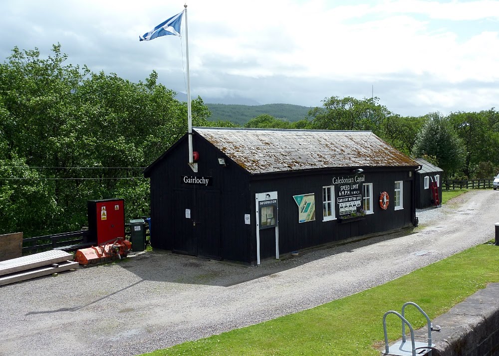
Then we were across the Firth, out of Edinburgh, and truly on our way to the Scottish Highlands.